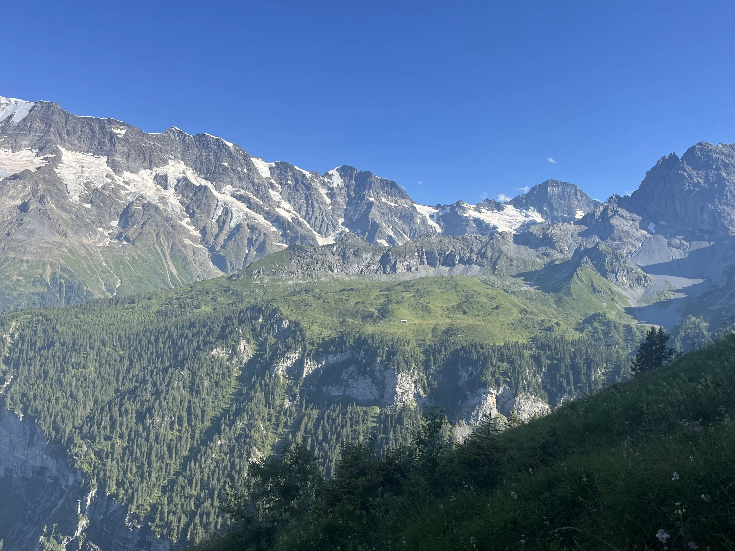
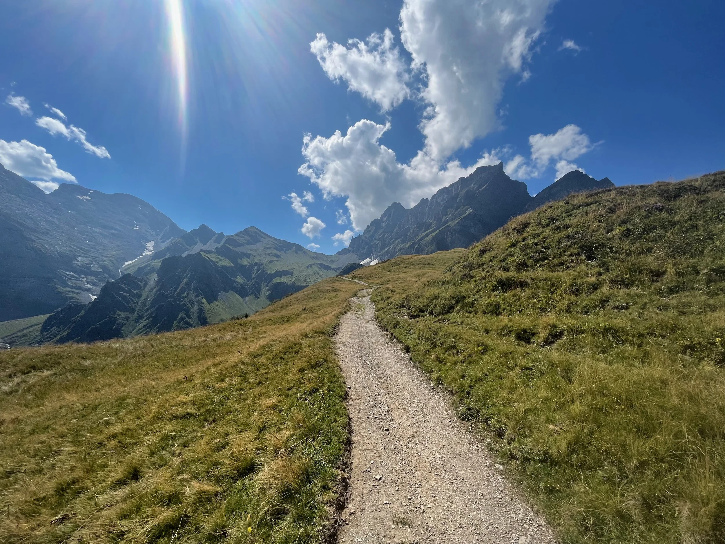
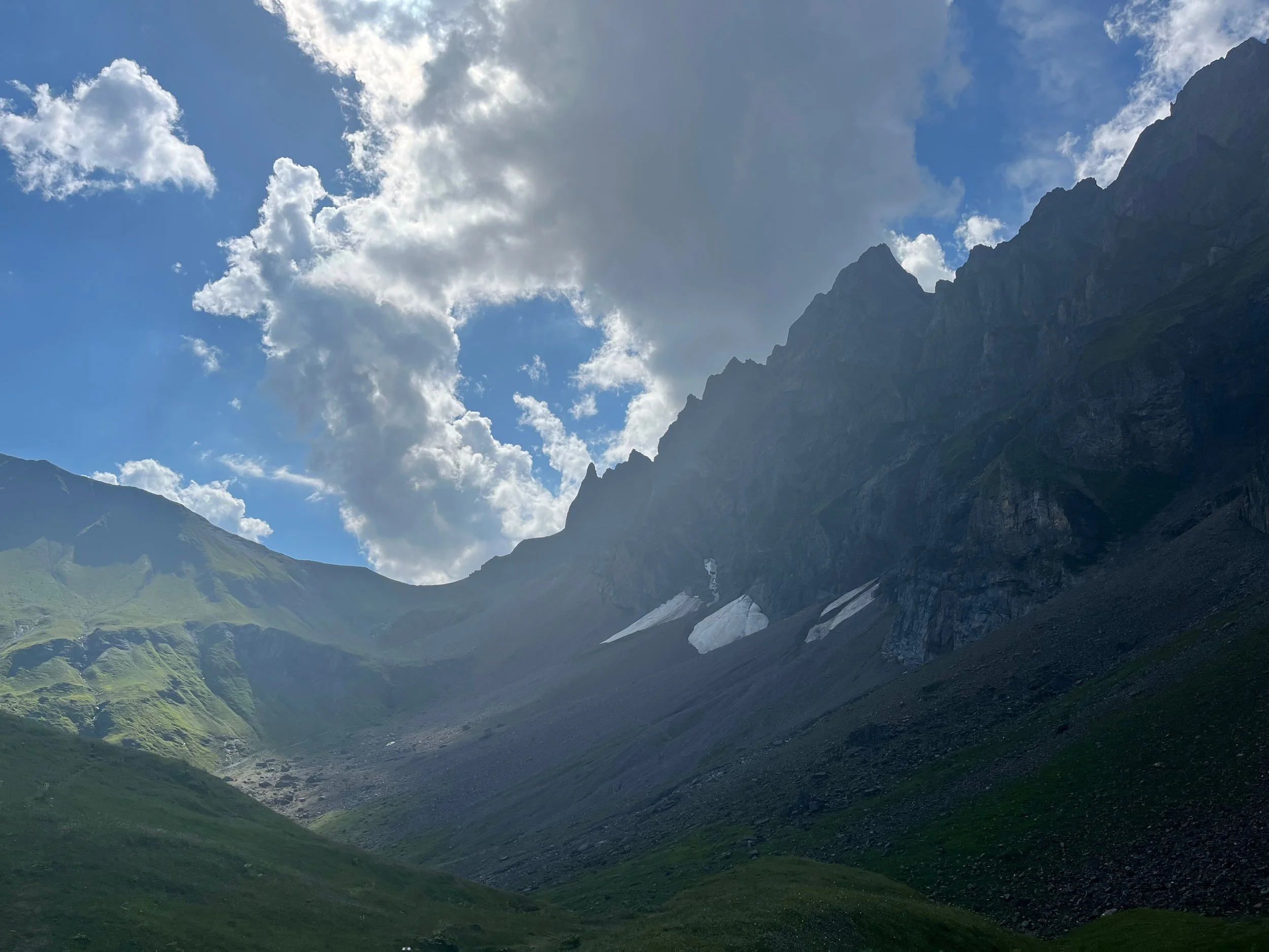
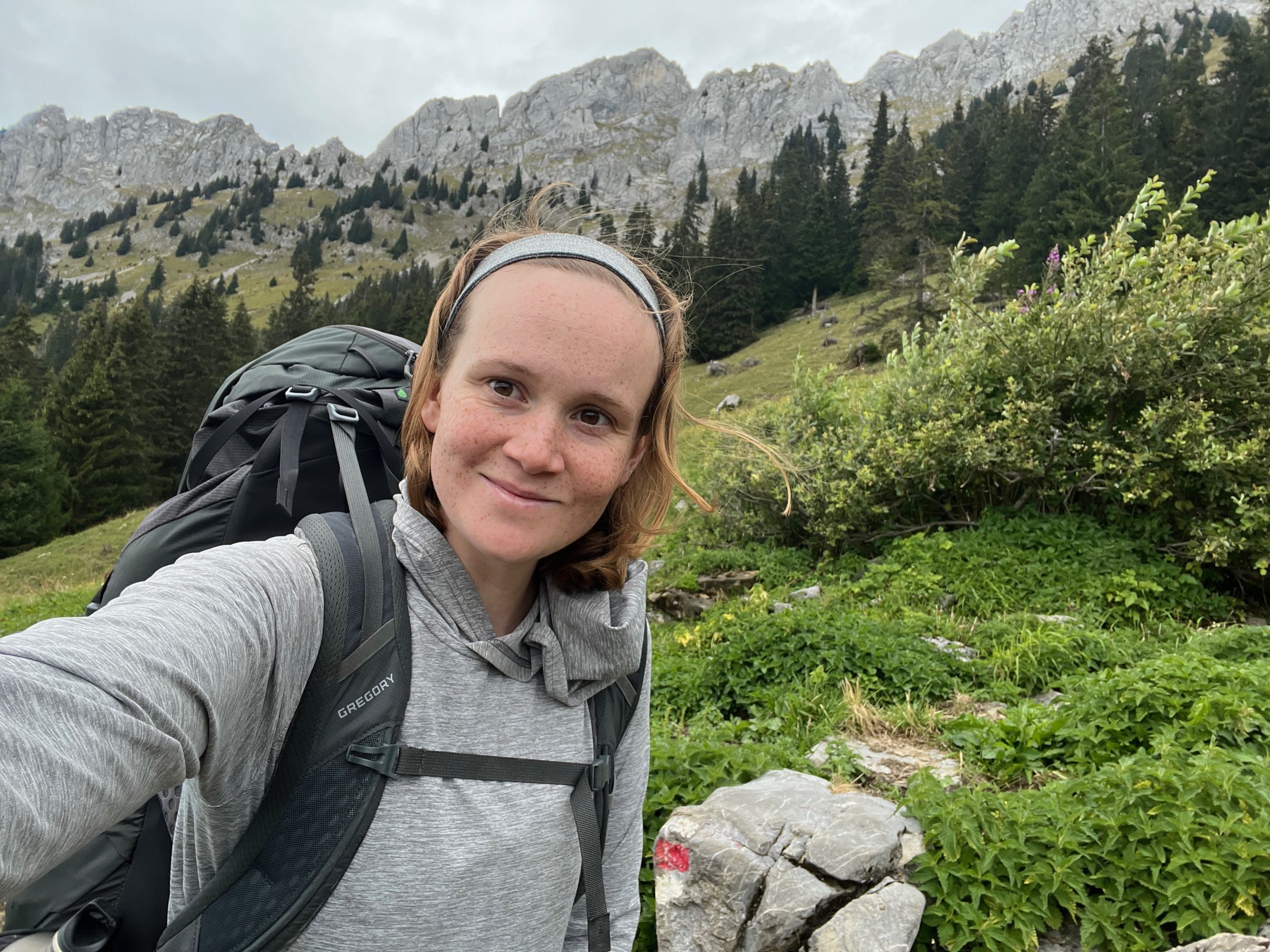
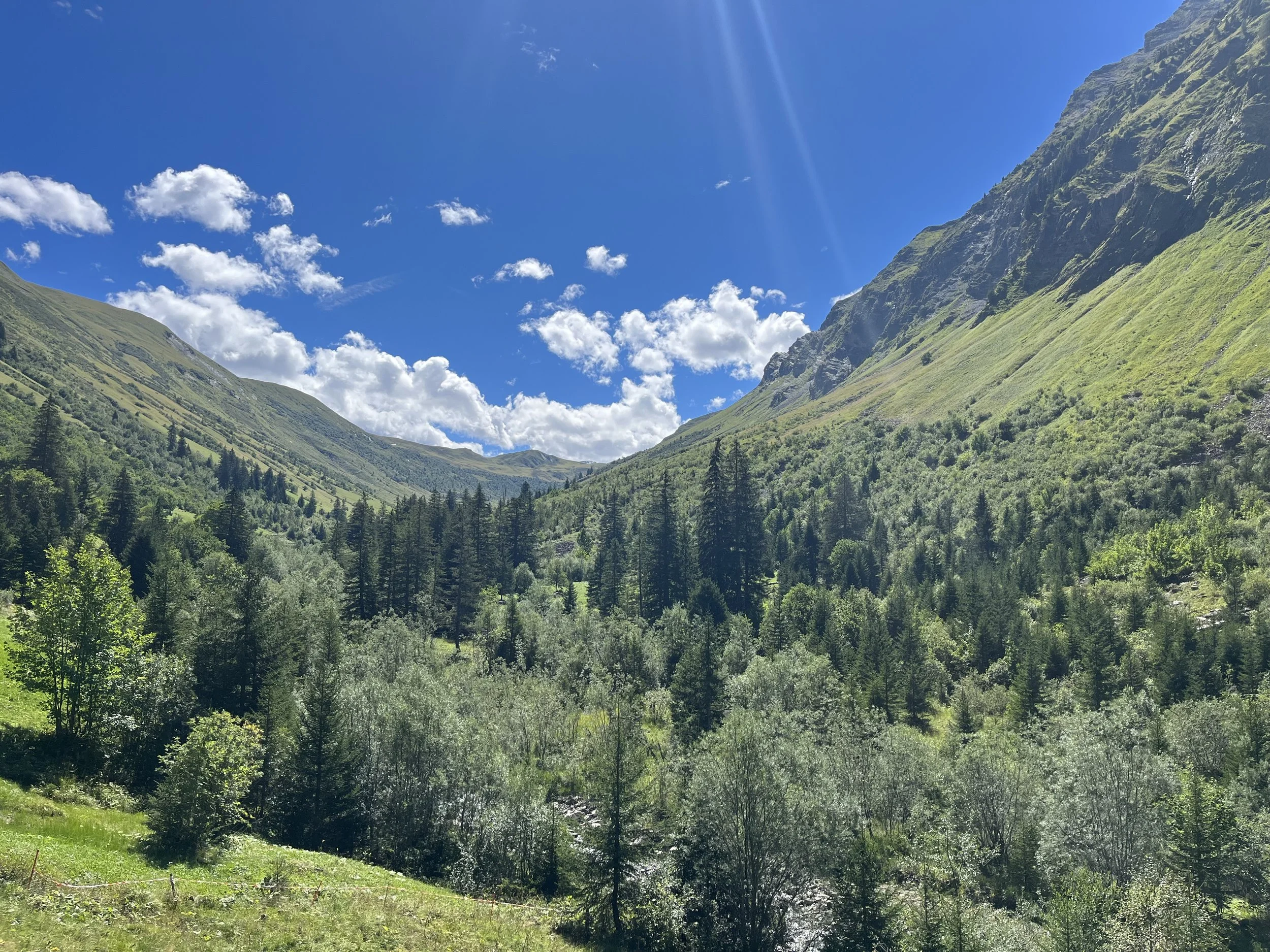
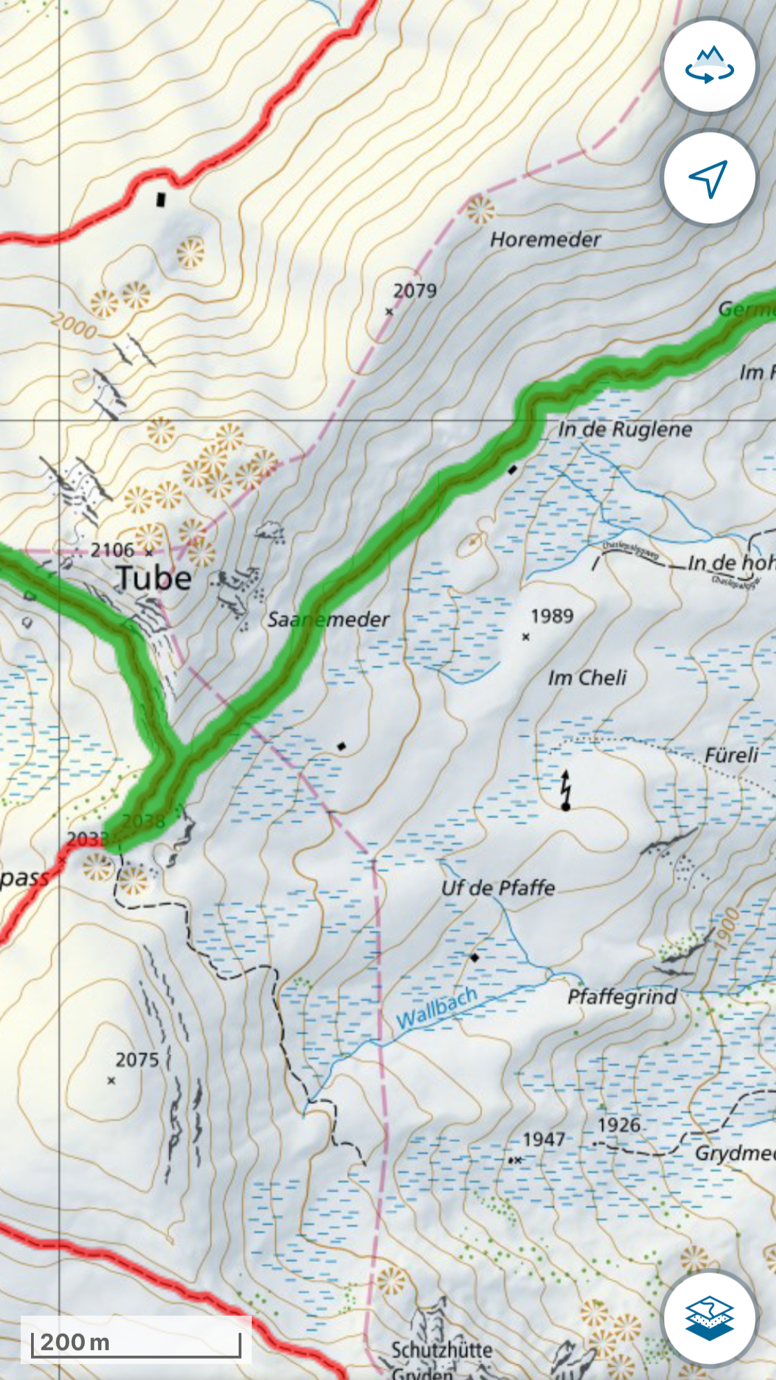
Via Alpina (Middle Section): Engelberg to Griesalp
The middle section of the Via Alpina from Engelberg to Griesalp.
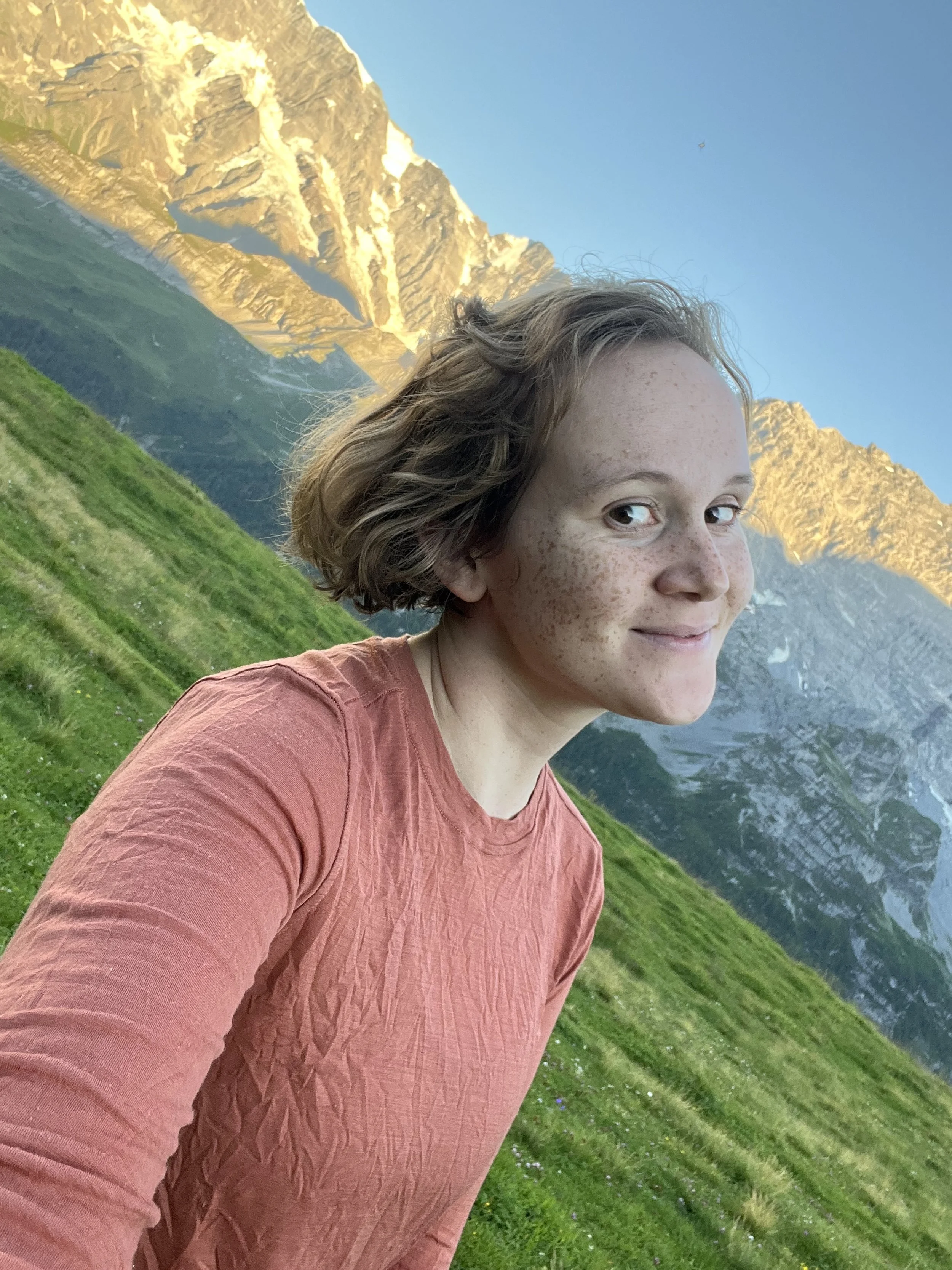
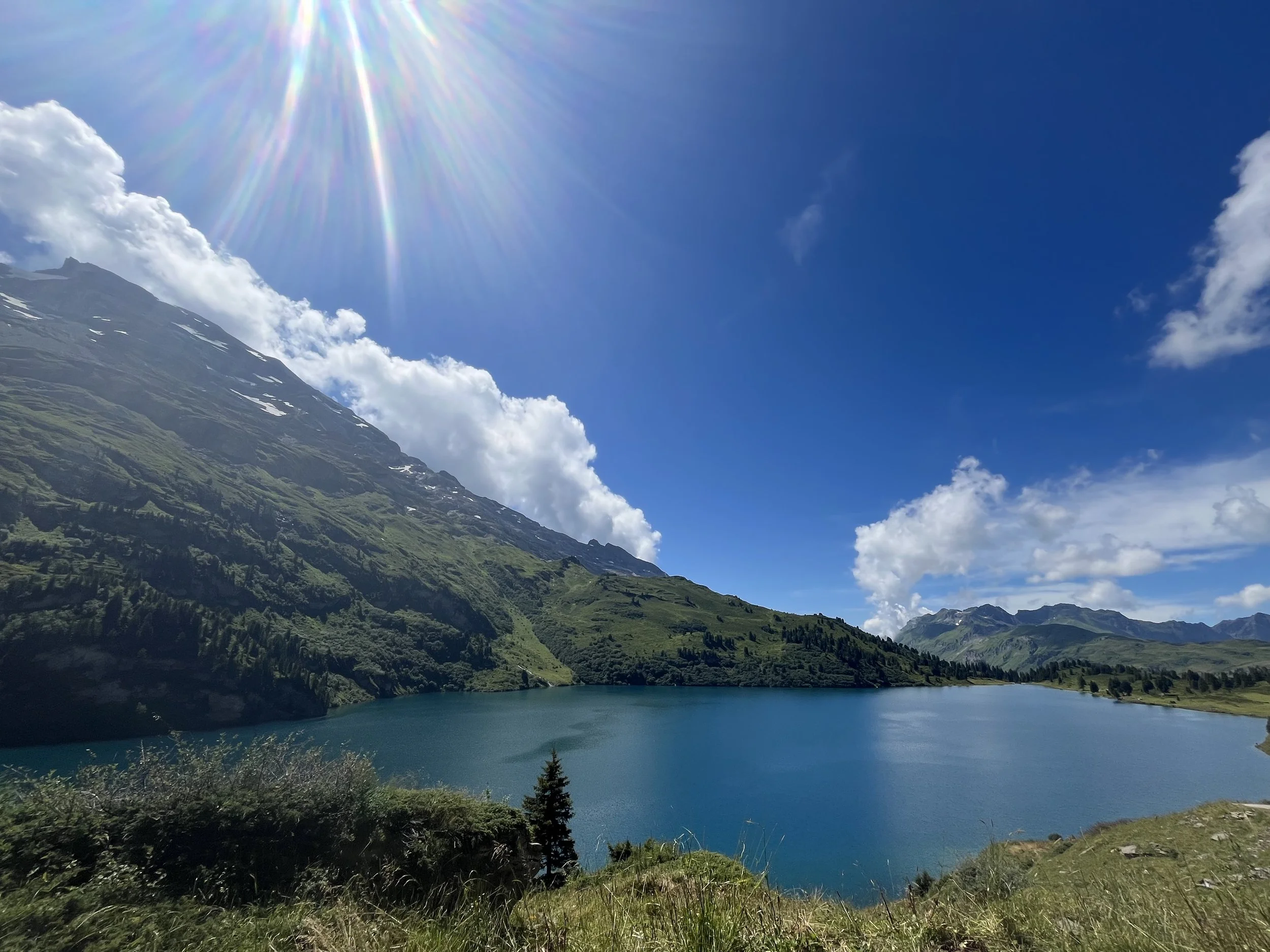
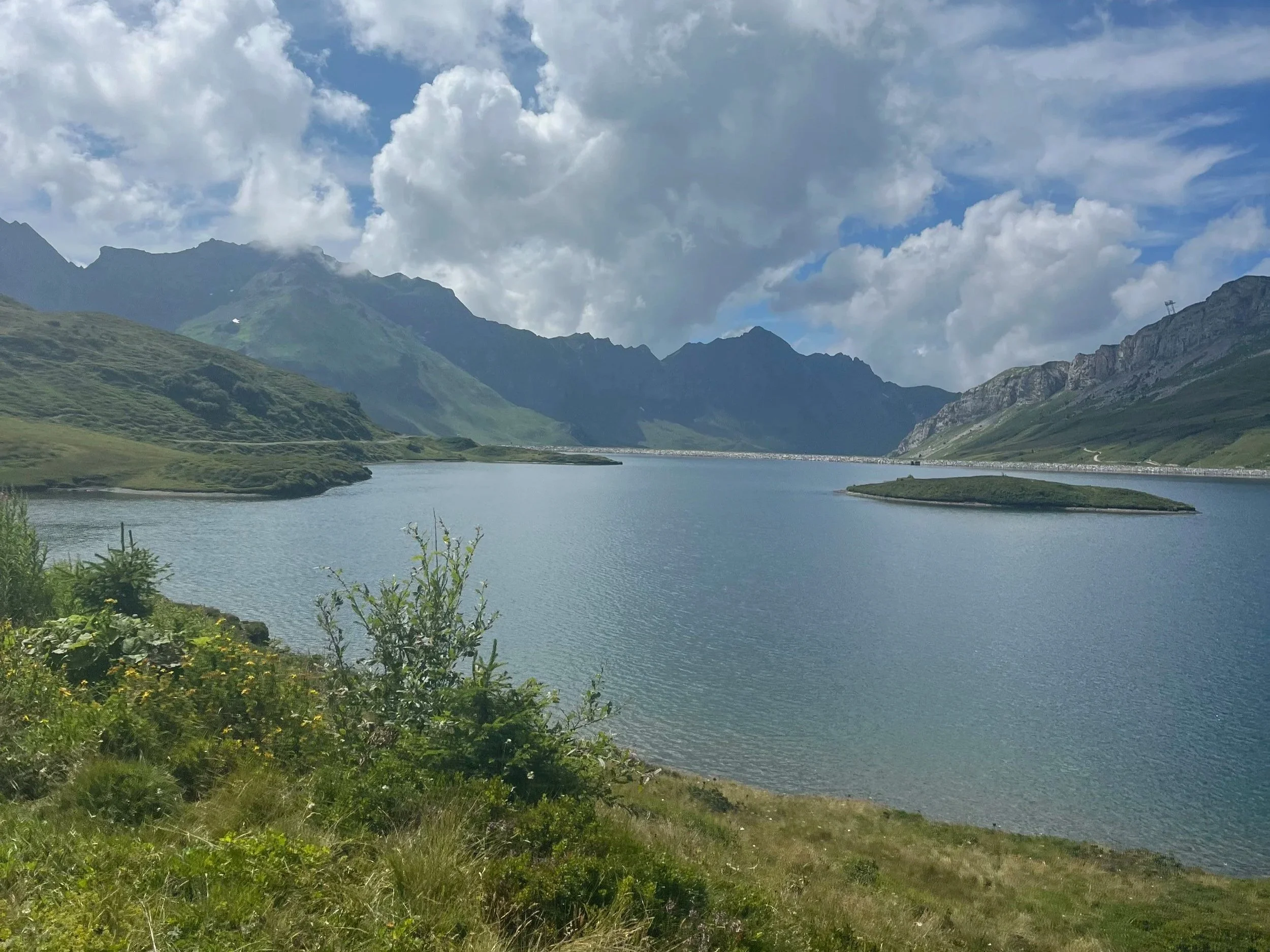
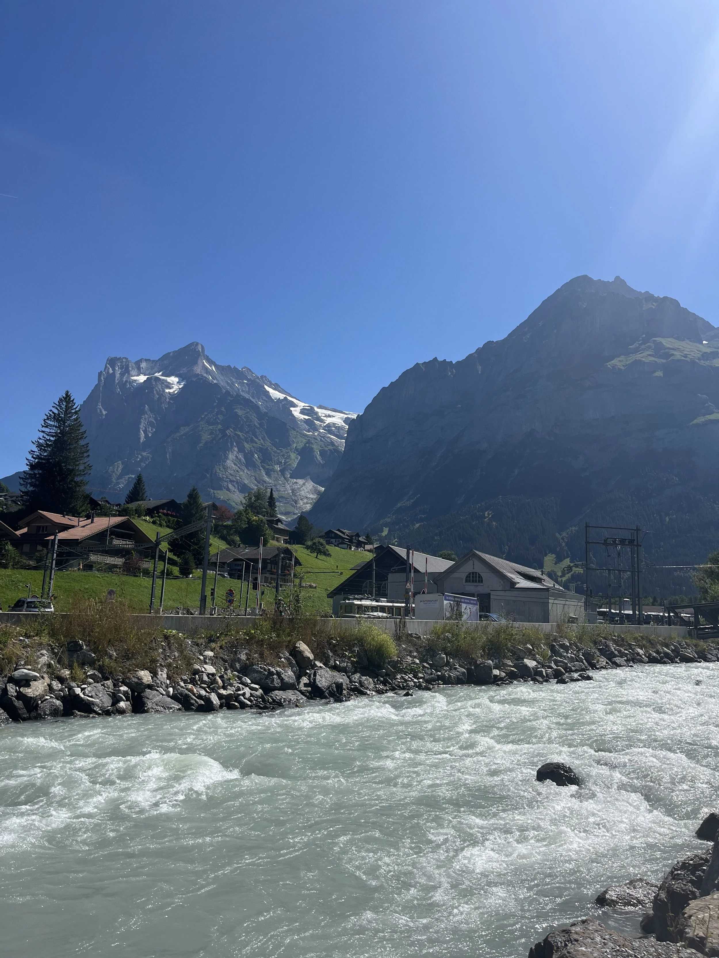
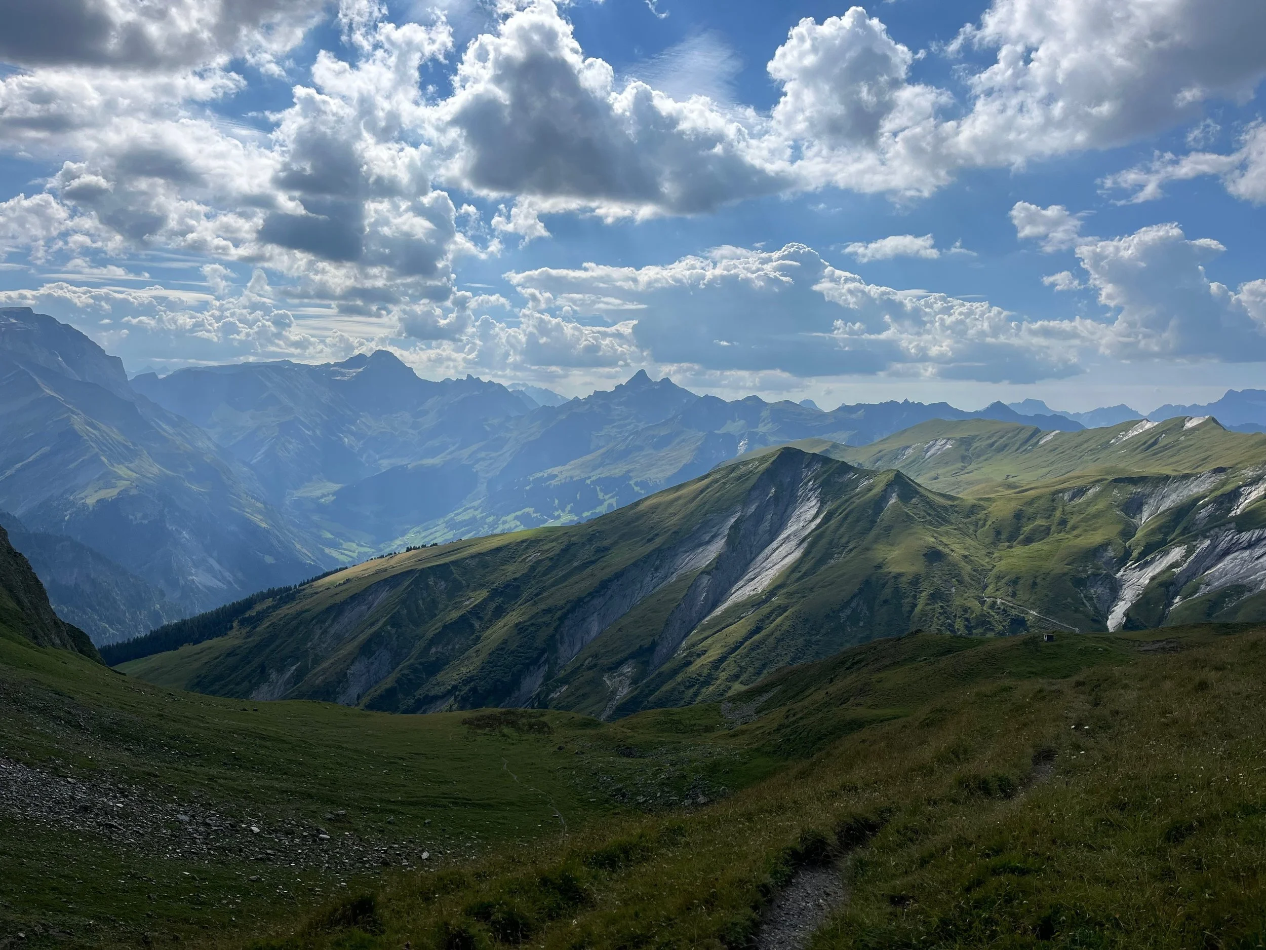
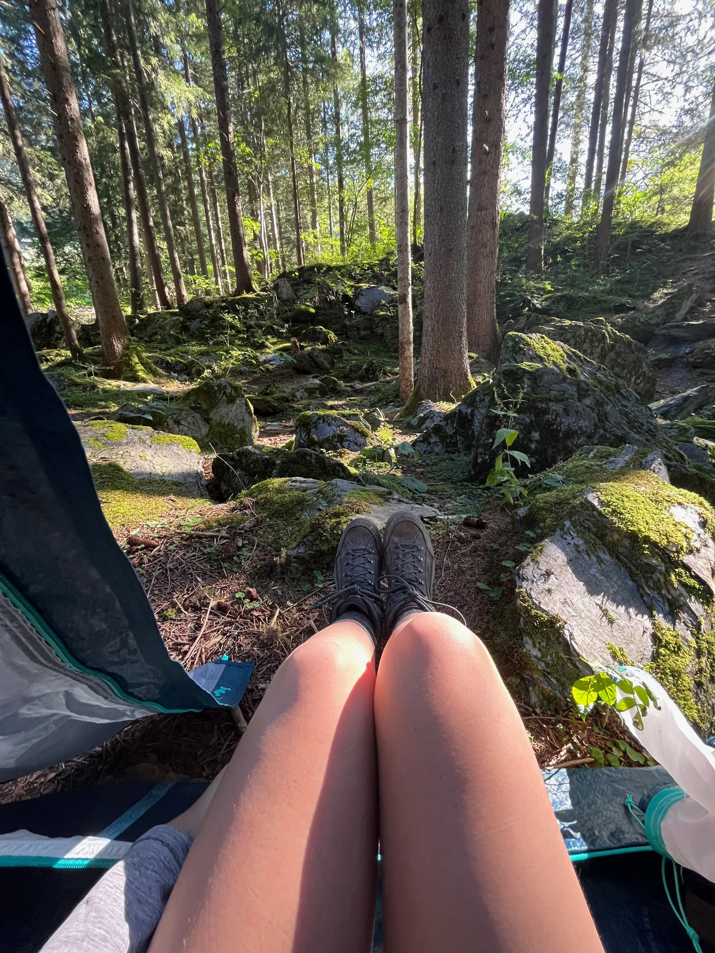
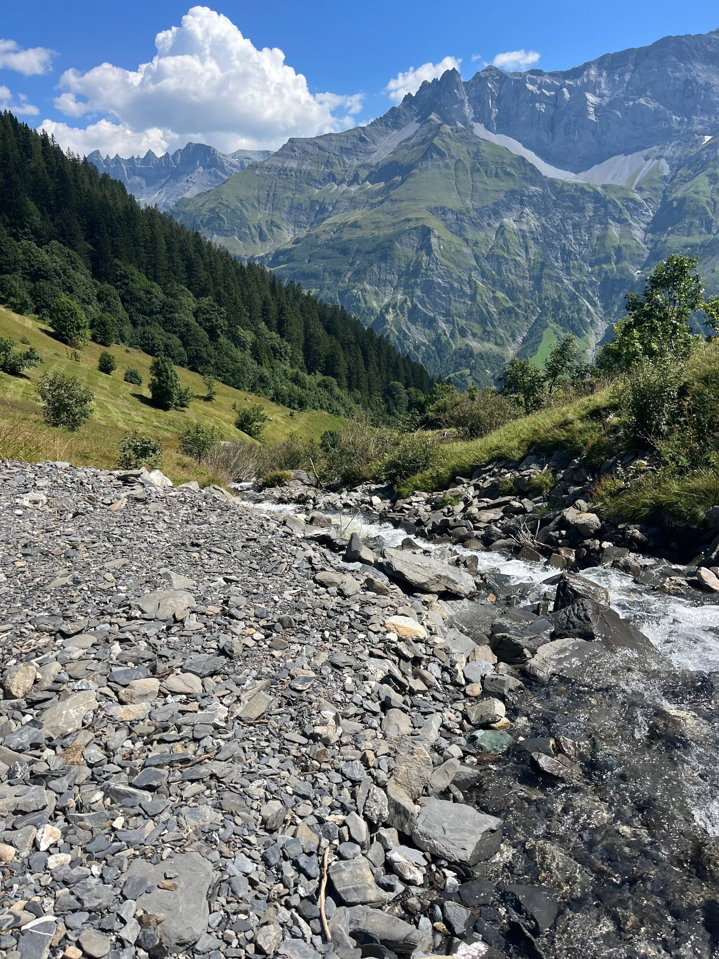
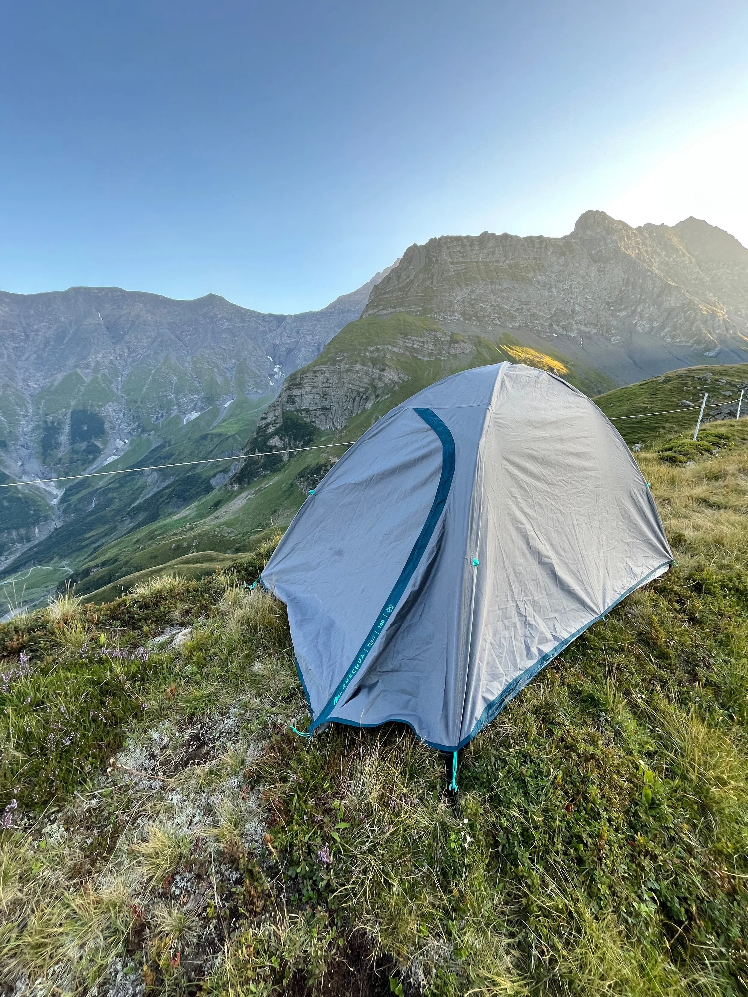
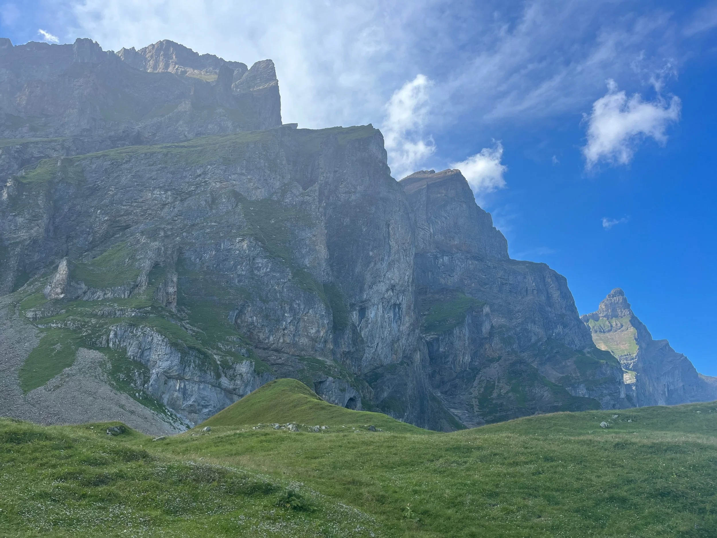
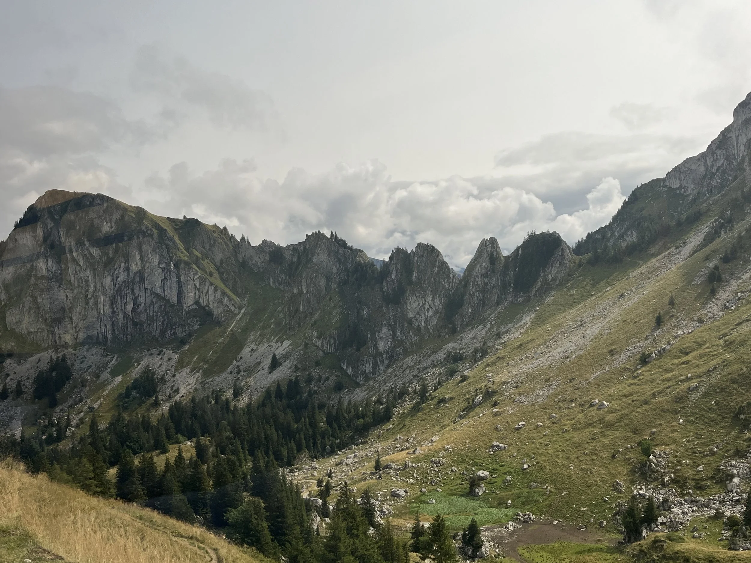
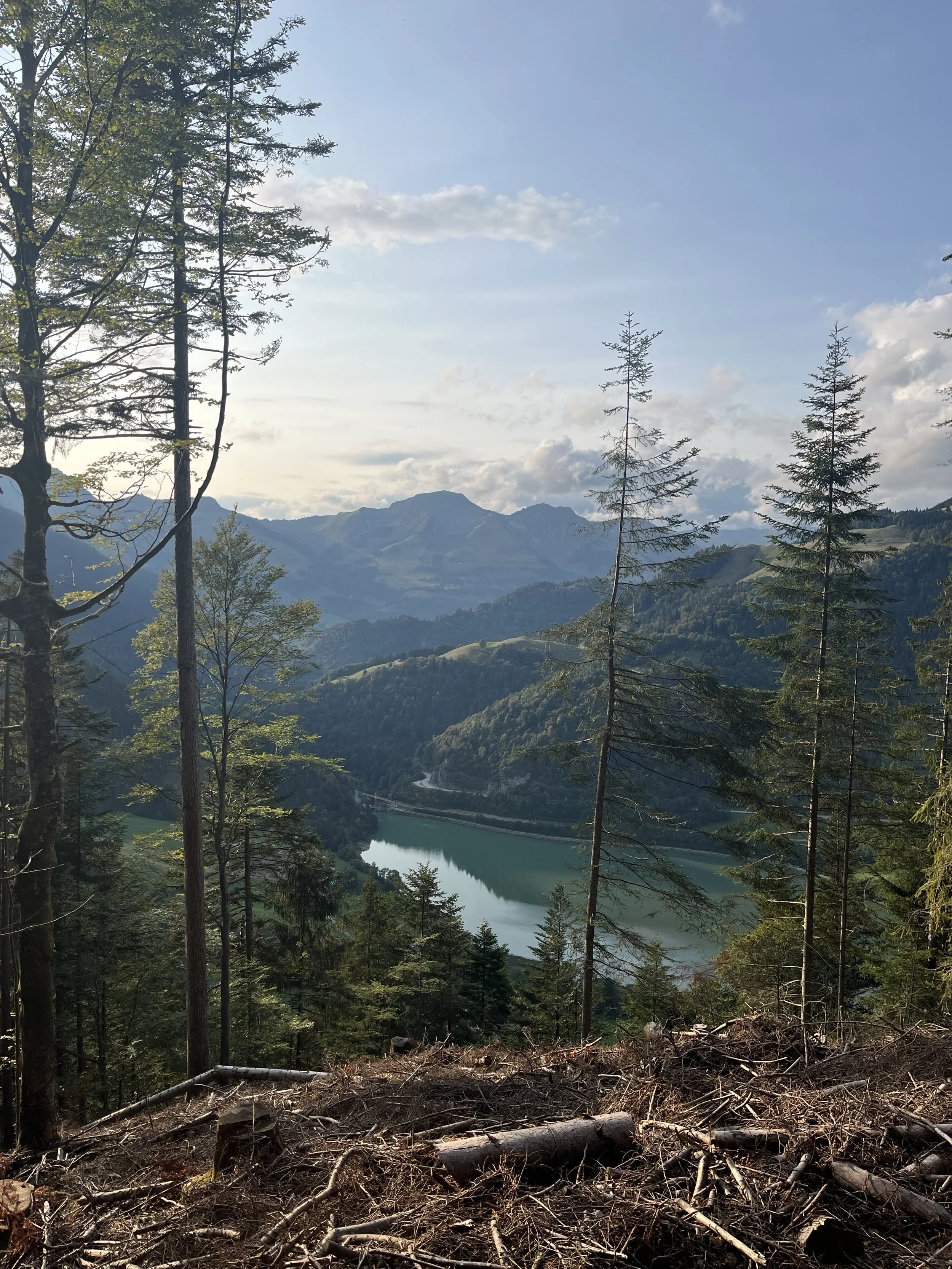
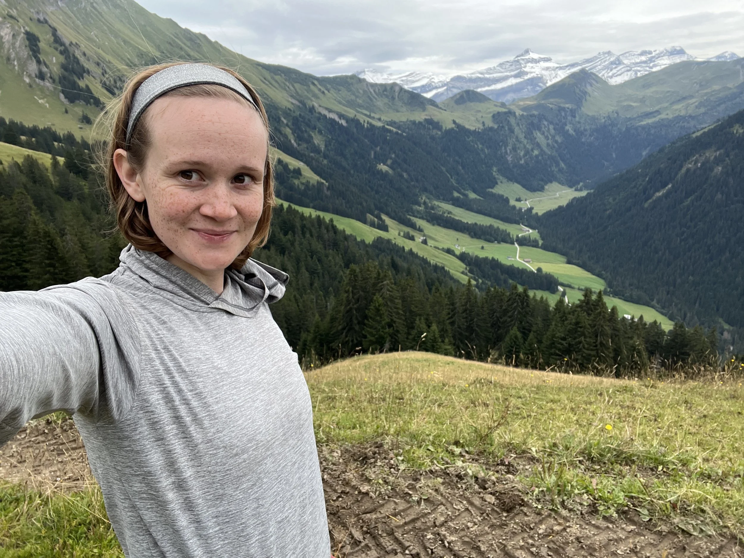
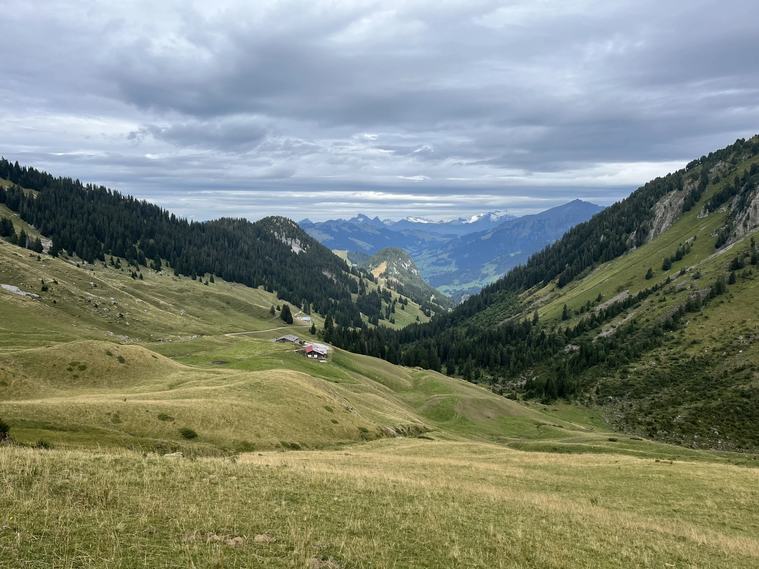
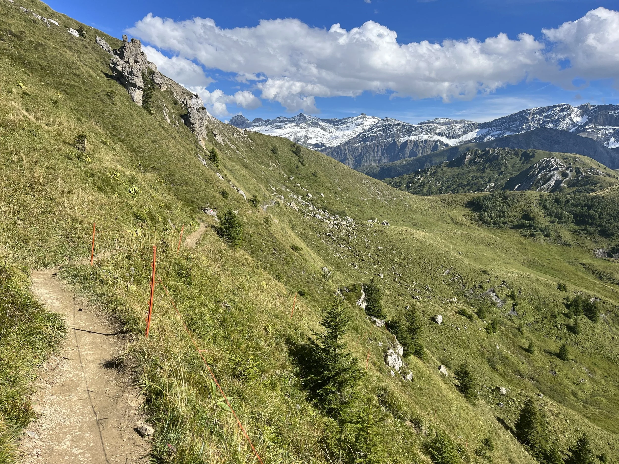
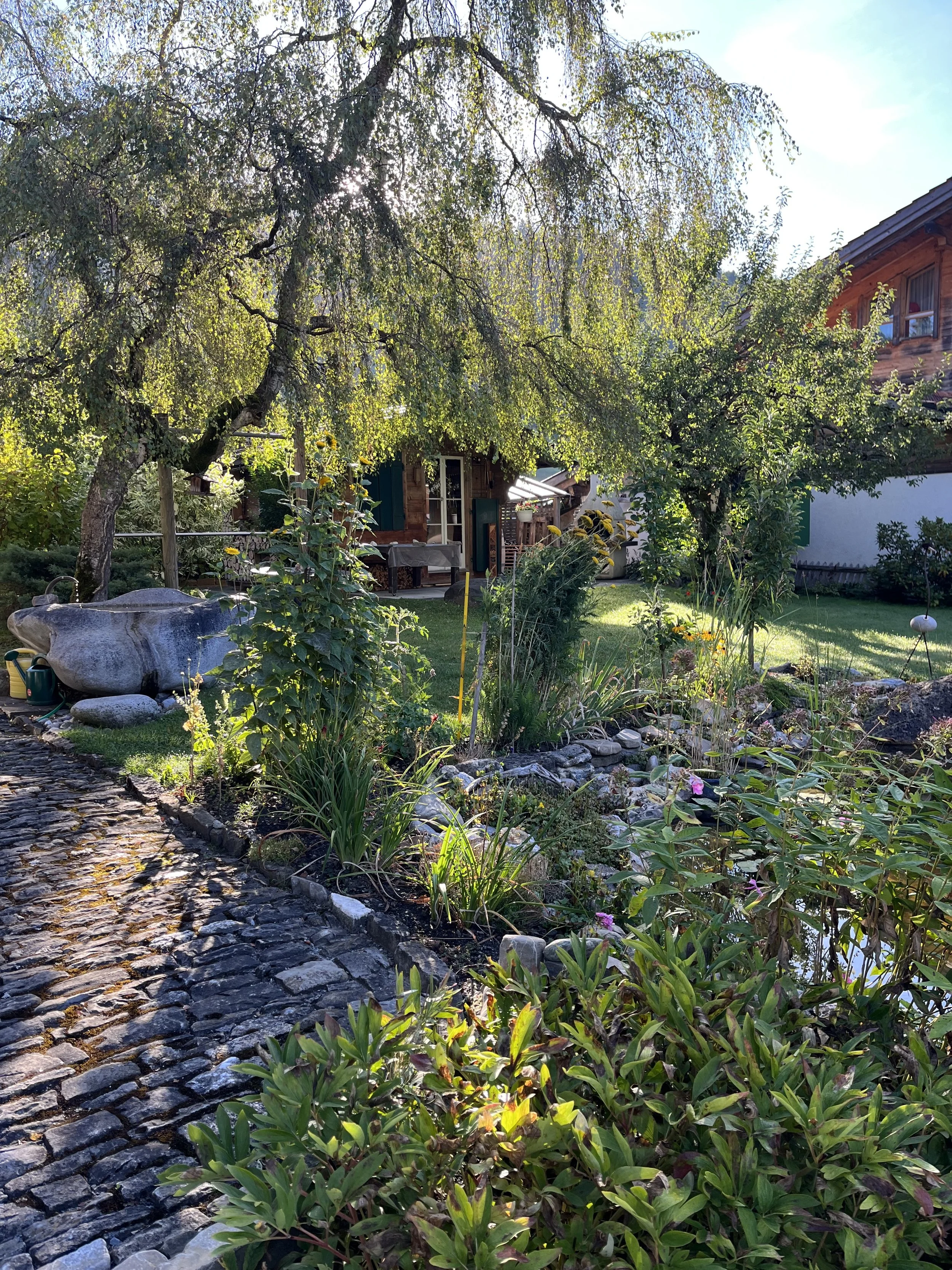
Wild Camping View from Gimmelwald
Technical Summary:
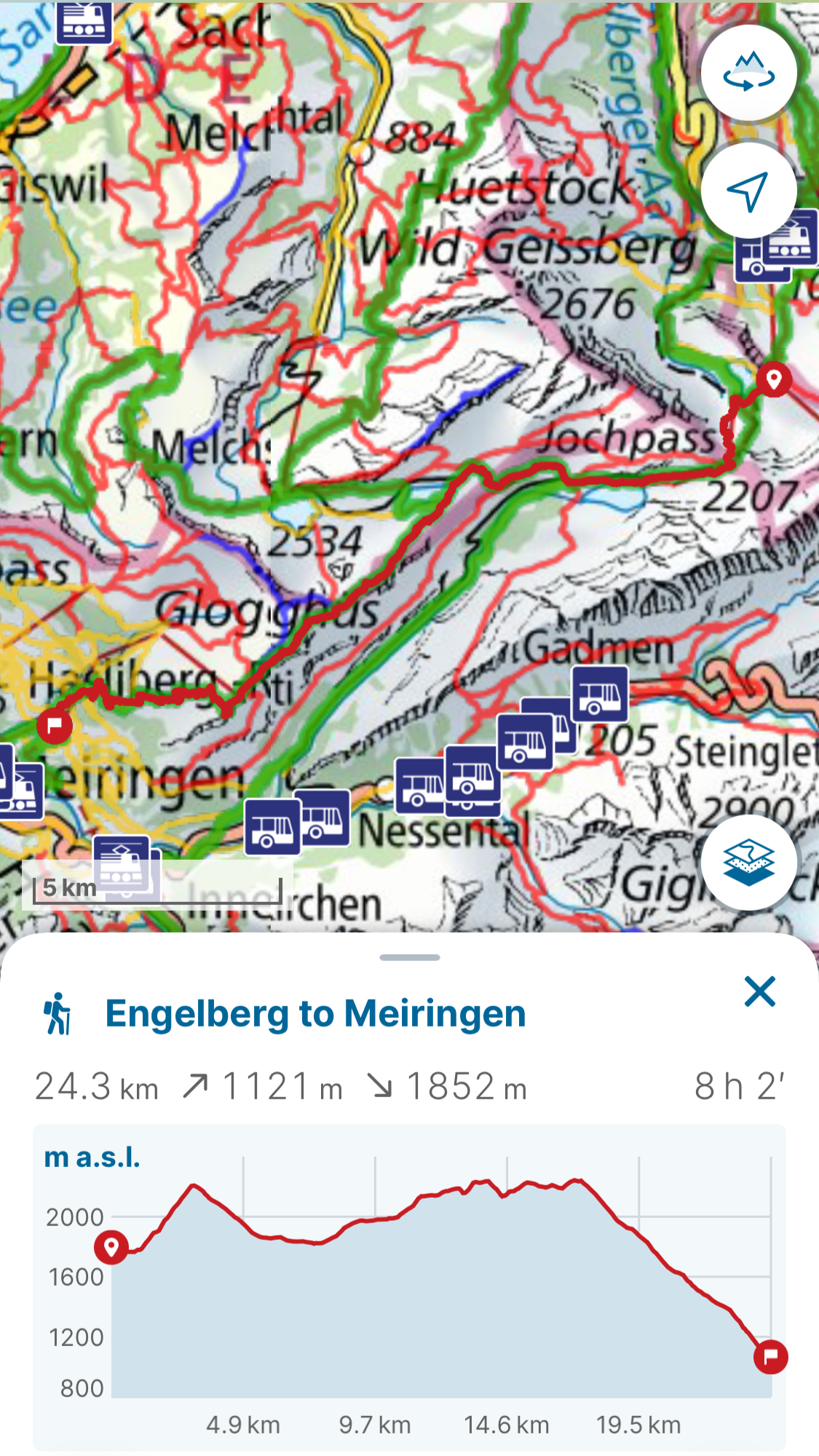
Day 1: Engelberg to Meiringen
Stats: 24.3km (112m ascent/1852m descent)
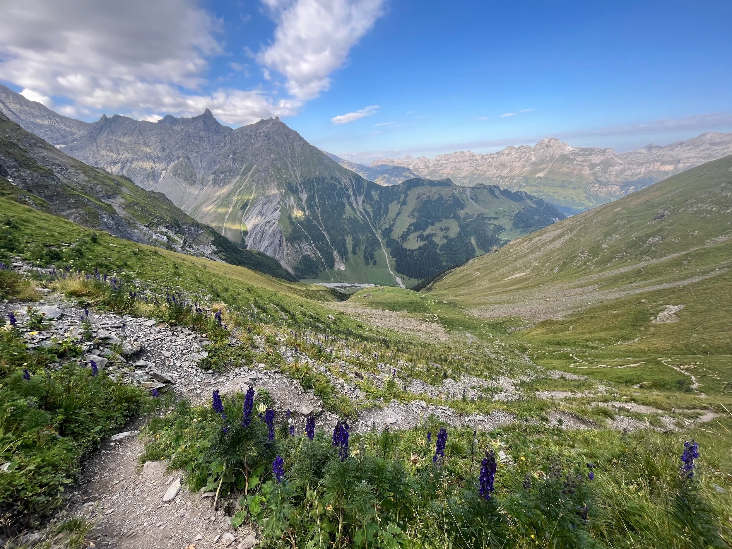
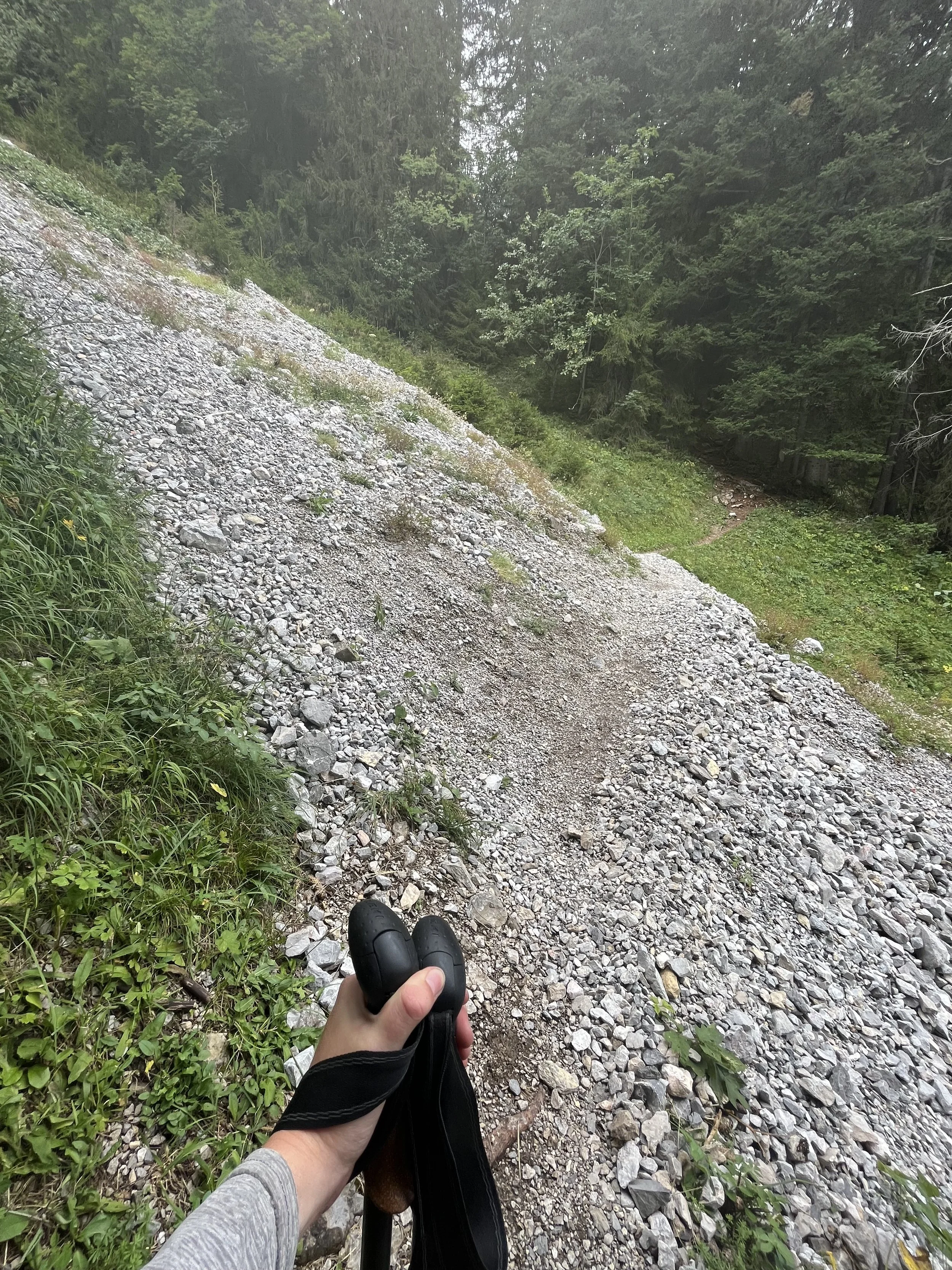
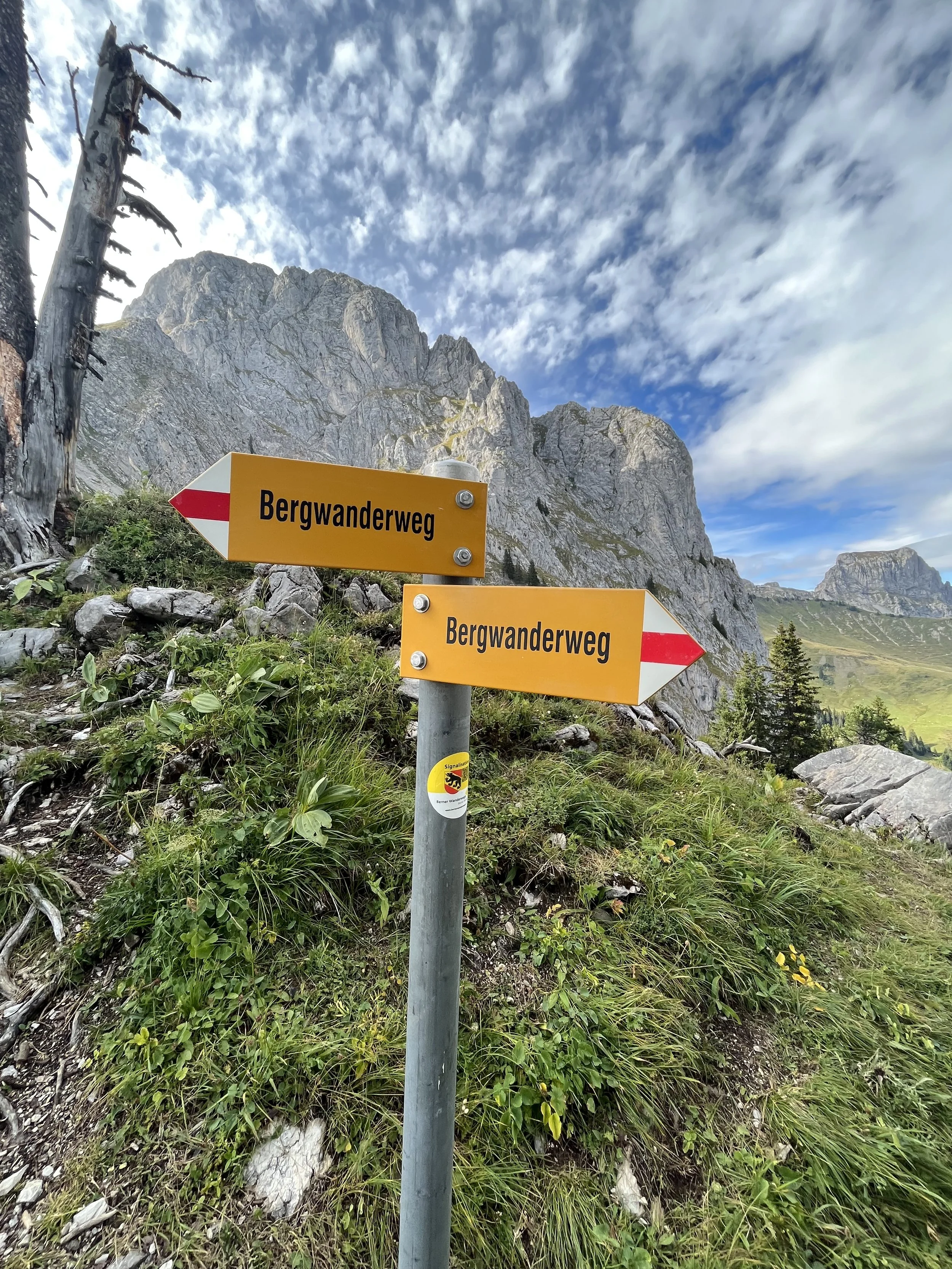
Trail Conditions: The whole trail was typical dirt/rock mountain trail. The technical difficulty increases towards the top where there is an amazing ridge hike. The descent goes through some grassy patches, which can be difficult to manage once your legs are fatigued from going down. I slipped a few times even with poles!
Good to Know: There is a gondola GB 2534 that brings you up to Trübsee. There are a few different gondola options going down from Planplatten area. The first closes early around 16:00, so if you arrive later in the day like I did you may have to hike down or catch one of the smaller gondolas below. I ended up catching one of the lowest gondolas PB2480 at Hasliberg Reuti to Meiringen. The 1800+ meters of descent will have catch up with you so the gondola was much needed by that point.
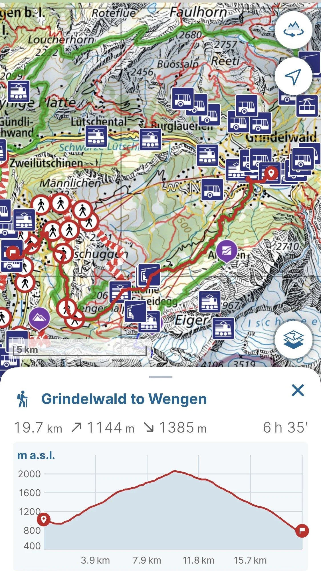
Day 2: Meiringen to Gimmelwald
Stats: 19.7km (1144m ascent/1385m descent) & 5.6km (462m ascent/49m descent)
Trail Conditions: On the first section around Meiringen/Grindelwald were a lot of paved road throughout the way as well some rocky roads. The second part I intentionally started from Mürren to start back on normal dirt/rock mountain trails.
Good to Know: This section I found the most annoying. There was a lot of transportation options, which I ended up using some (buses B164 & B128 from Meiringen to Schwarzwaldalp to Grindelwald; gondola PB2461 from Lauterbrunnen to Grütschalp & train R66 to Mürren). I happened to arrive on the day of a bike race and got instantly annoyed trying to share the streets the paths were on and within Grindelwald there were tons of tourists and traffic. Honestly, my least favorite section of the trail.
Day 3: Gimmelwald to Griesalp
Stats: 12.3km (634m ascent/1280m descent)
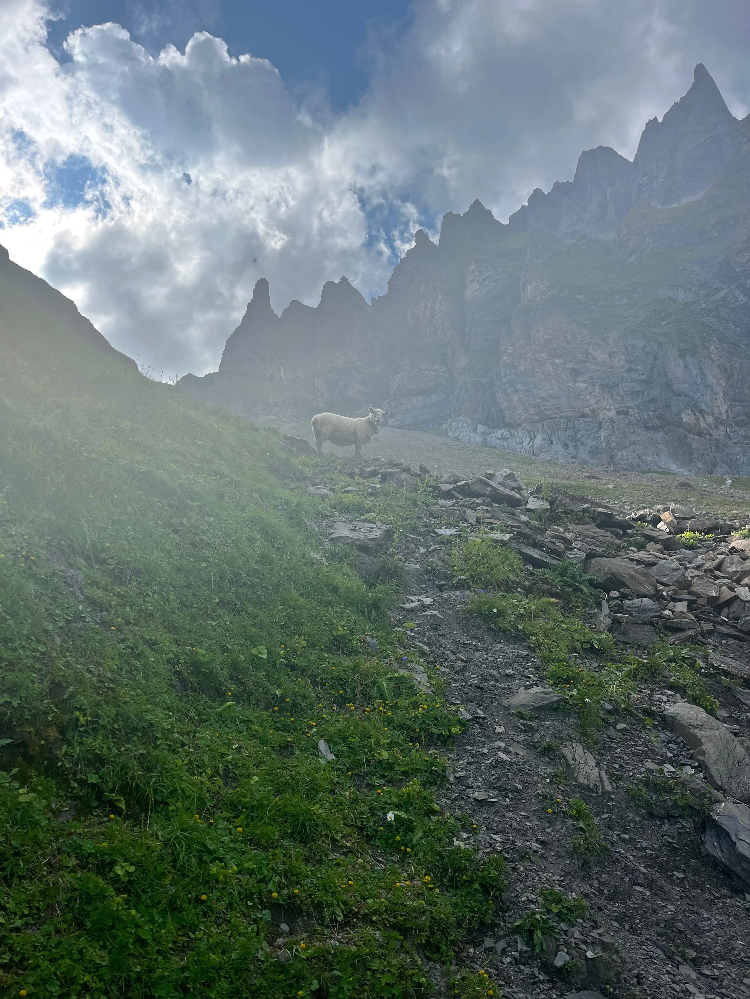
Trail Conditions: The trail starts off as the same typical mountain trail as the day before, but becomes rocky and steep after Hundshubel. It remains that way until it reaches a rocky road. The road was very rocky and I slipped quite a few times (also due to my lack of hydration and nutrition).
Good to Know: There is one hut (Rotstockhütte) right by the start here where there is a water fountain nearby, but after that there is nothing until close to Griesalp. I was dehydrated and hungry most of this day and wished I had stocked up better in Mürren the day before.
Daily Blog:
Day 1 - Engelberg to Meiringen
Trübsee
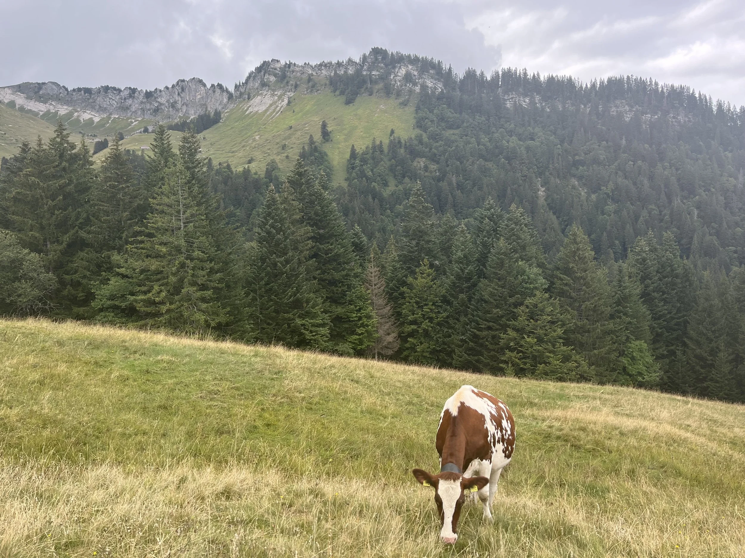
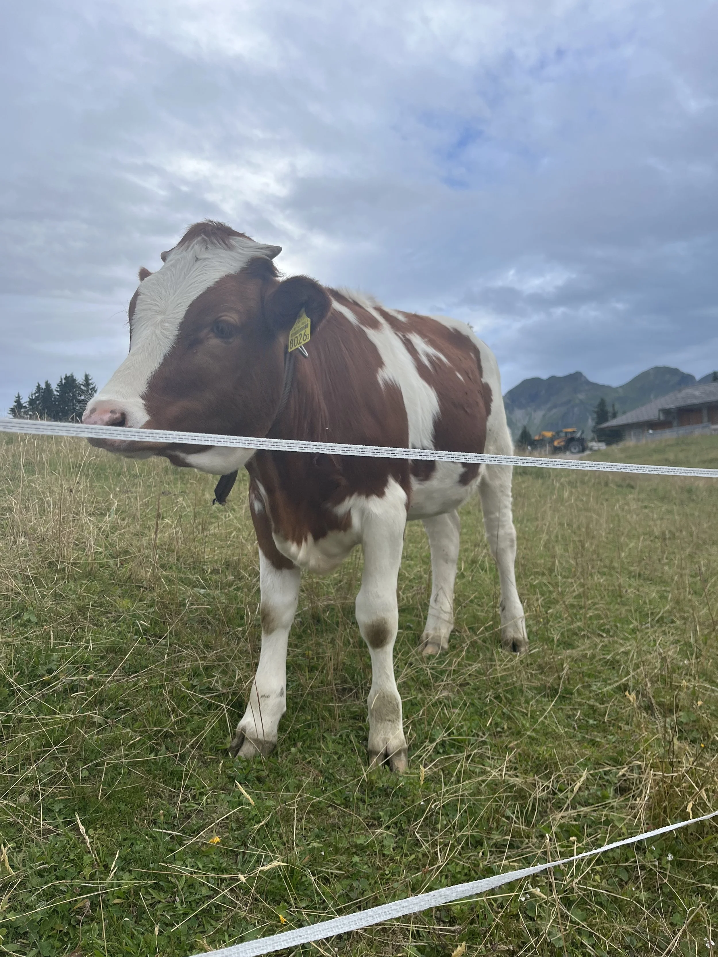
The first day from Engelberg was very hot so I immediately opted for the gondola to Trübsee. After the quick ascent from there to Engstlensee, the cows there at the top even looked exhausted from the heat.
Exhausted cow and I in the heat
Right at the top, there was one of the stamp stations.
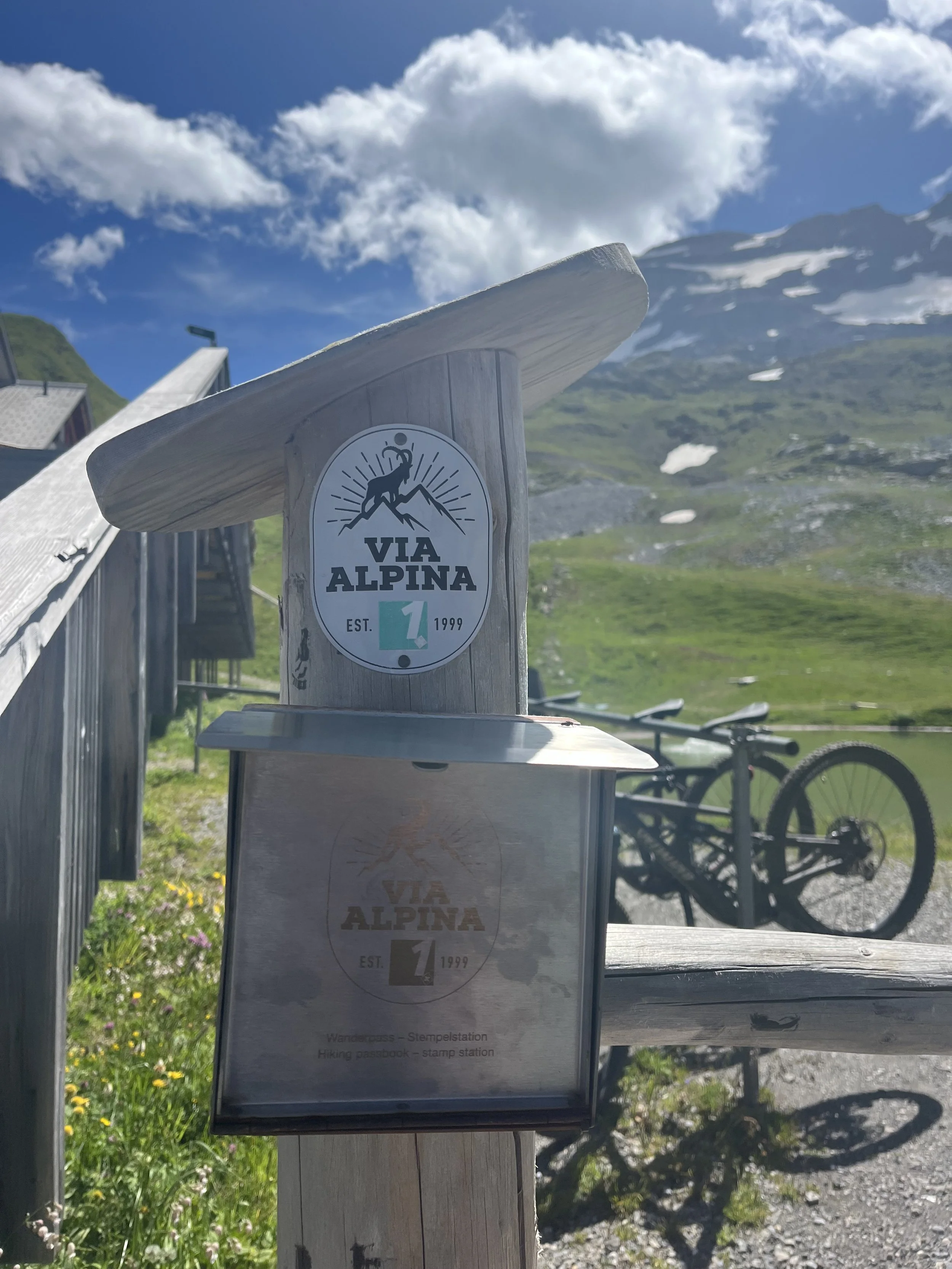
Stamp Station
Then a short descent to Engstlensee, which was really gorgeous. This part of the path was like a dirt road with plenty of places to stop for lunch. I opted for under a pine tree.
Engstlensee
Then there was a short but really beautiful ascent to Tannensee.
Near Tannensee
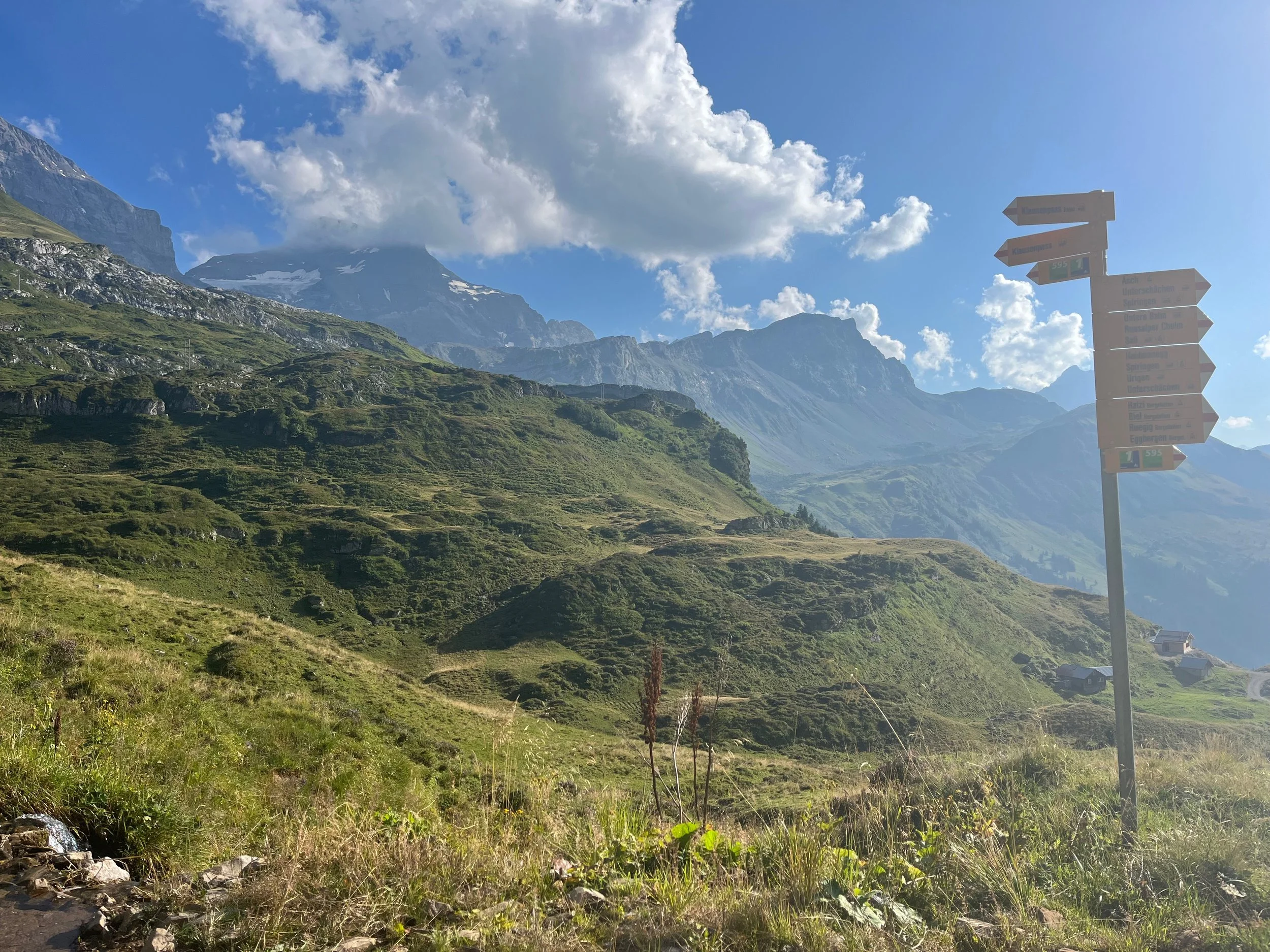
Around the lakes, there were cute goats. The trail became like road again and there were more tourists including a little tourist “train”, which was linked little cars that looked like a child’s train.
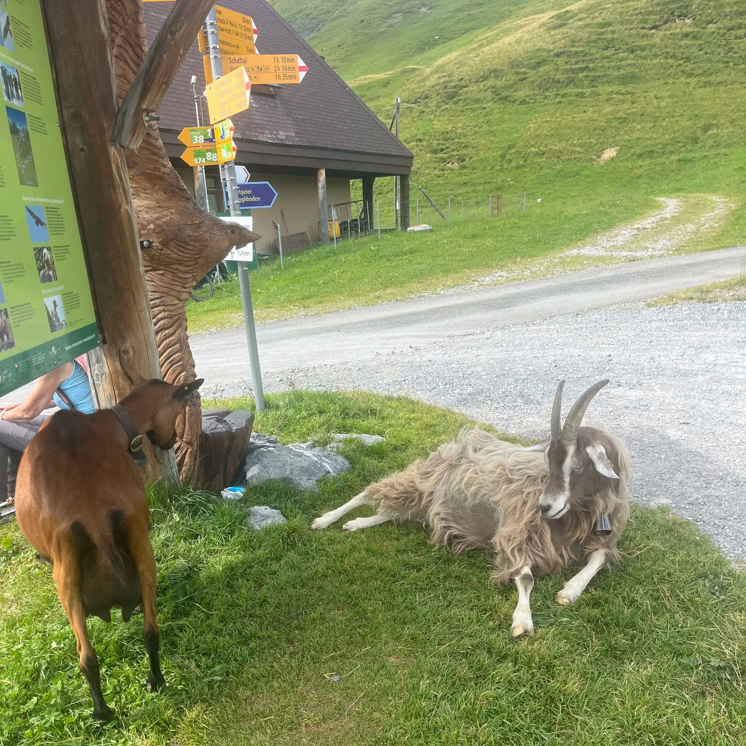
Goats next to the Via Alpina sign
Tannensee
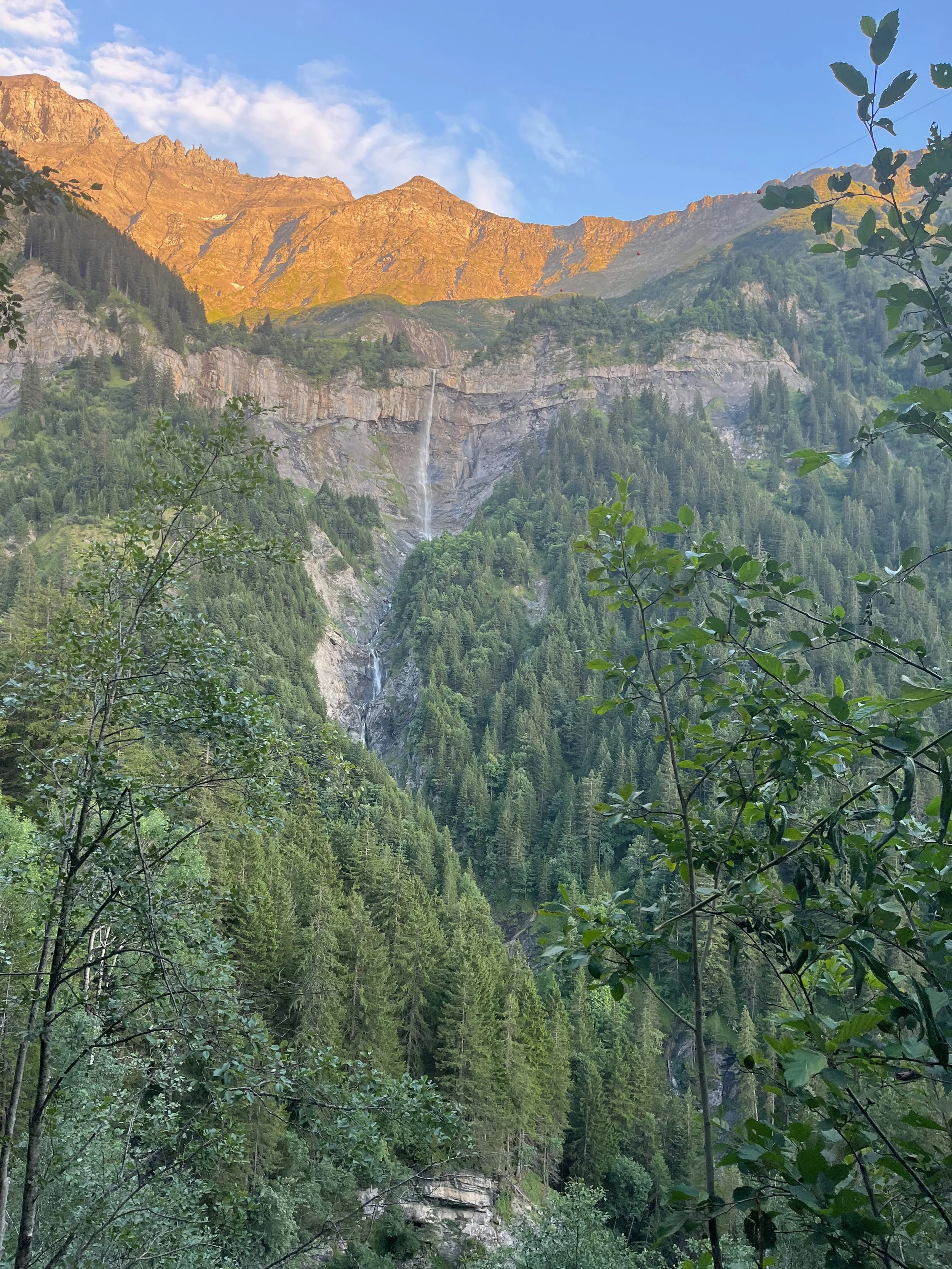
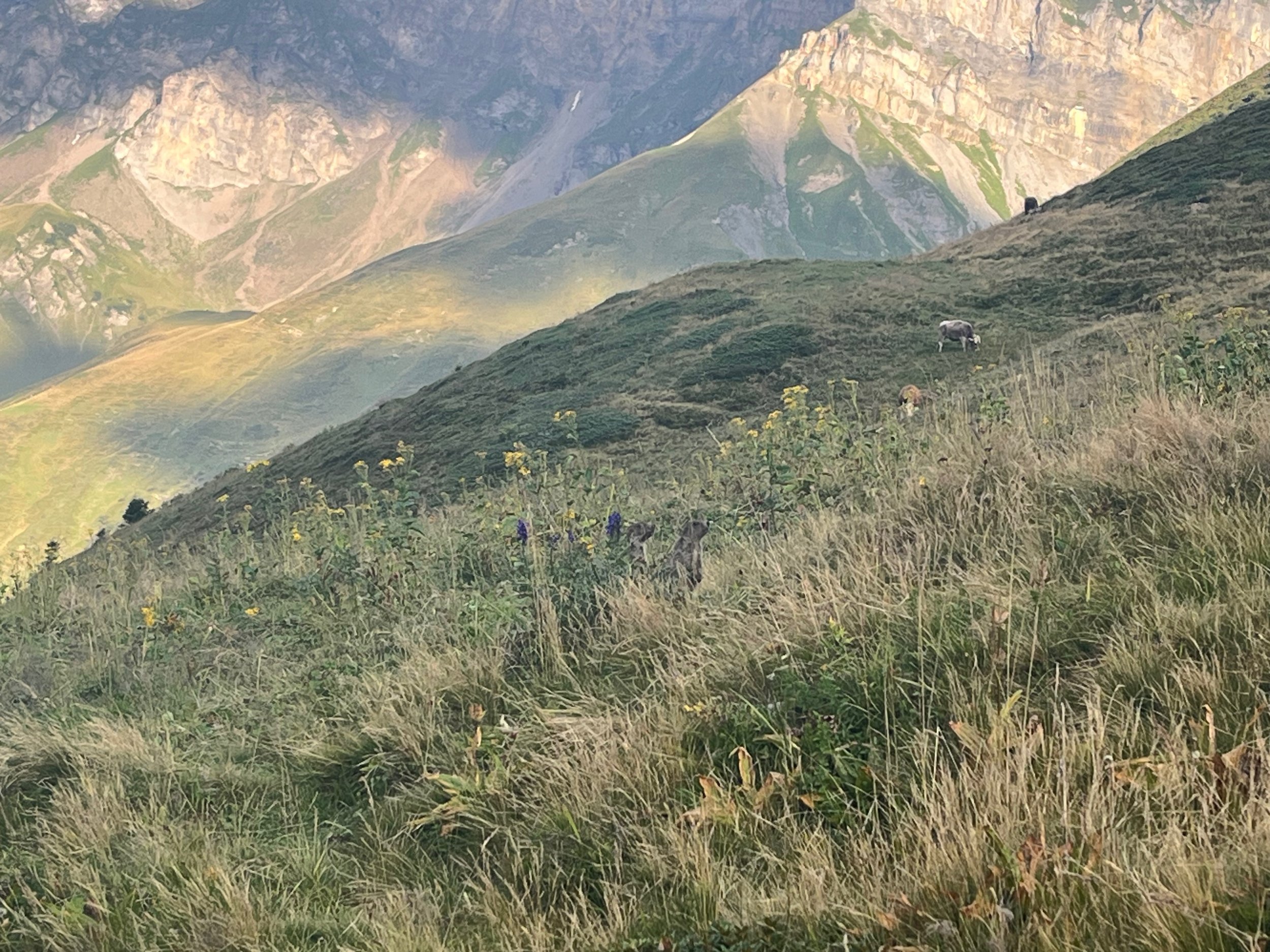
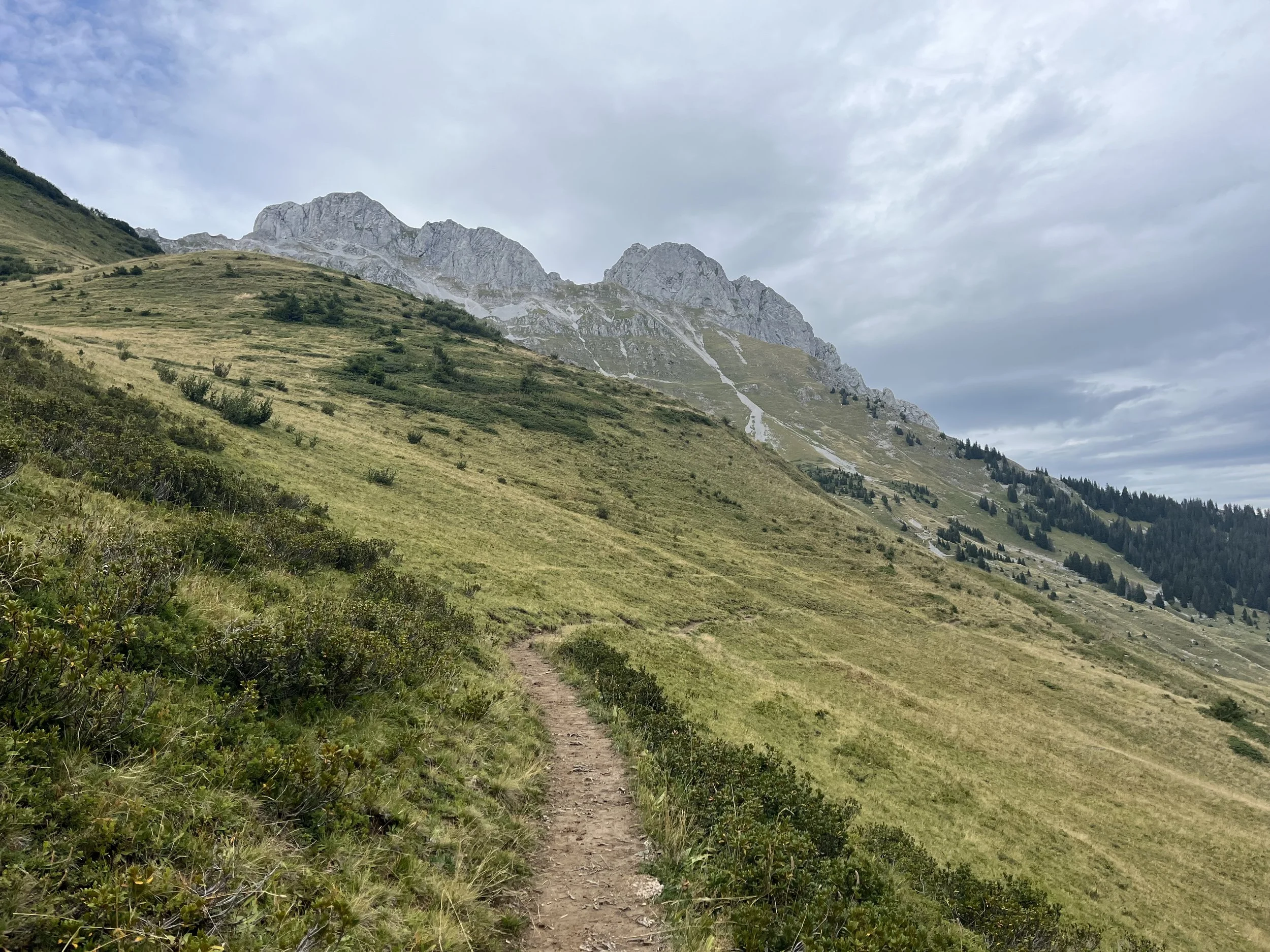
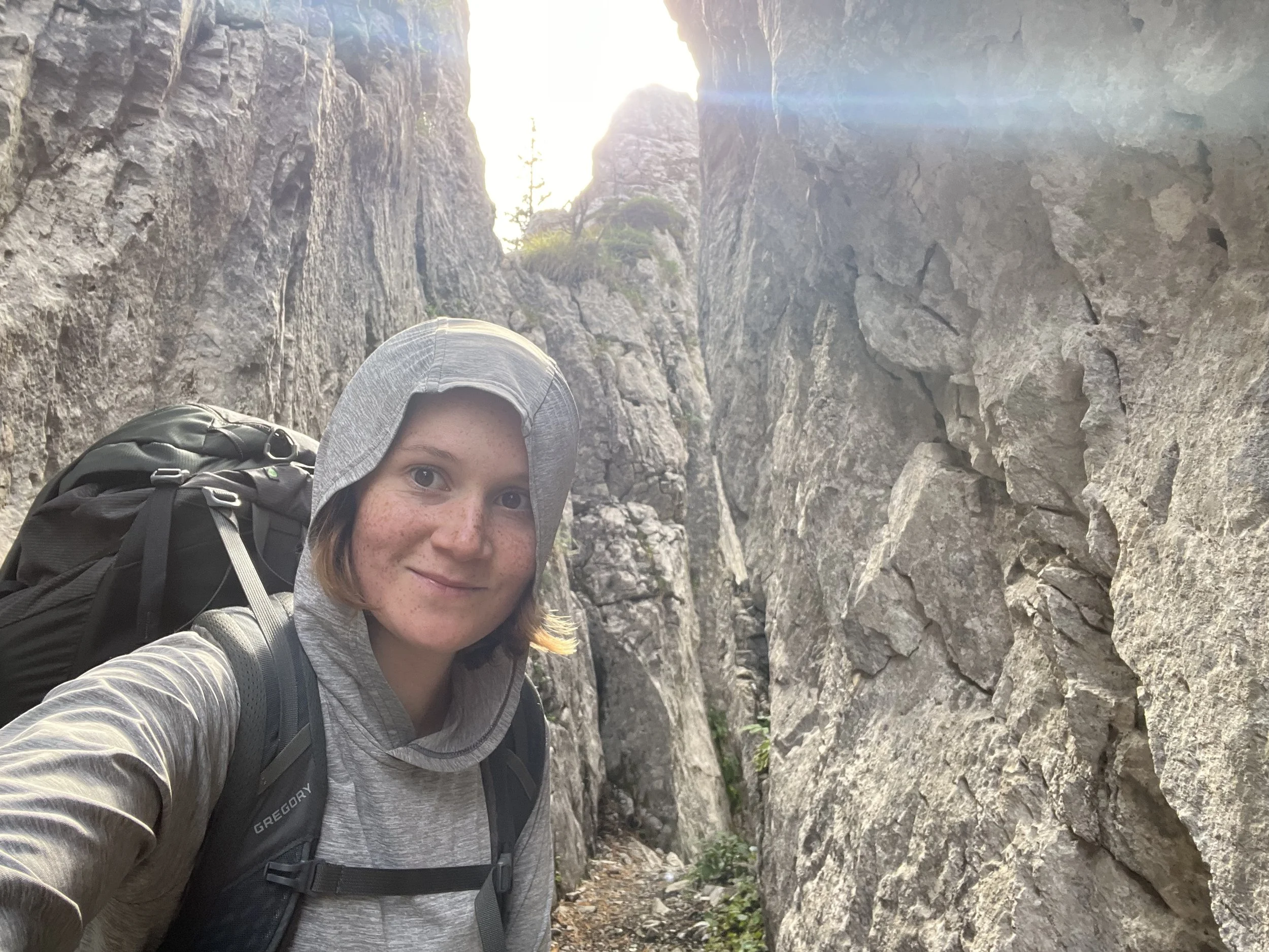
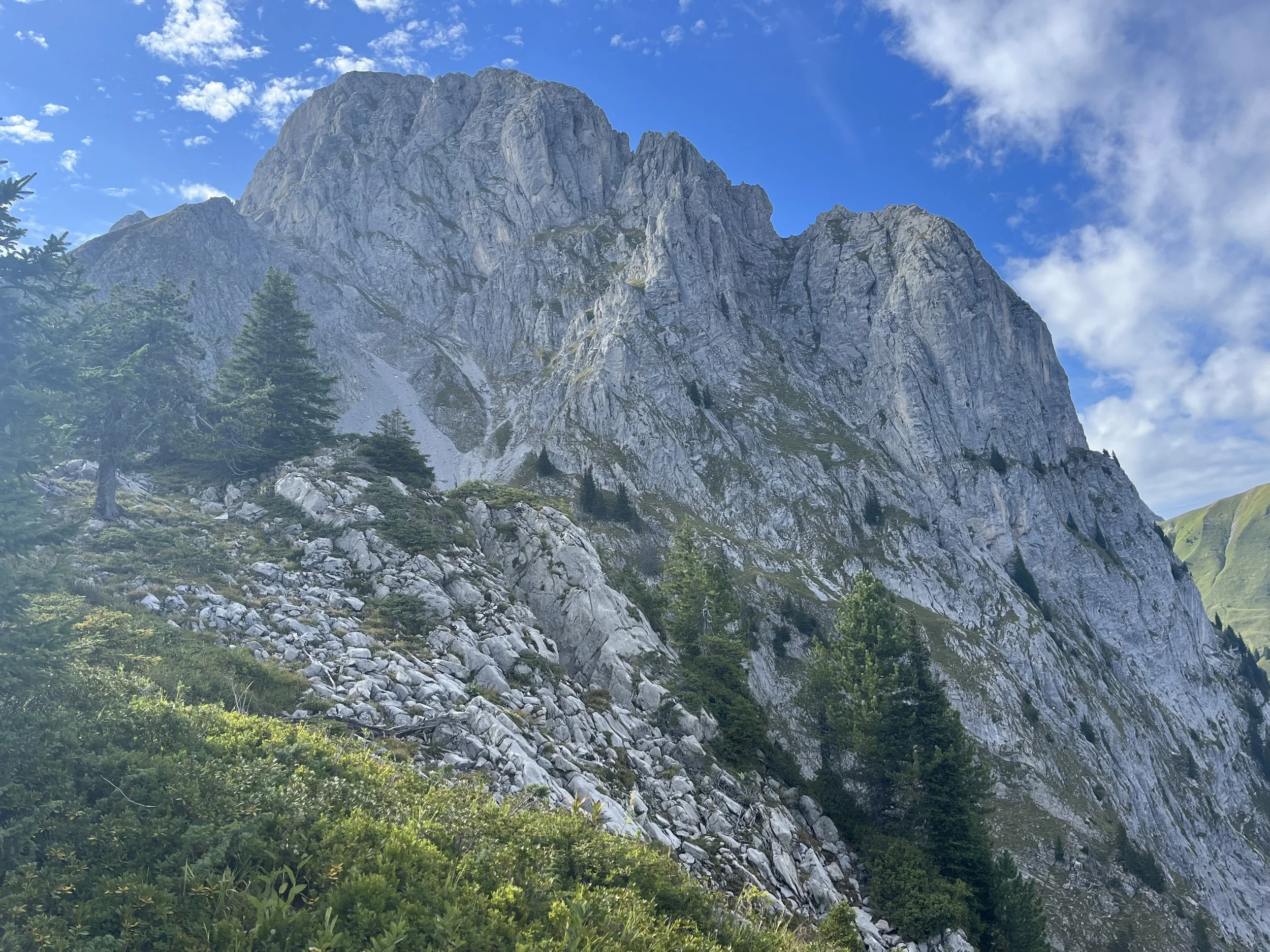
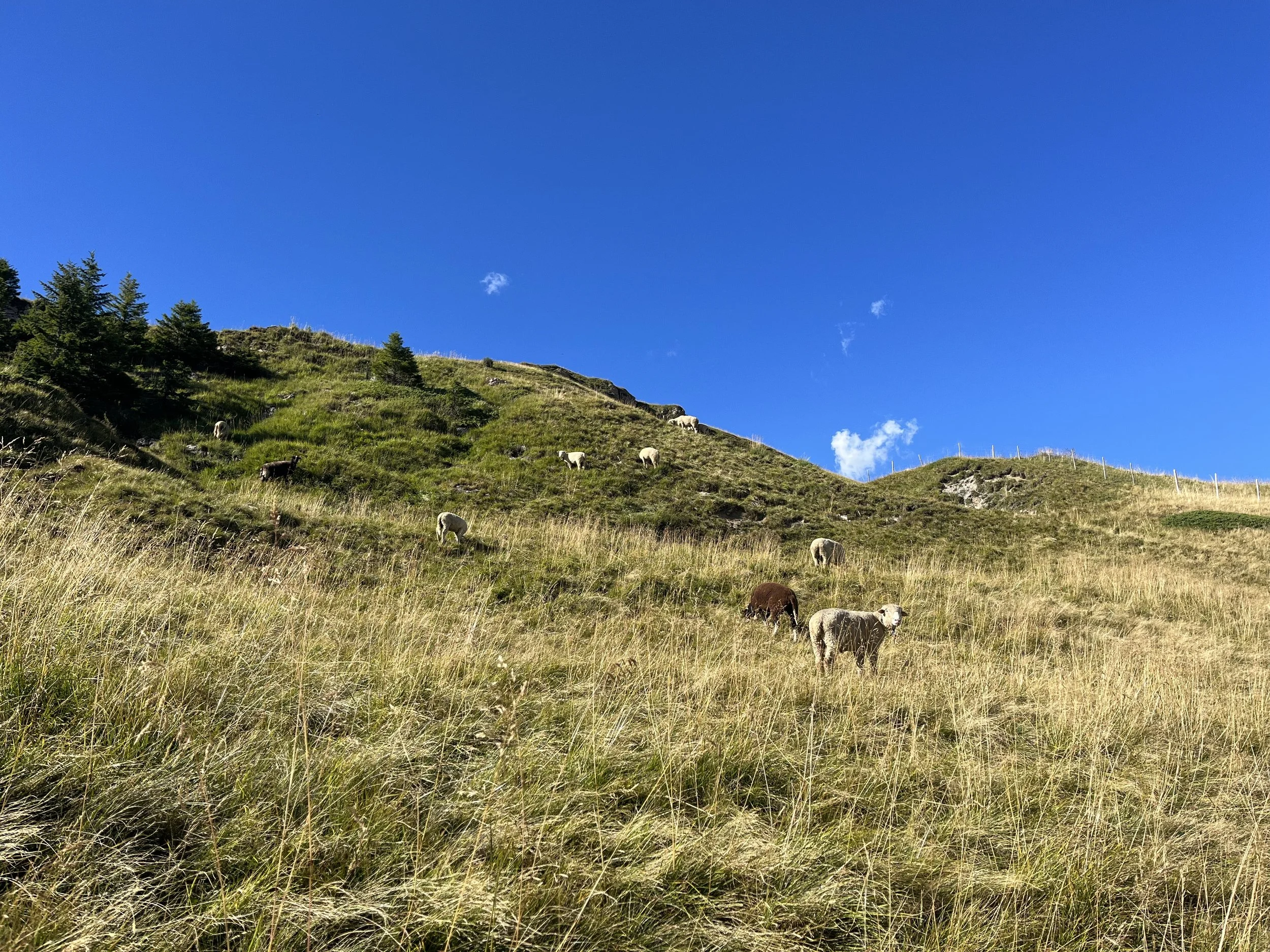
There was another ascent from Tannensee to the start of the ridge hike. The ridge hike was very stunning and started the most technical segment of the hike. From this point, I didn’t see any more people - just sheep!
Start of ridge hike
At one point, I found two marmots. See if you can see them in the video below.
….and then the sheep!
The rest of the way down. I was very focused on my footing due to the amount of grass. I slipped a couple of times before taking the gondola from Hasliberg-Reuti down to Meiringen, where I camped for the night. The camping spot there was on a playground in AlpenCamping and the lady at reception was very kind. I had no reservation and she even ordered me bread for the morning. I met a British man and Dutch couple were doing a cycling tour and camping next to me. We had a lovely chat over dinner. Meeting people at the camping spots is a real perk. It’s so nice to meet fellow outdoor-loving people and exchange recommendations of adventures to do.
Altitude description and map of trail
Day 2 - Meiringen to Gimmelwald
Schwarzwaldalp
The morning started off very relaxed with the delivery of the fresh bread and gipfelis. After saying goodbye to my new friends, I went to Coop and get some supplies for the next couple of days. The next part of the route was right along a bus line to Schwarzwaldalp. At the top there was connecting bus down to Grindelwald. Around Schwarzwaldalp there was a lovely view from the base of Wetterhorn as I waited for the connecting bus, which I was glad I did because the trail ran along the road and there were a couple of different biking races going on at the time. One on the road for race bikes and one on the trails for mountain bikes. It felt good to avoid all the bikers - however, I would soon learn in Grindelwald the races would continue from there again following along the trail. Grindelwald felt very overwhelming with the heat coming off the pavement and the tourists everywhere. I started to continue the trail to Wengen.
Grindelwald
The trail towards Wengen was mostly on the road with lots of cyclists from the race. It was not ideal and un-motivating to continue.
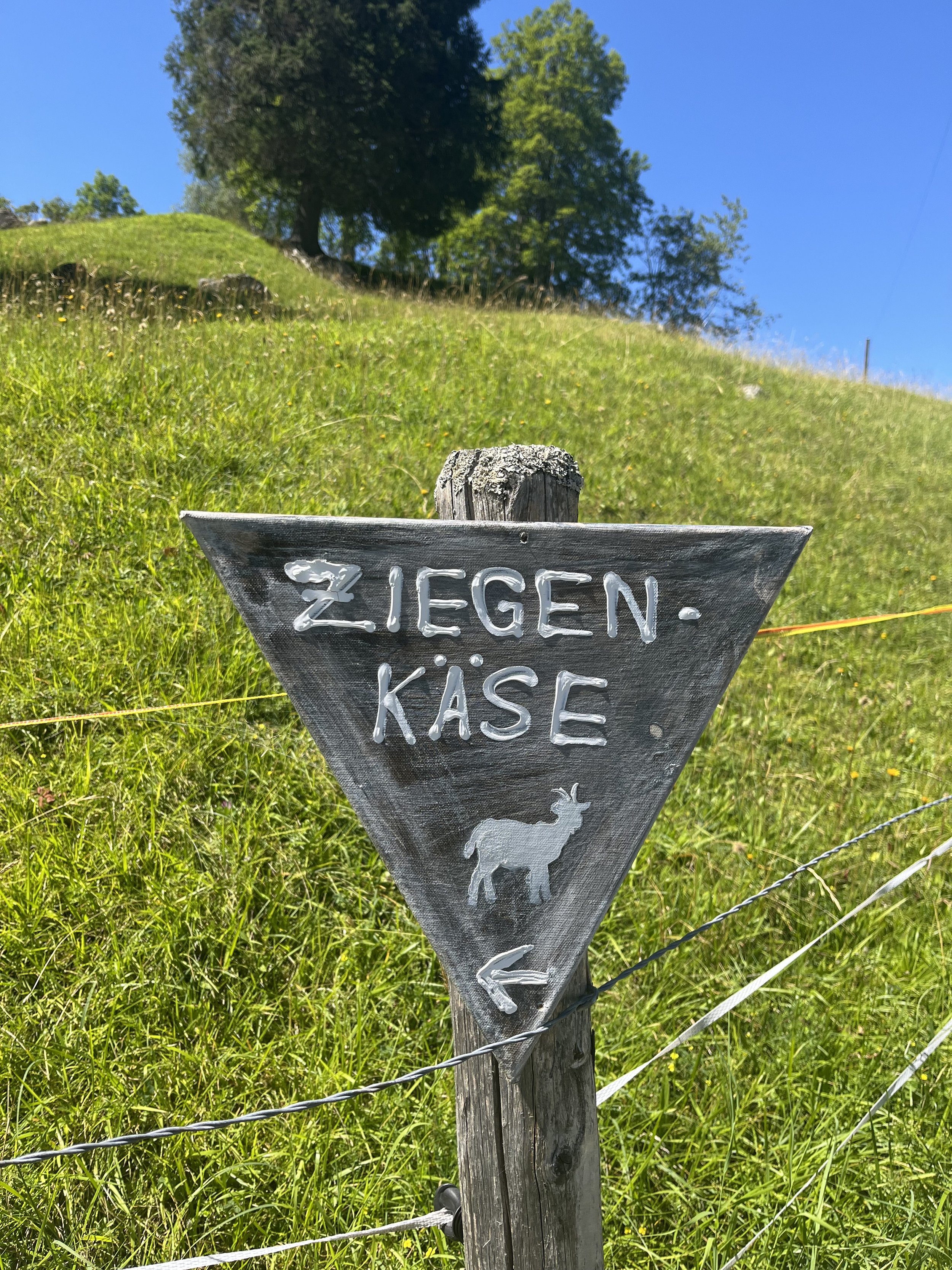
Cute sign for goat cheese. There were white Saanen goats (native to Kanton Bern)
I stopped part way to Wengen and took the train to Lauterbrunnen as the combination of the heat, roads, and cyclists were all wearing on my enthusiasm and energy to continue. At Lauterbrunnen, I took the gondola up and then took the tiny mountain train to Mürren. I have done the trail from Lauterbrunnen to Mürren many times, so I did not feel the urge to repeat it along it is a very nice trail.
In Mürren, I purchased some snacks, which I enjoyed while gazing at the magical views from the village. I would end up regretting not purchasing more snacks or drinks for the next day (as I would run out of food and water).
View from Mürren
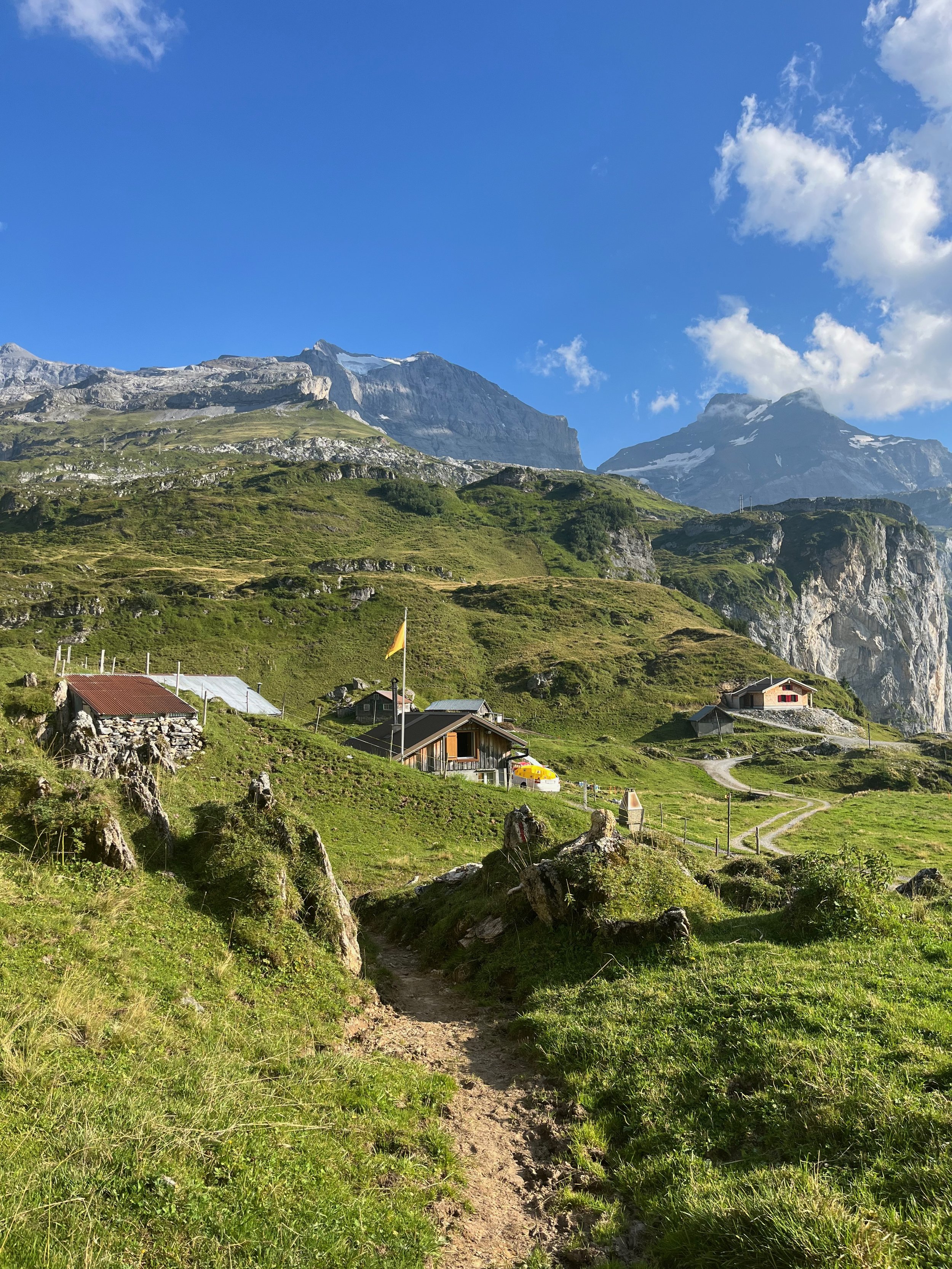
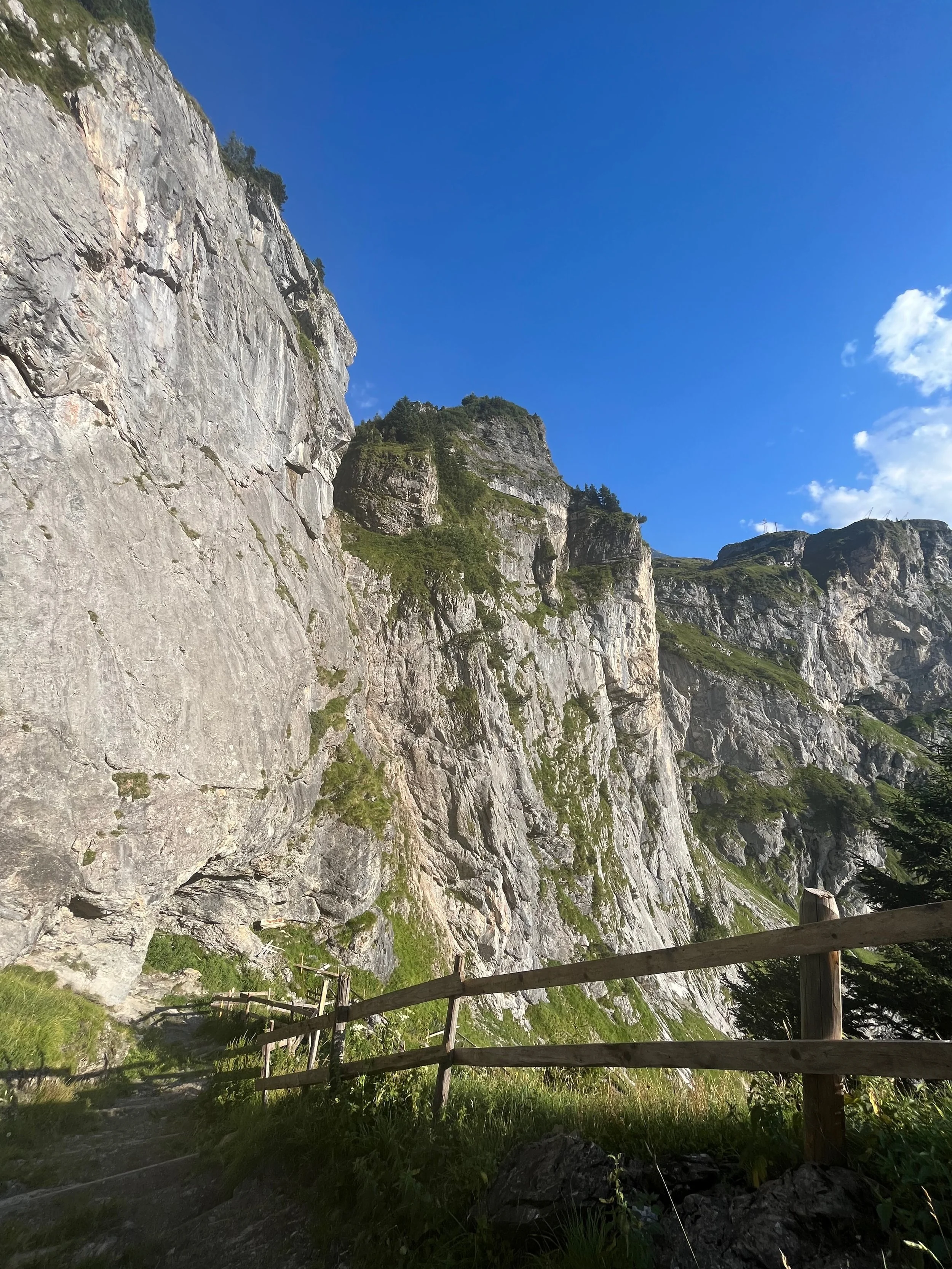
The hike out of Mürren towards Gimmelwald was beautiful. After the road, there was the classic dirt mountain trail (my favorite type of trail).
And then I stumbled upon more Saanen goats at a little farm before the first true ascent.
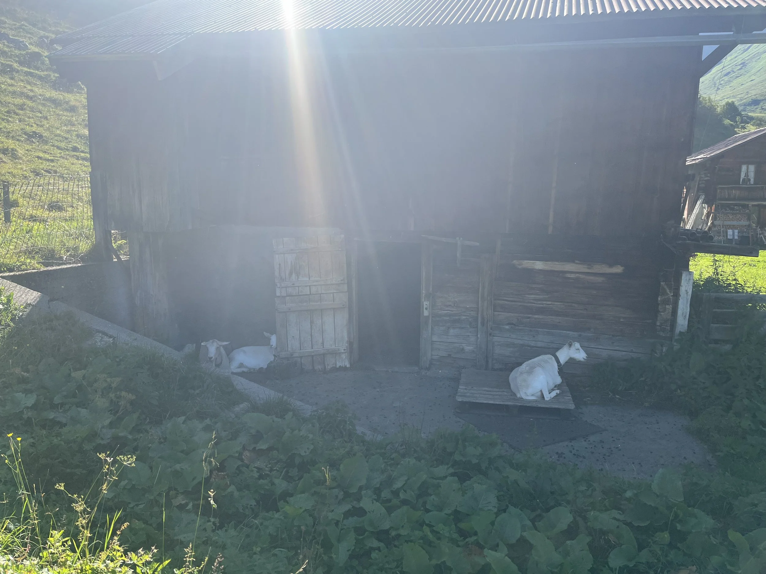
Saanen goats
The sun was getting lower in the sky and this part felt really refreshing and my enthusiasm was high as I made my ascent.
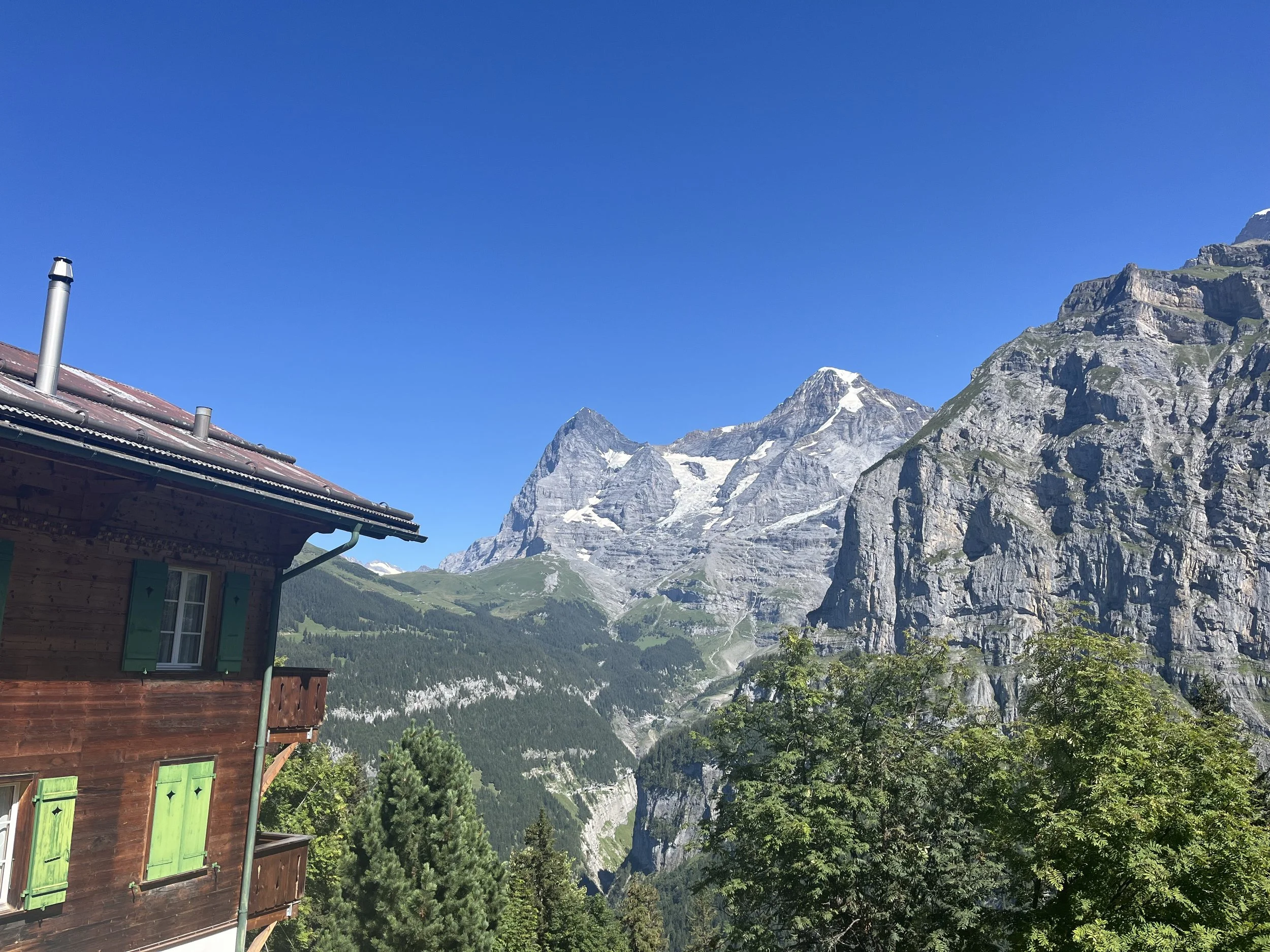
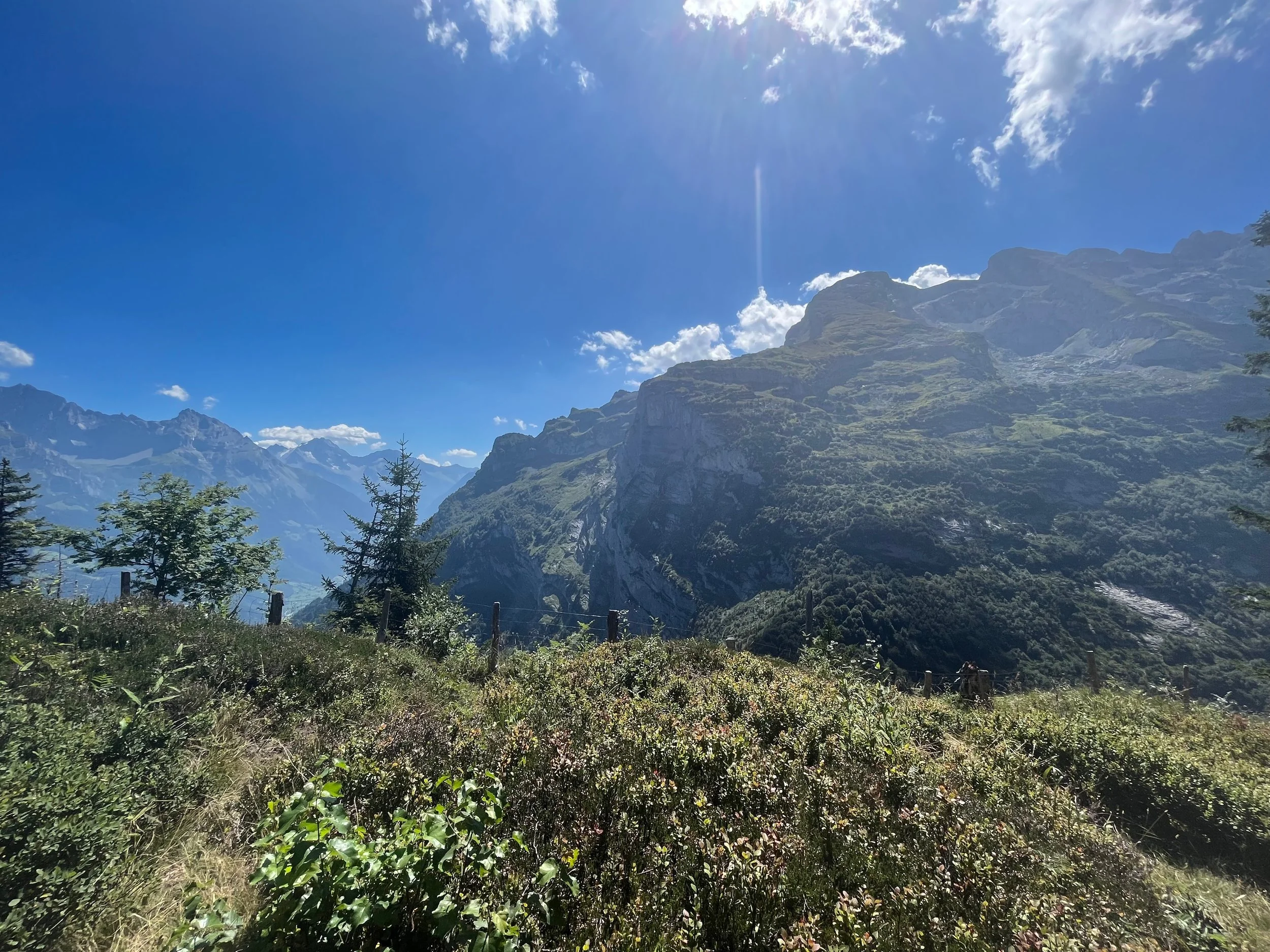
View from the ascent in Gimmelwald
After the ascent, the trail was easy with breathtaking views!
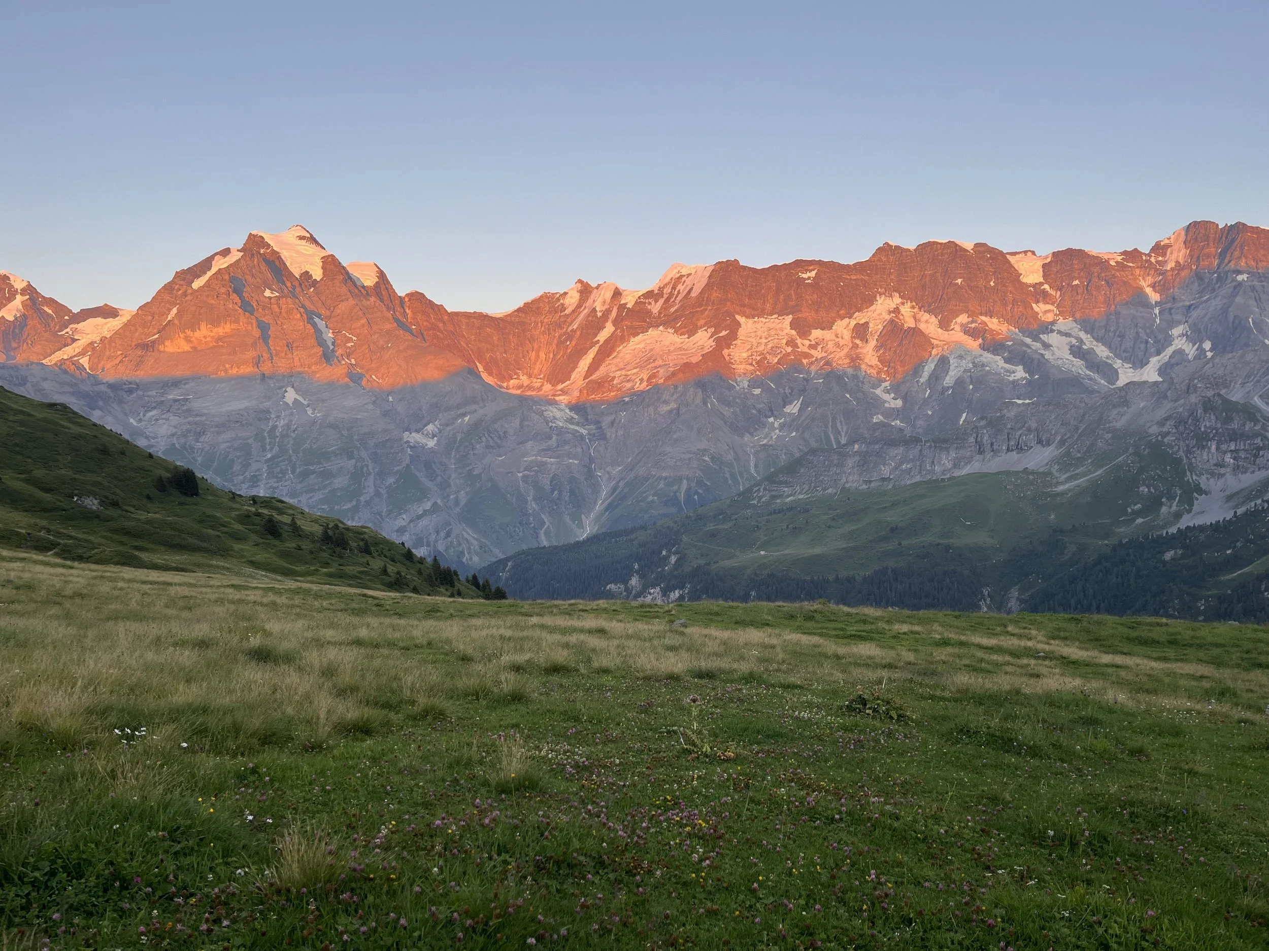
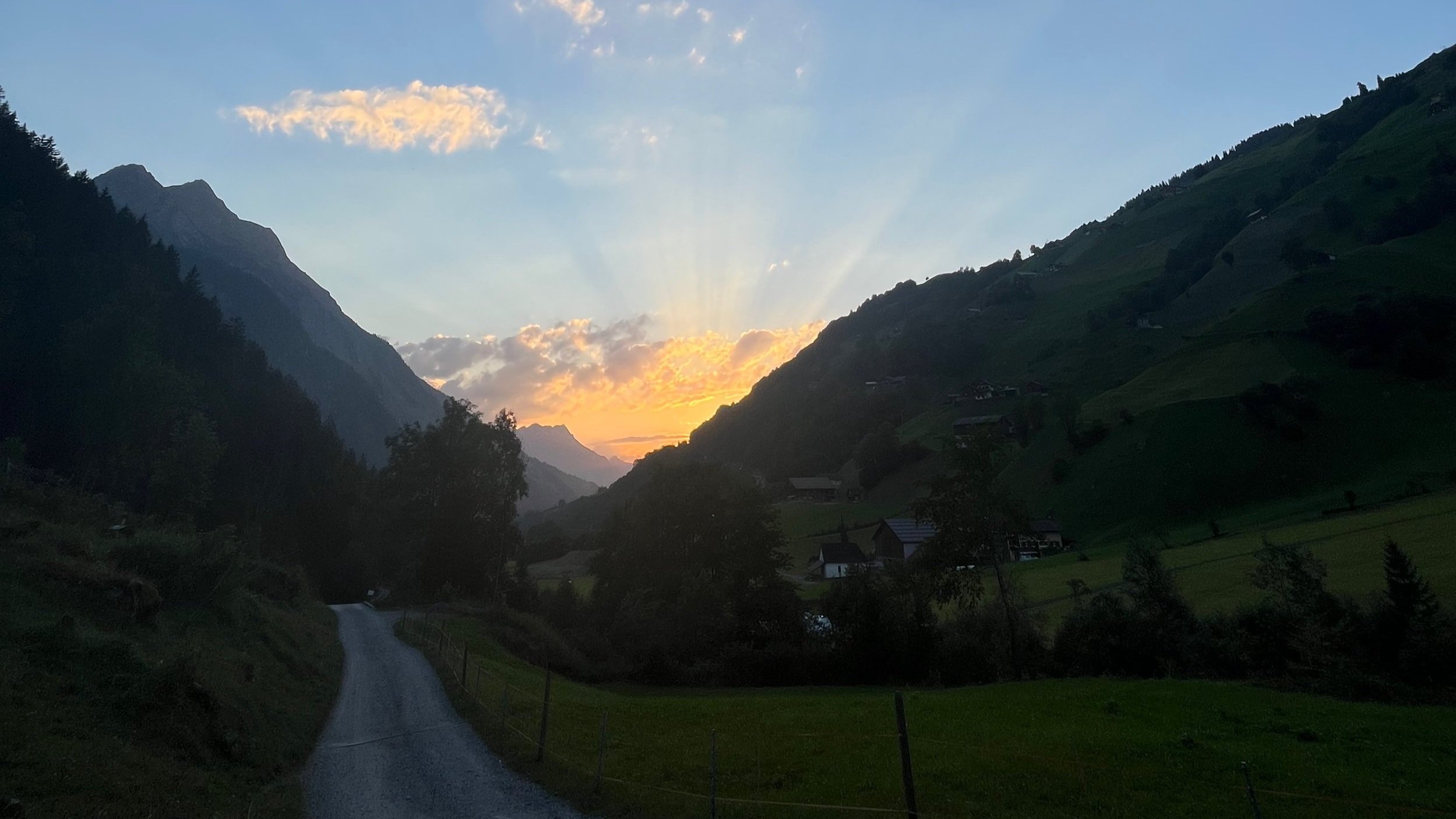
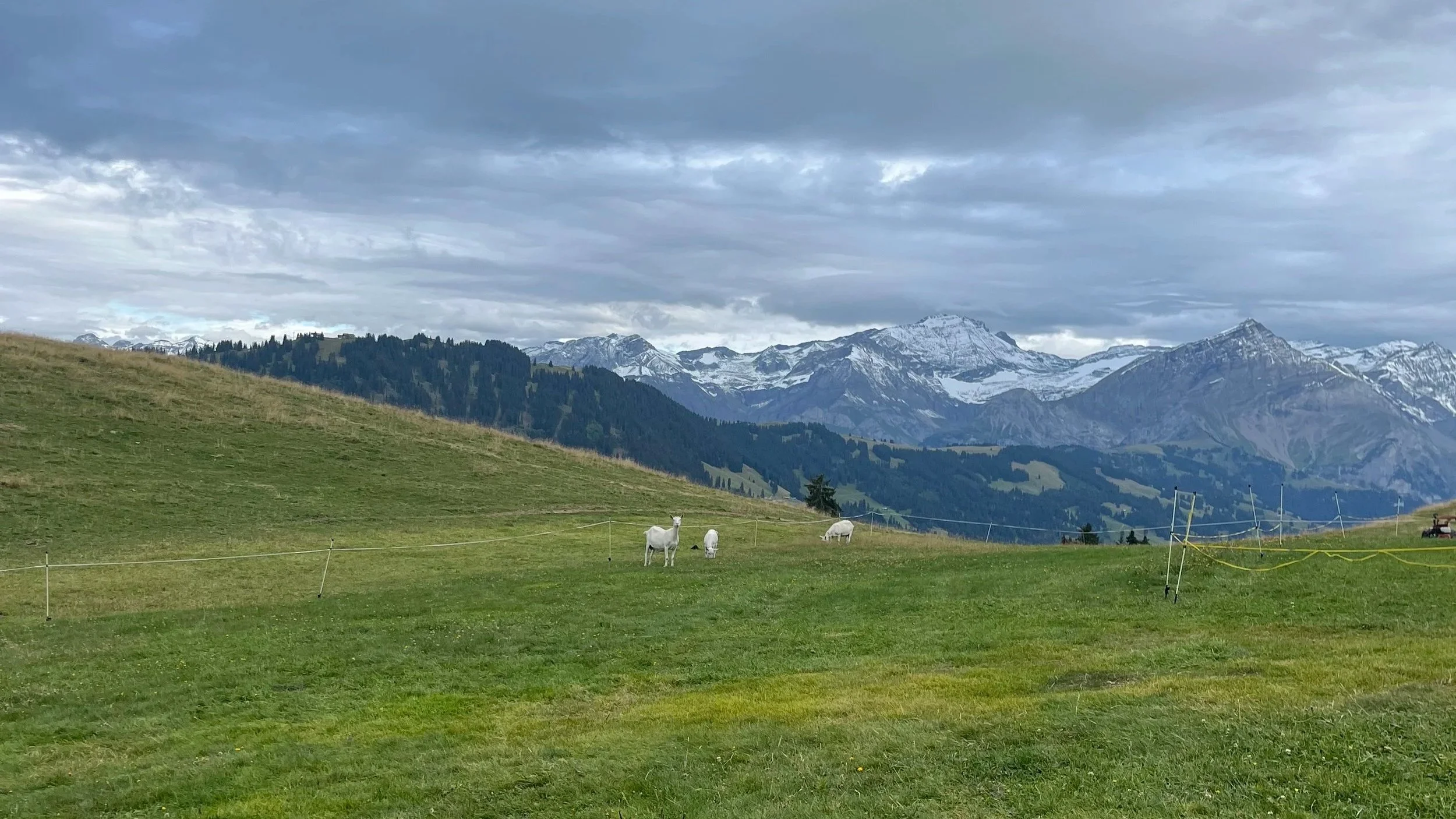
It was shortly after this point that I found what may be the most beautiful wild camping spot that I have camped at.
The sunset there was gorgeous!

Happy camper!
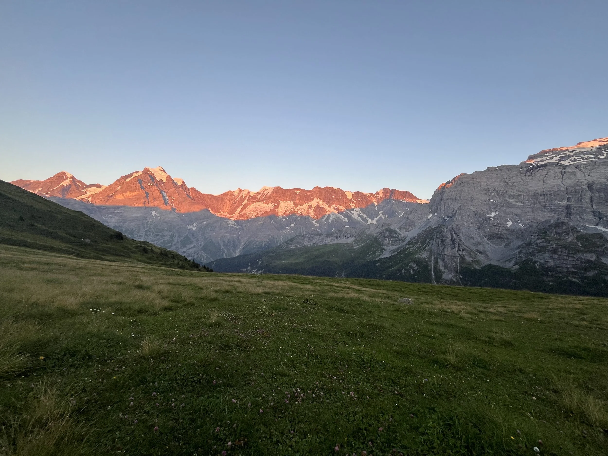
Sunset from wild camping spot
Map and Elevation Profile (Grindelwald to Wengen)
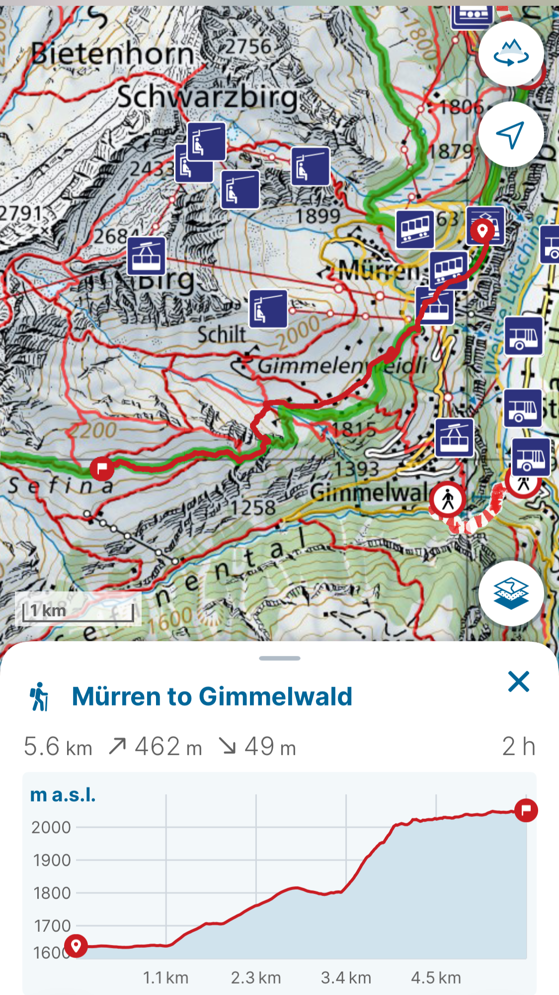
Map and Altitude Profile (Mürren to Gimmelwald)
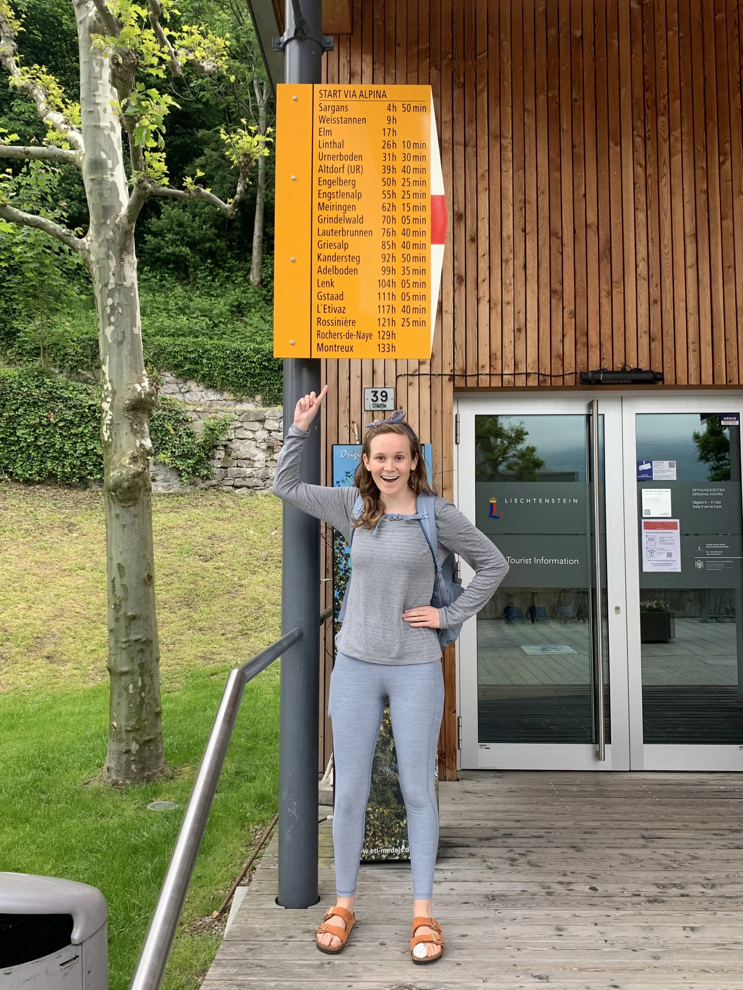
Via Alpina: Vaduz to Montreux
The most scenic route across Switzerland
I have been obsessed with the Via Alpina Green trail since I discovered the starting point at Montreux on a random day trip. After looking it up, I mapped it out and read multiple articles about the trail. This trail was a dream to me — a chance to cross Switzerland through its most scenic mountain passes.
Here’s a link to a GPX file for the entire tour from Vaduz to Montreux: Via Alpina - GPX Link
For further information about the first section please read my article about my journey from Vaduz to Engelberg here: Eastern Via Alpina Section Link
For information about my journey on the western part of the Via Alpina read my article here: Western Via Alpina Section Link
In order to prep for my Via Alpina journey, I packed all the items pictured below (total weight around 17 kilos without water):
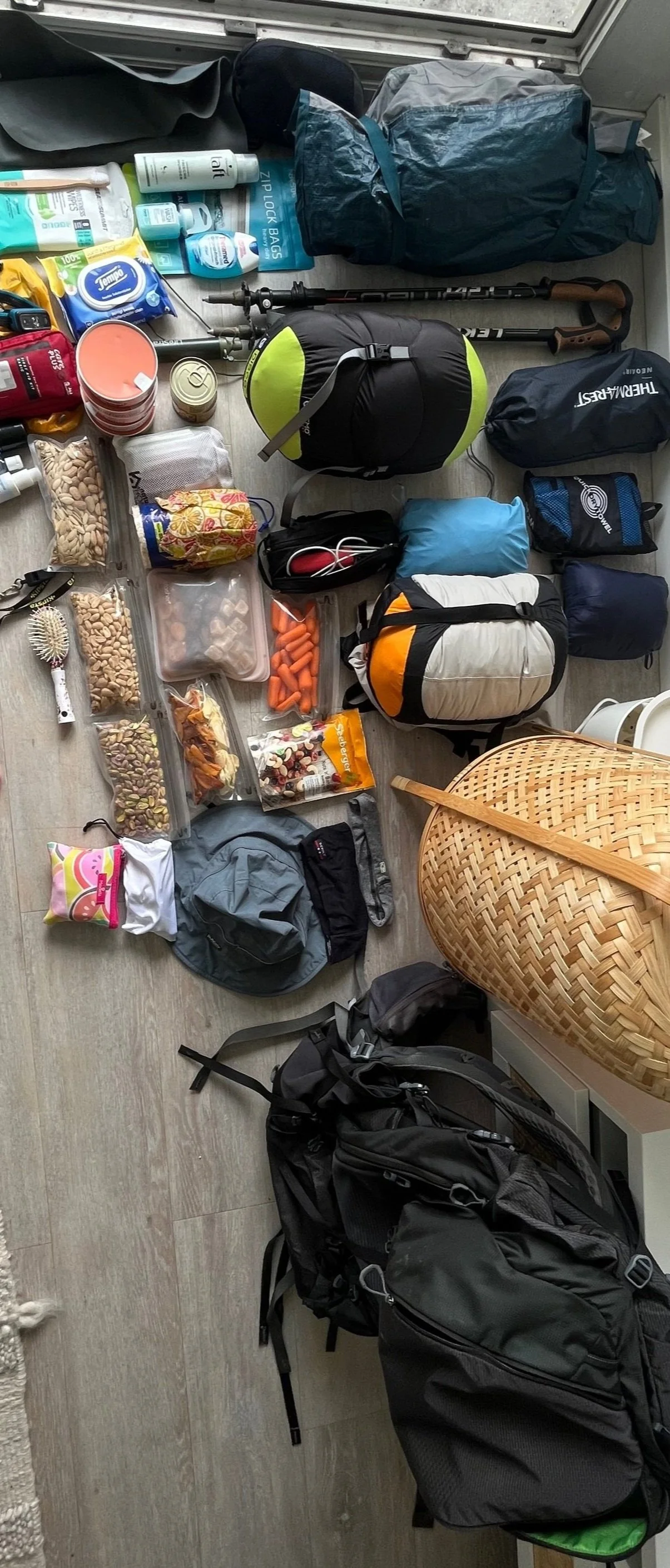
This includes food (dried fruit, nuts, canned tuna, granola bars, rice cakes, and carrots), toiletries and sealed trash bag, quick dry towel, hiking clothes including a swimsuit, hat, packable raincoat and light down coat, headbands, and buff, inflatable mattress and pillow, sleeping bag, tent, hiking sticks, first aid kit (with emergency blanket), sunglasses, electronics case with portable and wall chargers, and whistle.
Via Alpina (East Section): Vaduz to Engelberg
Vaduz to Engelberg: the eastern section of the Via Alpina
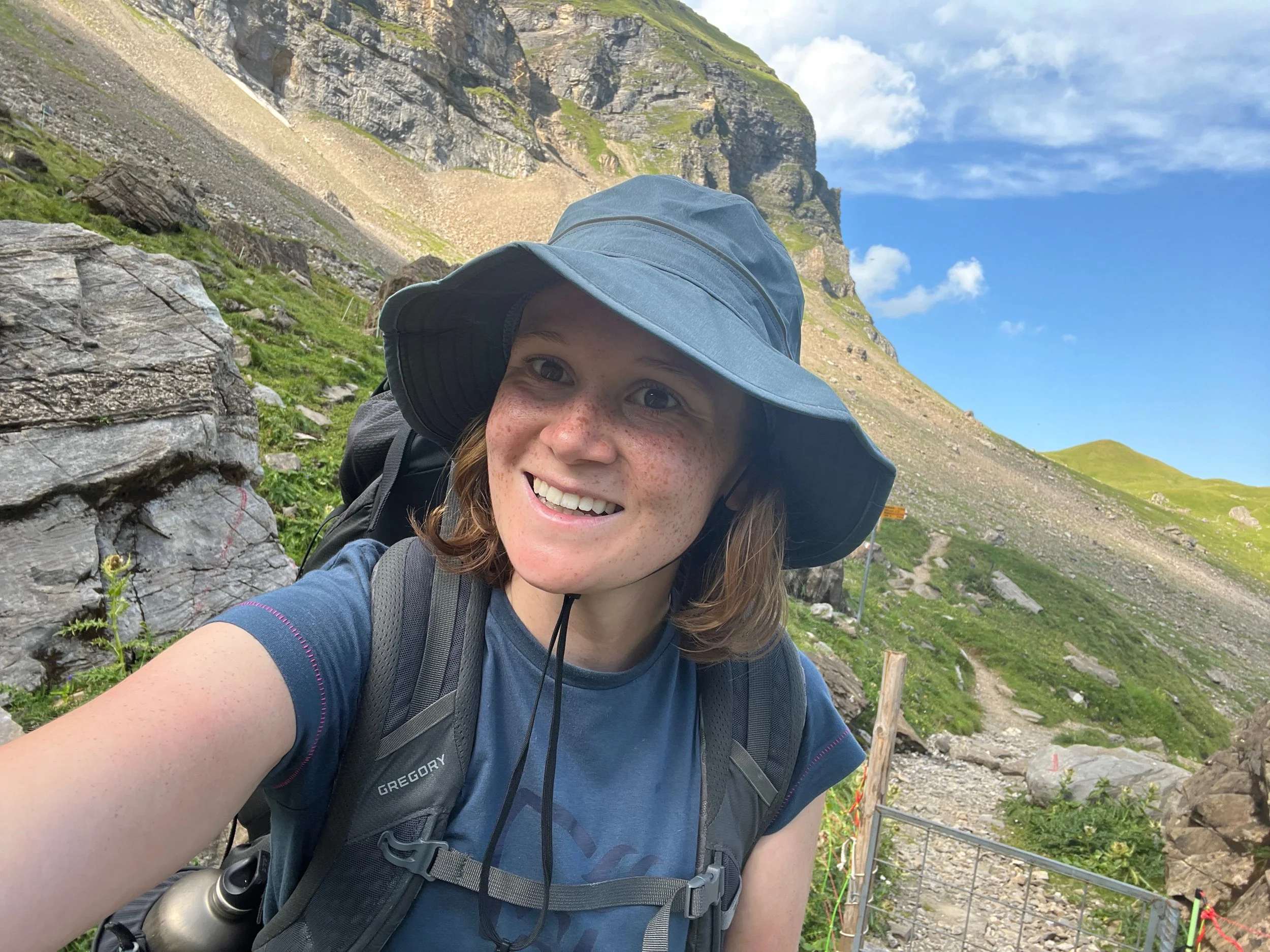
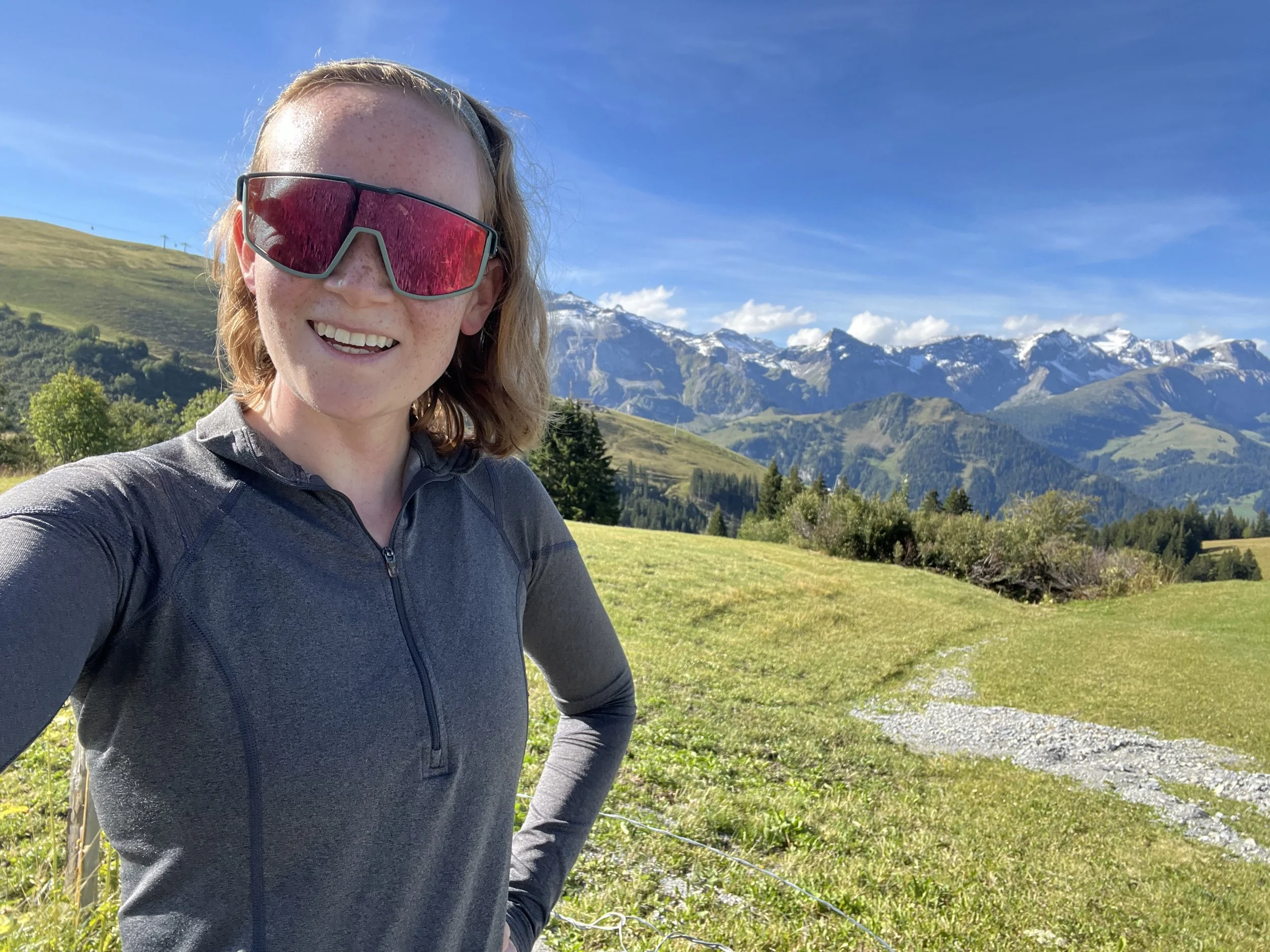
Selfie at Surenenpass
On my Via Alpina adventure, I ended up hiking the trail on two different trips for various practical reasons. The first section I did took around 6 days to complete and spanned from Gaflei, Klink bus stop in Liechtenstein to Engelberg station in canton Obwalden. To be honest, I have a couple of cheating rules that I live by that meant not all of the Via Alpina trail were hiked from point to point. I optimize for time on the “real mountain trails” and strongly avoid trails that are in the city/streets or that can be covered by public transport. I did not fully optimize for this as well as I could have, but I will insert some tips if this is also your target.
Below you will find both a short technical summary as well as a longer daily blog with additional information including maps with GPX links.
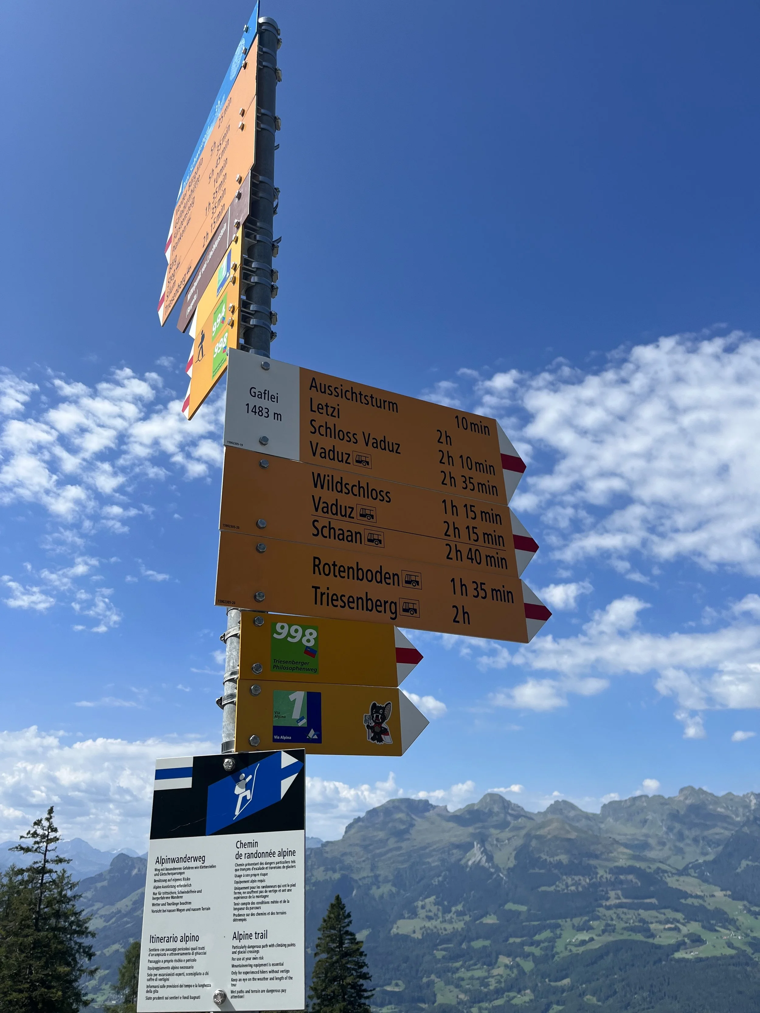
Start of the Via Alpina trail in Liechtenstein
Technical Summary:
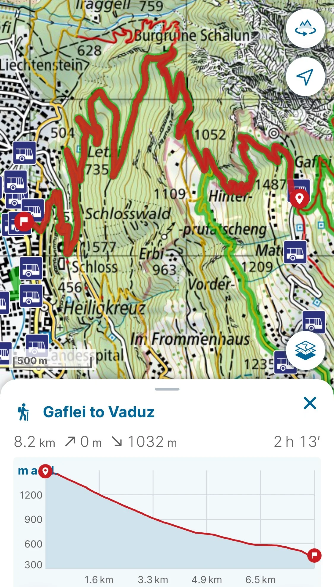
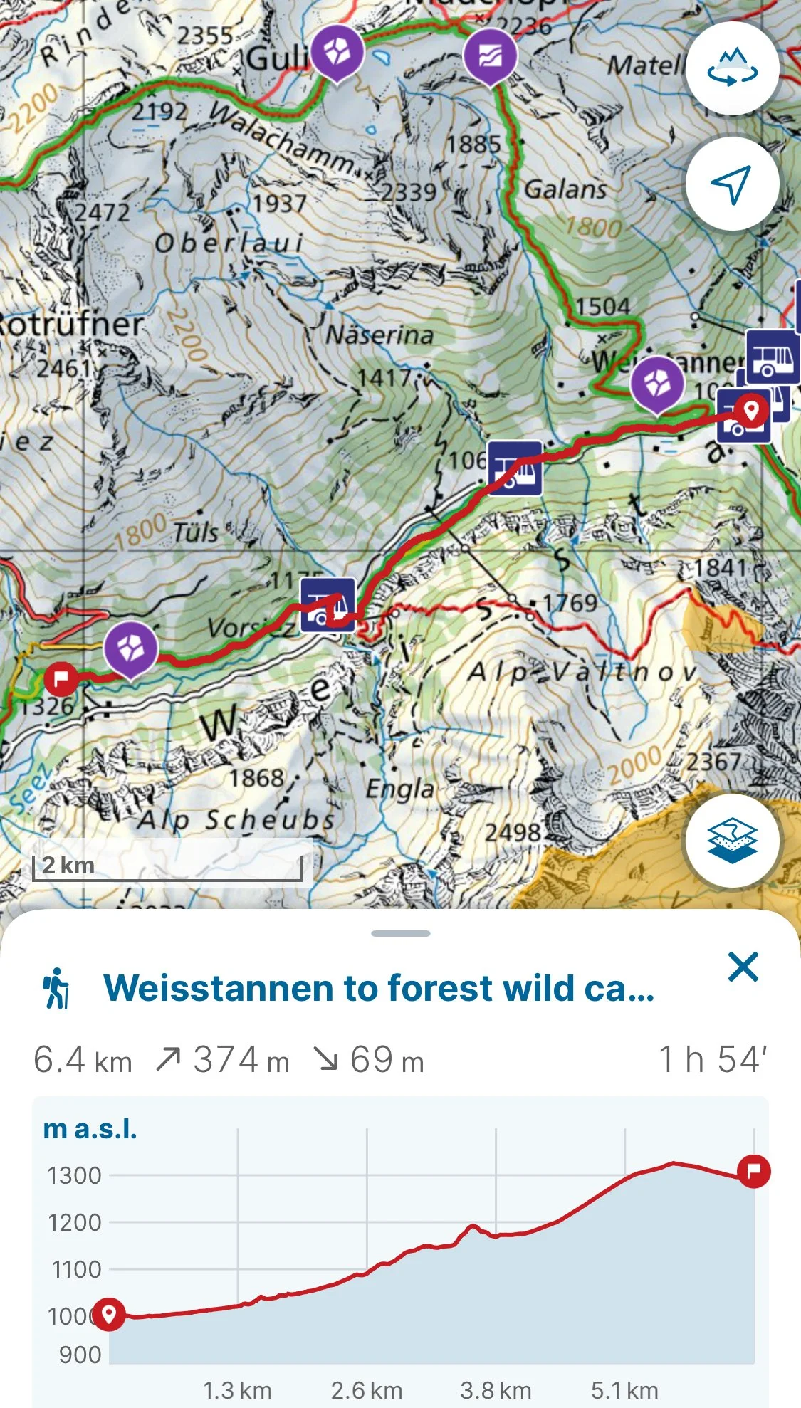
Day 1: Gaflei to Weisstannen
Stats: 8.2 km (1032m descent) & 6.4 km (374m ascent/69m descent)
Trail Conditions: Technically easy with lots of dirt/gravel trails/roads
Good to Know: Many drinking points and shops/bathrooms around Vaduz and Weisstannen
Weisstannen to wild camping spot near Foo Pass - GPX Link
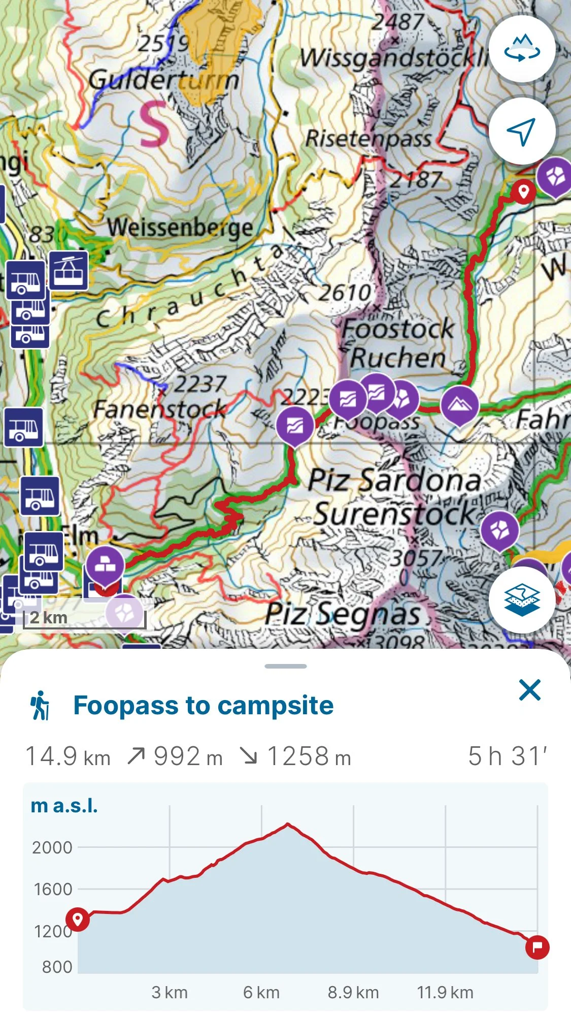
Day 2: Weisstannen to Elm (Foospass)
Stats: 14.9km (992m ascent/1258m descent)
Trail Conditions: More technically challenging, but still fairly easy/moderate mountain trail with narrower grassy/dirt hiking trails with some rocky trail areas on the first part of the ascent. Last part of descent is mainly road (transitions from dirt to paved)
Good to Know: Drinking fountain is available near a waterfall at the beginning of the ascent and a second one is available near a farming building near the top of the ascent. After the first part of the descent there is a farm providing refreshments before the last road down. Please note that the land is protected during the descent, so camping is only possible at the campsite in Elm! There is limited cellular reception for most of Foospass.
Foo Pass to Elm Campground - GPX Link
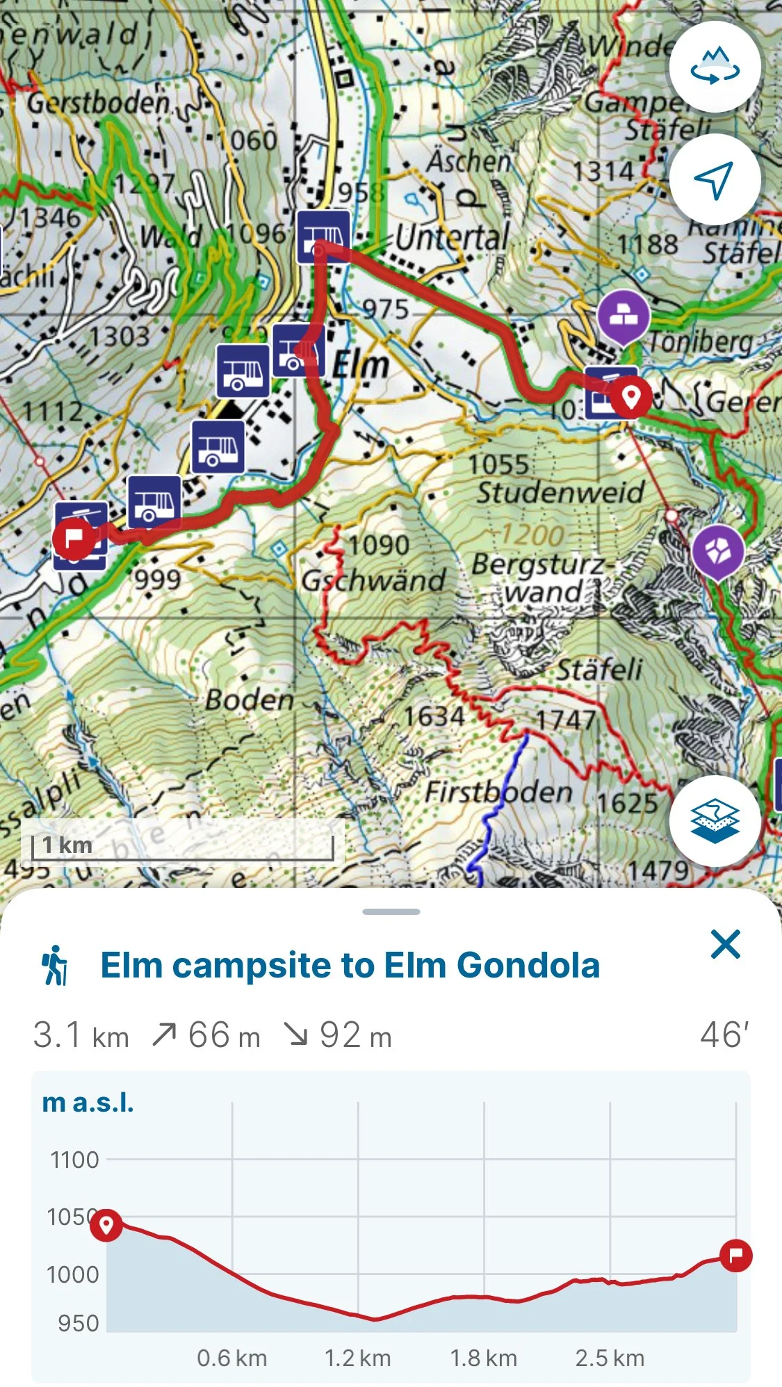
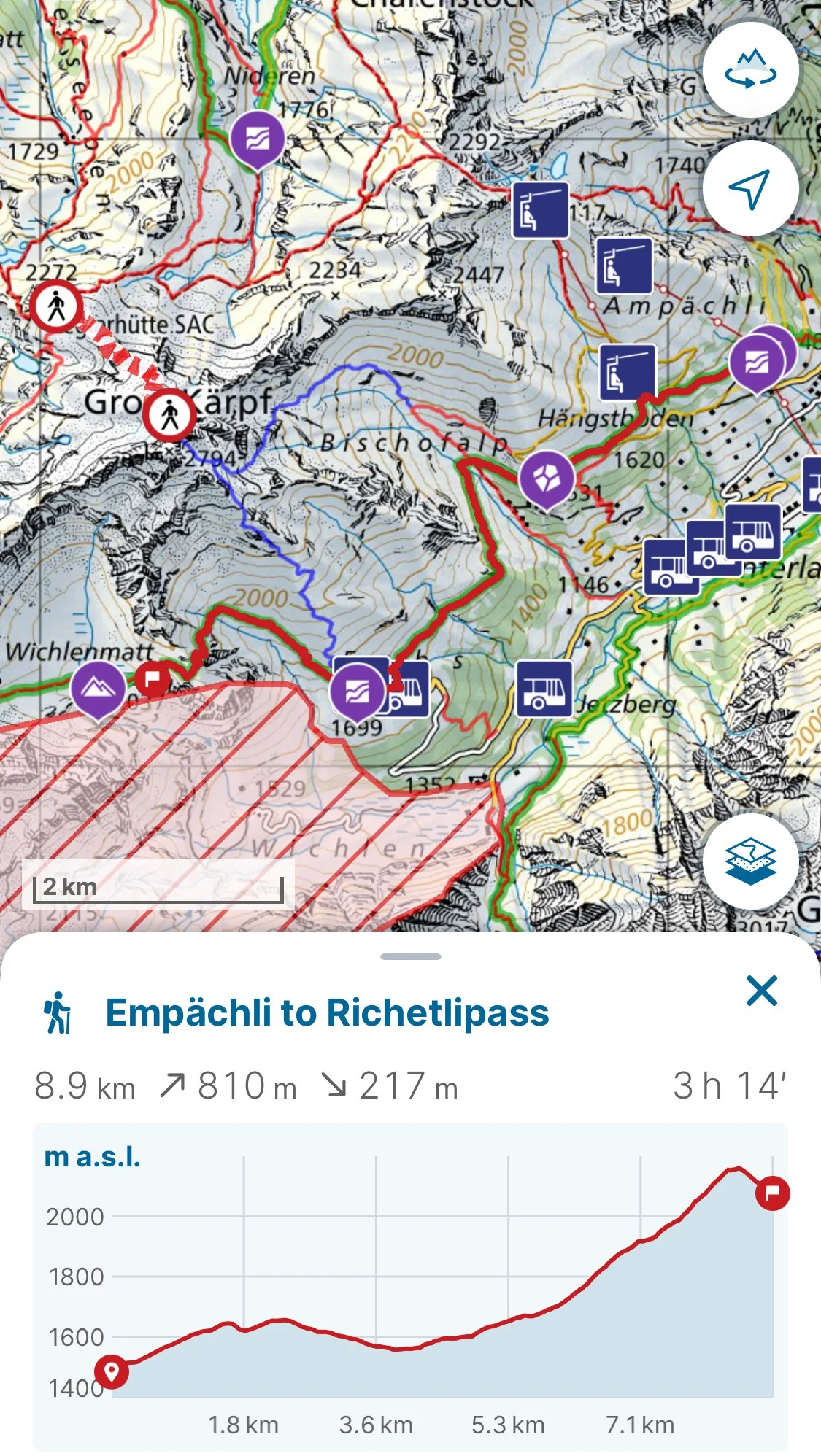
Day 3: Elm to Richetlipass
Stats: 3.1km (66m ascent/92m descent) & 8.9km (810m ascent/217m descent)
Trail Conditions: The first hike from the campsite to the gondola is on a paved road whereas the second hike is on a dirt mountain trail.
Good to Know: A short cut can be taken by taking the bus 545 from Elm to Obererbs Skihütte instead of taking the gondola at Elm Sportsbahnen like I did. There are fountains and restaurants around Elm and Emphächli as well as a restaurant at Obererbs Skihütte. The restaurant at Obererbs Skihütte is the last place to get water before Linthal! There are limited streams where you can use a life-straw during the descent to Linthal.
Elm Campsite to Elm Gondola GPX
Empächli to Richetlipass wild camping spot
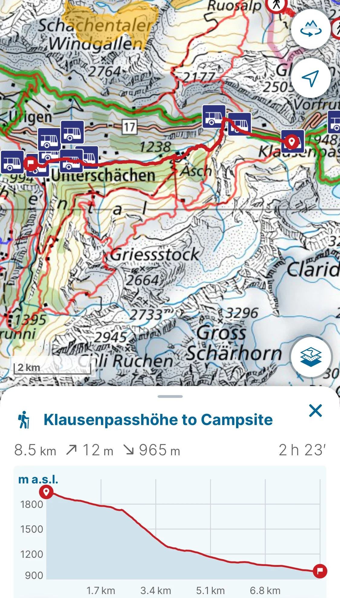
Day 4: Richetlipass to Klausenpass
Stats: 11.7km (229m ascent/1655m descent) & 8.5 km (12m ascent, 965m descent)
Trail Conditions: Very rocky/steep conditions around Richetlipass with risks of falling rocks. After inital descent, the trail becomes a dirt road before turning into a dirt trail through the forest.
Good to Know: Short cut available by taking the bus 405 from Linthal to Klausen Passhöhe. Linthal offers stores and water fountains as well as bus/train connections. On Klausenpass, there is a campsite in Unterschächen that is worth deviating from the Via Alpina trail for since it has showers.
Day 5: Klausenpass to Surenenpass
Stats: 6km (846m ascent/120m descent)
Trail Conditions: Moderate dirt/rocky mountain hiking trail with increased exposure to rockslides and unstable rocks towards the top of the ascent to Surenenpass.
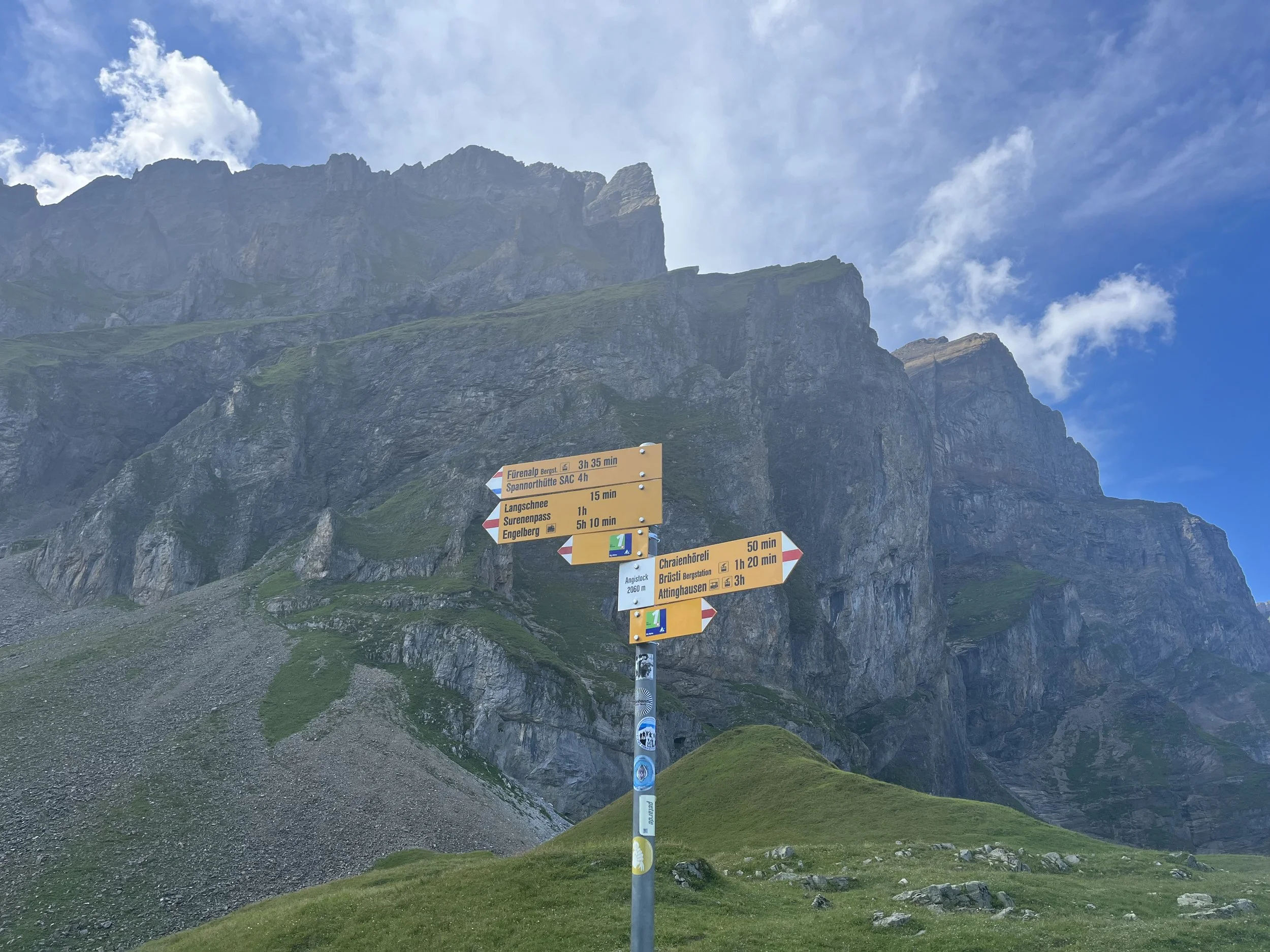
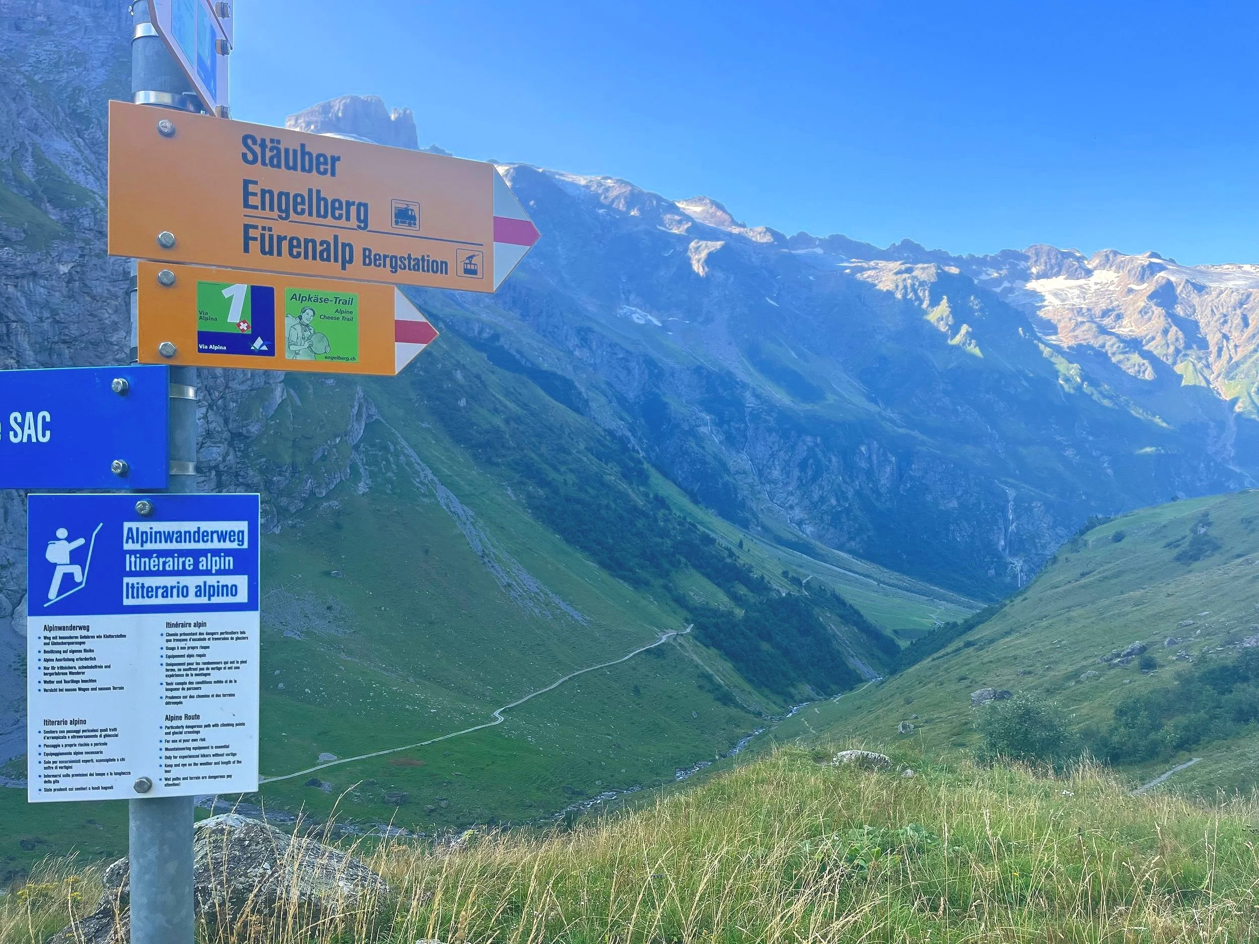
Good to Know: Short cut from Unterschächen via bus 408 from Unterschächen to Attinghausen Seilbahn and then taking the gondola at Attinghausen Seilbahn to Brüstli. There are restaurants and water fountains available at Brüstli. This is the last place for water before the farm during the descent to Engelberg (which was the next day for me)!
Day 6: Surenepass to Engelberg
Stats: 10.8km (22m ascent/1198m descent)
Trail Conditions: Normal, dirt mountain trail until after the farm when the trail becomes a dirt road until the forest at the end where it is a gentle dirt walking path.
Good to Know: No water at the refuge hut or anywhere nearby until about an hour into descent where there is a farm that has a fountain and open restrooms. There are streams before the farm, if you have a life-straw.
Daily Blog:
Day 1 - Gaflei to Weisstannen
This day was one of the most transport heavy days for me. I started off by traveling from Munich with the Deutschland ticket to Lindau-Reutin and then purchasing a short train ticket from there to Feldkirch in Austria. (Please note that international tickets are not sold on the SBB app but only on their website.) From there I had to take three buses to get to Gaflei, Klink (via Vaduz, Post and Triesenberg, Dorfzentrum). I arrived at the trail head shortly before noon. The trail descended gently down through a forest into Vaduz. There were some good places to stop on a bench to look across the valley into the mountains of Switzerland. The end of the trail was mostly gravel or pavement road, which is not a type of trail that I am a fan of. By the time I reached Vaduz, It was half past 2pm and quite hot. Therefore, I took the opportunity to indulge in the last of civilization by using the public toilets and stopping in a cafe for a “Käsewähe” for a late lunch bite. Using my strategy of optimizing for mountain passes, I took three buses from Vaduz, Post to Sargans, Bahnhof and then to Mels, Verrucano and finally to Weisstannen, Oberdorf. By that time, it was early evening so I planned to continue my hike until I could find a suitable camping spot. I saw a sign for a camping site 600 meters from Oberdorf yet I was unable to find it once I was on the trail. The trail gently ascended through a forest along the river. There were some gorgeous outlooks into the mountains and of towering waterfalls. Once I crossed a farm, the trail became a gravel road that winded up the hillside into the next forest. Along the road, I saw a couple picking mushrooms, but I was more interested in picking the bountiful raspberries and blackberries in the brush. Around 7:30pm, the trail separated from the road and went up into the forest. Here I found a little grassy hill to set up camp on. As a general rule, I do not like to camp near gravel roads, especially because farmers tend to drive on them first thing in the morning. This proved to be a lovely little camping spot, but the only problem was the plethora of slugs on my soggy tent the next morning.
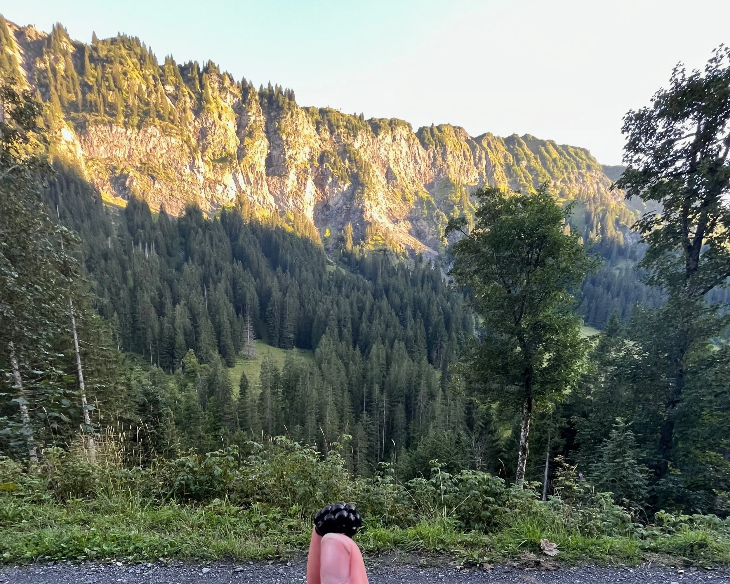
Blackberry on the road to the forest after the farm
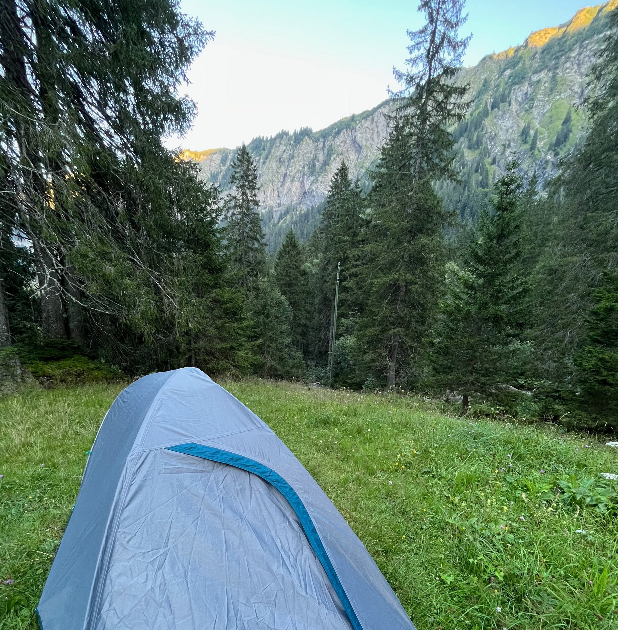
My cozy camping spot in Weisstannen
Map from Gaflei bus stop to Vaduz
Map to wild camping spot from Weisstannen bus stop
Day 2 - Weisstannen to Elm
Honestly, this was one of the toughest days for me despite the trail not being that physically or technically challenging. I had a migraine this day and there was absolutely no shade after exiting the forest first thing in the morning. I ended up sleeping for a couple of hours in a blueberry bush surrounded by cows under the heat of the sun. The path up to the cow pasture was rocky and beautiful brimming with rushing waterfalls and wildlife. There was a chamois running across the valley when I was crossing and I also saw a hunter carrying one on his shoulders.
The top of Foo Pass revealed a beautiful mountain landscape stretching as far as I could see. Shortly after crossing down Foo Pass, I ran into a friendly farmer who offered me a drink and some helpful advice on where to camp for the night. A lot of the forest below Foo Pass was protected, so no camping was allowed, but 2 hours down hill near Elm there was a small campsite for tents in a forest. This campsite cost only a few francs and offered a small bathroom (with a charging port by the sink) as well as a picnic table and campfire spot. It was very cozy here so I took advantage of this to sleep in a little and recover well before my next day of exploring.
Passing over the top of Foo Pass
Descending Foo Pass
Views of waterfalls at sunset from the forest road
Cozy little campsite in the forest of Elm
Map of trail from Foopass to Elm Campsite
Day 3 - Elm to Richetlipass (near Linthal)
My first stop of the morning was only minutes away from the campsite, but so worthwhile. There was an adorable train car cafe that offered coffee, drinks, and little cakes (including my favorite Biberlis). The lady there advised me about a bus that left near there that went directly to Elm, Obererbs Skihütte; however, since the bus was infrequent I decided to walk to the gondola instead to start from Empächli. The trail there started from a little ski resort where there were restaurants and amusements for children.
Train car cafe in Elm
The trail began as a road presenting gorgeous views of the mountains across the valley, including Martin’s Hole. These mountains are uniquely carved in sharp points like cat teeth. Nestled along the path were old, traditional huts.
The path wound through the forest gently up on a gravel road, similar to the road from last night. The gravel road from the day before had already tired my feet and this road multiplied this ache, so I took a moment to bathe my feet in the flowing, icy river.
View from my icy foot bath
Once I crossed the river, I was greeted by some gentle shade from lush raspberry bushes. The trail then wound through some light woods, including a charming picnic and fire pit. Once through the forest, there was an opening where cows were casually munching in the meadow. Both in the forest and meadow there were some warnings of unstable areas were staying for too long should be avoided. The trail however was very gentle and well-maintained. The cows of this herd were especially friendly and were eager to follow my lead along the trail. I found this very sweet and funny. At the end of the cow pasture, there was the road and the bus stop for Obererbs, Skihütte. There was a cute little hut there that served nice little cakes and drinks. I throughly enjoyed my “rüeblitorte” and my conversation with the waitress. She was very kind and inquired about my travel plans. After a delightful break, I ventured up through the blueberry bushes and gentle grassy hillside towards the first outlook over Richetlipass.
Soon I reached the overlook that revealed a small grassy dip in the mountain more the final rocky ascent to Richetlipass. Originally, I confused this small dip for the pass itself and I set up camp there for the night. As I first enter this little meadow it looked like the perfect paradise for camping, but in reality it was quite the opposite.
The meadow was bumpy and the ground so uneven and wet that find a place to pitch a tent was difficult. More concerning was the rocks that started to fall from the mountain ridge above. At one point my original camping spot was so close to a rock slide that I had to grab my fully deployed tent by the top and run with it across to a nearby hill. I settled on the top of this hill where I could find the only few feet of flat space. The hill went straight down into a rocky cliff right at the edge of my tent. Honestly, I felt a bit nervous to be so close, so I slept on the side away from the cliff. There was also a small wire fence on the edge, so I felt somewhat protected.
Map of trail from Elm campsite to Elm Gondola (bus can also be taken instead from Elm, Obererbs Skihütte to skip part of the trail from the top of the Elm Gondola at Empächli)
Map of trail from Empächli to Richetlipass (majority of this trail can be skipped by taking bus to Elm, Obererbs Skihütte)
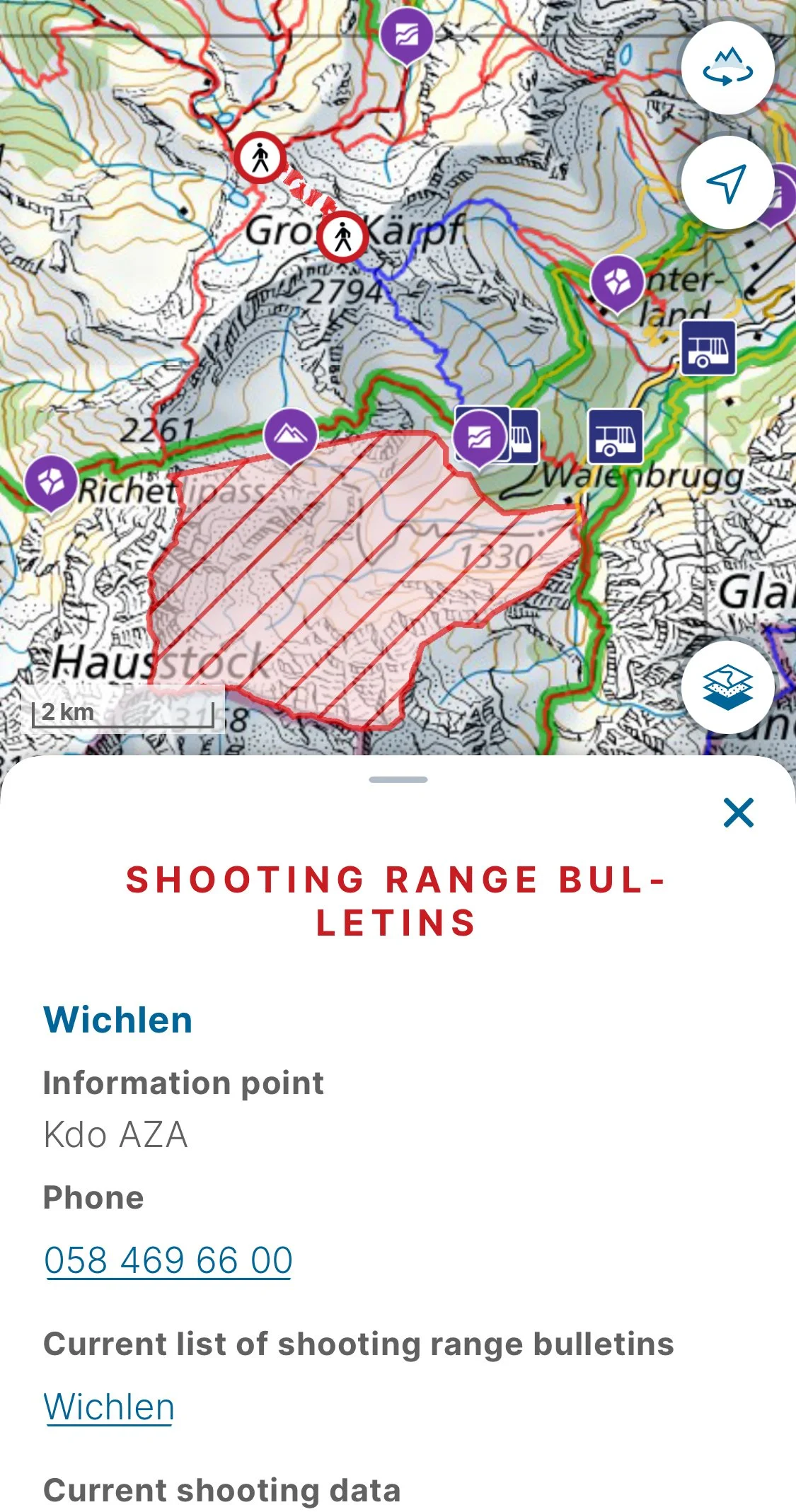
Please note advises on Swiss topo such as this one present for a shooting range nearby
My final camping spot on the edge of the cliff
Day 4 - Richetlipass to Klausenpass
The next morning, I awoke to the loud howl of the wind followed by a cascade of rock falls across the valley. Even though my location was quite safe, since the rock falls were still at a far distance, I quickly started out on my hike of the day. Shortly after starting out, I realized that I had actually not reached the top of Richetlipass, but it was actually a short distance further up. The trail up to the top was scarred by rockslides and crumbly, flaky rocks. I quickly ascended to the top of the pass motivated by thirst as my water hadn’t been filled since the cake stop at the small ski restaurant as well as by fear of possible rock falls. The top of the pass was stunning, but the path down was a bit steep with small, unstable rocks. However, there was some flora to keep the trail in tact, including my absolute favorite lupines.
View down the pass
The trail down was long and winding with no shade from trees even the occasional bushes were too short to provide any protection. There was also no water sources; however, there was a stream nearby and once it got close enough to the trail I went down the river bank to use my life straw since I was parched by this point. The trail continued down through some cow pastures towards a rocky stream. I spotted a little marmot curiously fixated on me amongst the piles of rocks.
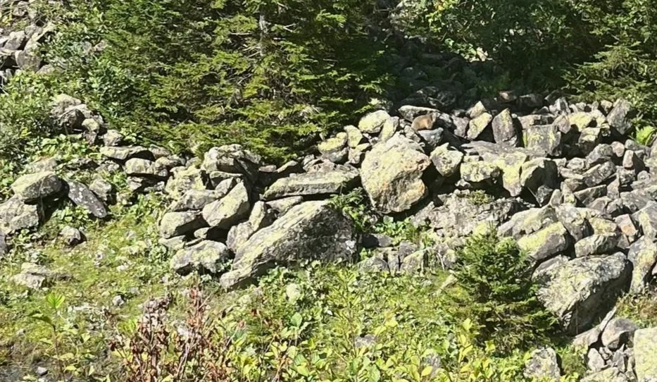
Find the marmot amongst the rocks. He blends in quite well with the rocks, but one hint is that he is facing towards the right of the image and is perched on one of the higher stones.
The rest of the trail was a stony road that intertwined with forests and farms yet was shockingly sunny. Further down there were little forest shortcuts from the main farm road. Amongst the trees there were raspberry bushes yet there were no drinking fountains. I used my life straw on numerous cow water tubs, but was still quite parched. The path down took longer than I had expected despite adding some little trail running spurts into my hike. The stream turned into a flowing river, which cascaded down in numerous waterfalls down to Linthal. I had expected to complete the hike down to Linthal before noon, but I only arrived to the town around 2pm. Linthal seemed like heaven, since a shady bench and fresh, cold water fountain greeted me along with a much needed garbage can to rid of my waste collection from my night of camping. After resting on the bench and drinking as much water as my heart desired, I ventured to the Volg where I restocked on some snacks and got some local cheese and bread and fresh fruits for lunch. I could not find an ATM in the town prior to the bus that I took towards Klausenpass despite there being listings of ATMs online and some advice from local people.
The sun was beating down and it was already late in the day, so I decided to skip the entry into Klausenpass by taking the bus. I felt very justified in this decision, since the path seemed to closely follow the road and I was uninterested in hiking so close to traffic.
The grassy path starting off from Klausen Passhöhe before I deviated to the trail towards the campsite.
I arrived at Klausen Passhöhe just after 4pm. This stop was ideal since it was deep into Klausenpass and had a free bathroom and water spout. The trail started down here, but at this point I was starting to feel the wear and tear of the numerous days of hiking in the sun and heat without a shower, so I started searching camping sites. I found one that was a bit off the Via Alpina trail, but offered a shower and bathroom with tent pitched sites. This was irresistible to me, so I deviated from the normal Via Alpina trail down to the town of Unterschächen, where the campsite was settled right next to the river and had all the facilities of the Langlaufzentrum available for use such as a small living room/kitchen, showers, and a toilet and sink. This stop helped me to refresh myself and charge my devices while I showered and used the other facilities. The facilities were very clean. The campsite was easily payable by cash or twint.
Point just before my deviation from the Via Alpina trail
Little family farm near the point where I deviated to the trail towards the campsite. The stoney cliff that I hiked under is all the way to the right of the image.
The trail towards the campsite from Klausen Passhöhe started off very steep and stoney. The stones slipped out from under my feet causing the descent to be quite stressful and taxing on my legs. The trail followed a cliff of rocks that looked potentially unstable with trails of loose stone beneath. There was a fence that I leaned on for support at some points.
Start of the slippery, stoney trail under the cliff towards the campsite.
After the steep and slippery start, the descent continued to be somewhat steep and slippery yet less exposed and rocky and more protected by brush and trees.
The trail took about two hours to complete and this first leg lasted no more than 45 minutes before the trail turned into a gentle, grassy paradise weaving in and out of small farming villages and forested areas. The first village greeted me with a wonderfully huge waterfall.
The waterfall was very impressive and made the challenging trek already feel worthwhile, especially with the sun slowly settling into the valley for the night.
The path from here was very easy, so I injected a few trail running sprints into it to get to the campsite quicker since the sun was setting. I reached the campsite just after sunset, and enjoyed all the facilities that the campsite had to offer.
Richetlipass to Linthal GPX Link
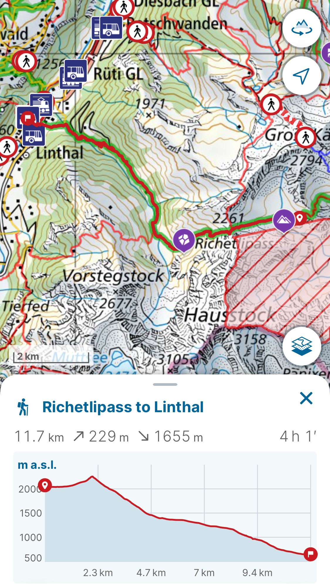
Map of first leg from Richetlipass to Linthal where the bus 408 can be taken to Klausen Passhöhe
Deviation from normal Via Alpina trail to go from Klausen Passhöhe to camping site at Raiffeisen Langlaufzentrum in Unterschächen
Day 5 - Surenenpass
In the morning, I took the opportunity to sleep in and air out my tent since it had accumulated some dew and dampness from the grassy campsite. I ended up only leaving after 10am and decided to take the bus down Altdorf and then take a gondola from Altdorf towards the next pass.
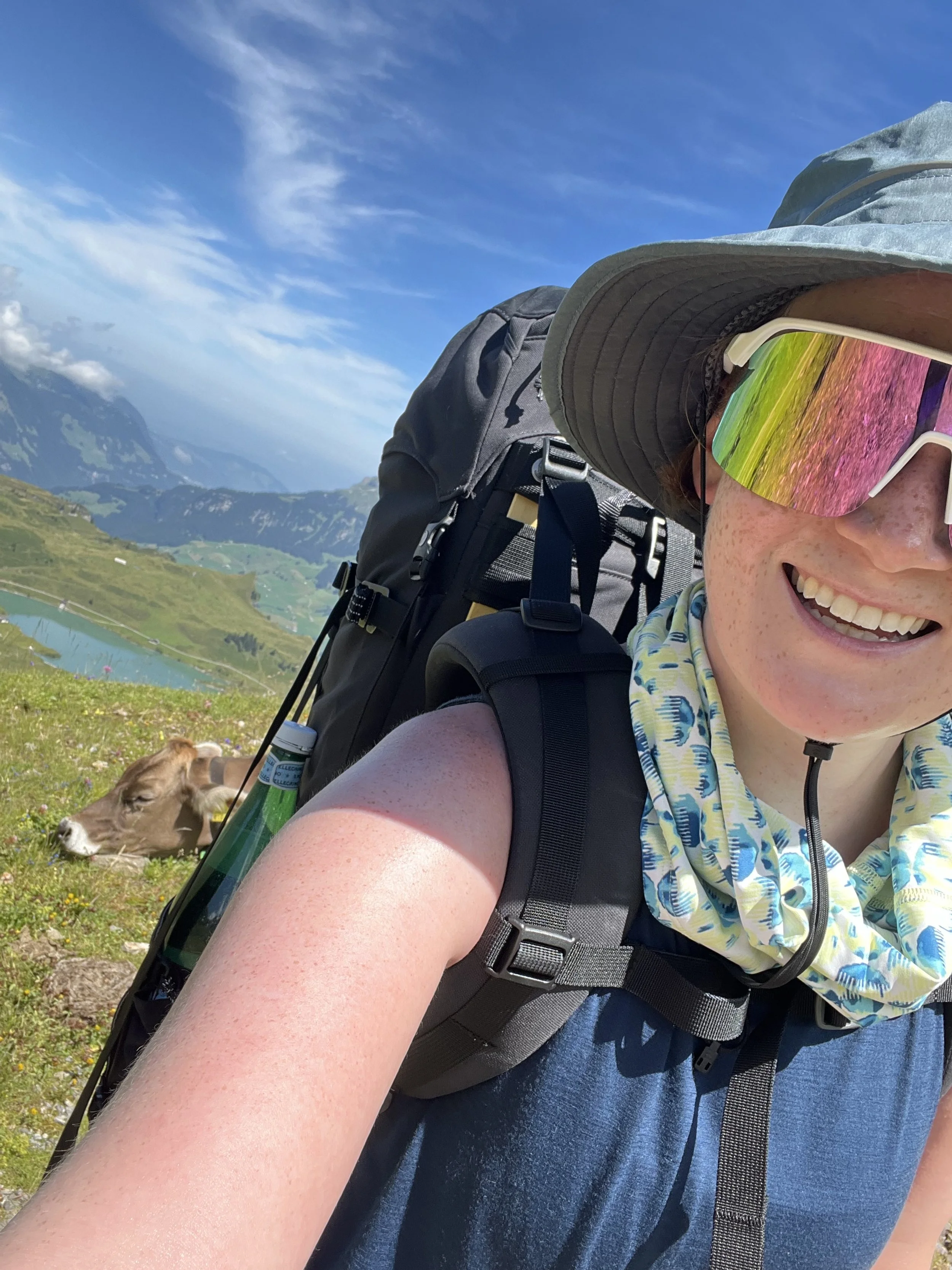
I started my hike at Brüstli, where I promptly found a nice alpine restaurant, Berggasthaus Alp Catrina, to have my first full meal in almost a week. The Älpermagronen that I had there was the best I had ever had. It was so creamy and delightful. I took this short break as an opportunity to journal for a few peaceful moments. After lunch, I found a fountain to refill my bottles and there were actually quite a few benches, fountains, and picnicking spots nearby. By this time of day, the sun was fully shining with scarcely a cloud to be seen. After the initial blueberry bushes and occasional tree, there was no more shade, which made the ascent very challenging.
Picnic spots near Brüstli
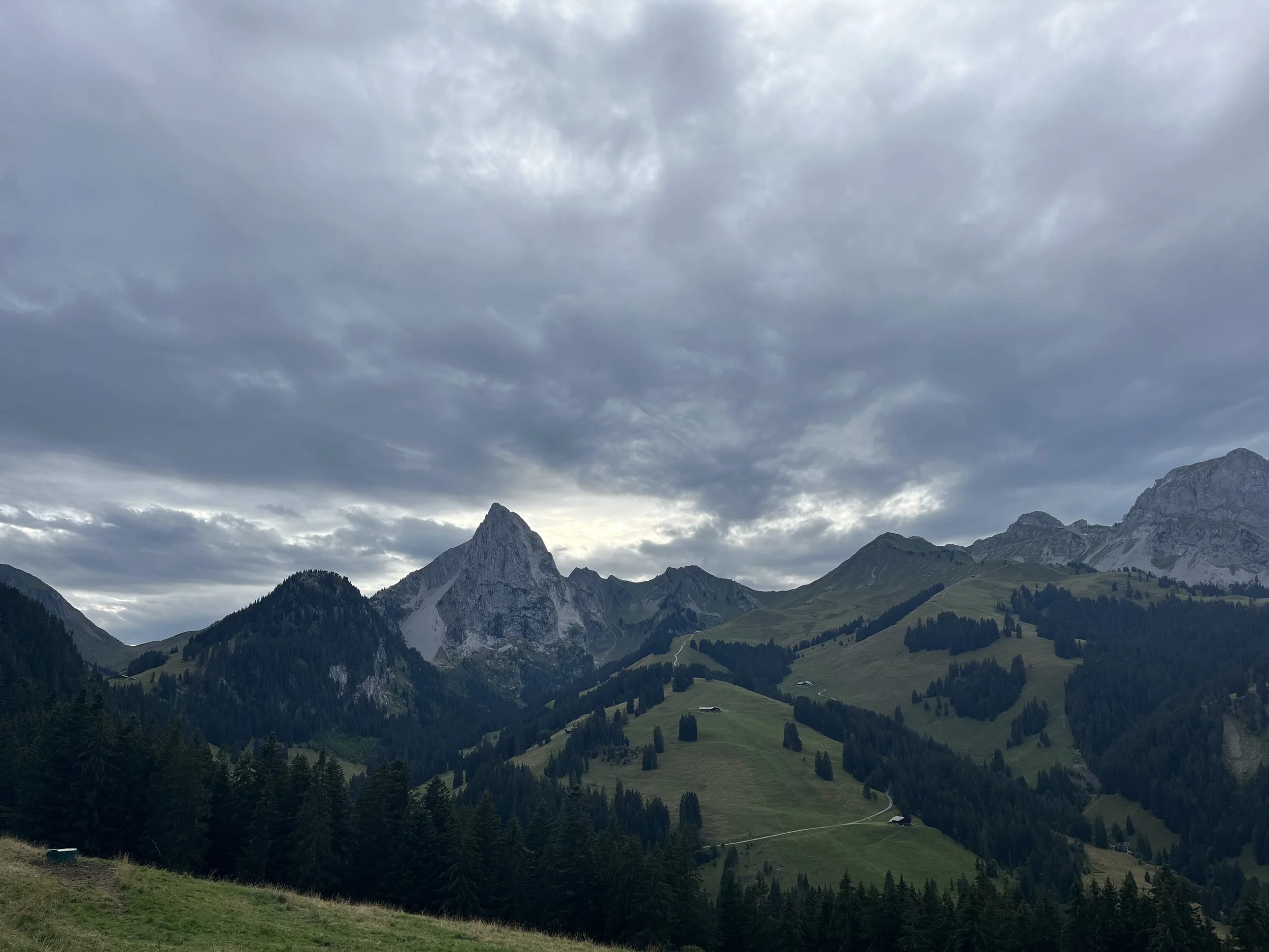
The views were incredible with incredible views of the mountains from all sides as well as a peak on the Vierwaldstättersee on the approach towards Langschnee. The path from here was relatively stable and easy until reaching Langschnee.
A view on Vierwaldstättersee and Langschnee
Path towards Langschnee
Upon reaching Langschnee, the trail began to become more rocky and steep with old rock slides marking the sides of the trail.
Entry into the Langschnee area
View into Langschnee
The trail began to become even more challenging and rocky as it twisted to the top of Surenenpass; however, the views were well worth it. There was a herd of sheep that made the trail seem more lighthearted.
A little sheep on the trail approaching Langschnee
After the breathtaking journey and views, the stunning top of Surenenpass presented even more spectacular views.
After crossing the top of the pass, the wind started to kick in and clouds soon flooded the sky. The weather started feel ominous. Thankfully, there was a small shelter hut close by that I stopped in to eat dinner while waiting to see how the weather developed. The thick blanket of clouds and strong wind continued after my dinner pause, so I decided to call it a night and sleep at the shelter hut.
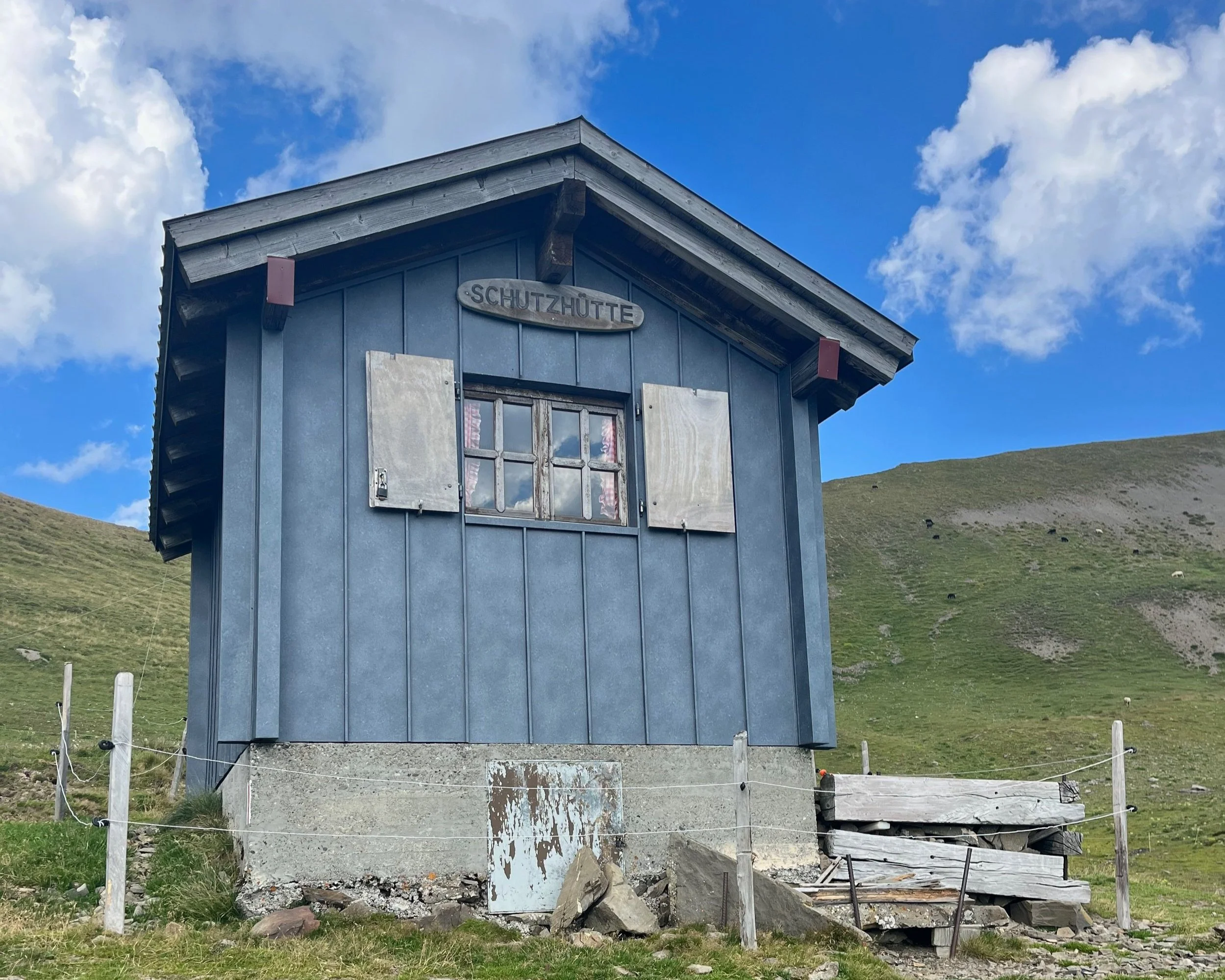
The shelter hut
The shelter hut had the traditional Swiss hospitality in the form of wooden signs with a poem of the reasoning and rules on the hut as well as guest book where adventurers could leave little notes. It was nice to read through these during my little dinner.
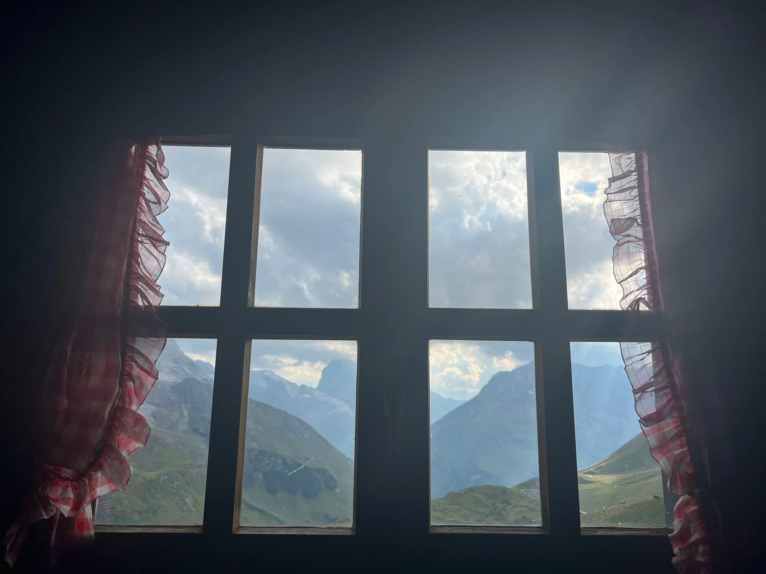
View from inside the hut
The view was incredible with a couple of glaciers in sight from the long wooden dinner table and bench. Waking up to this view was magical. Wildlife was unaware of my presence, so I spotted sheep and marmots playing up close to the hut.
View on the hut in the morning after leaving
Brüstli to Surenenpass Refuge GPX Link
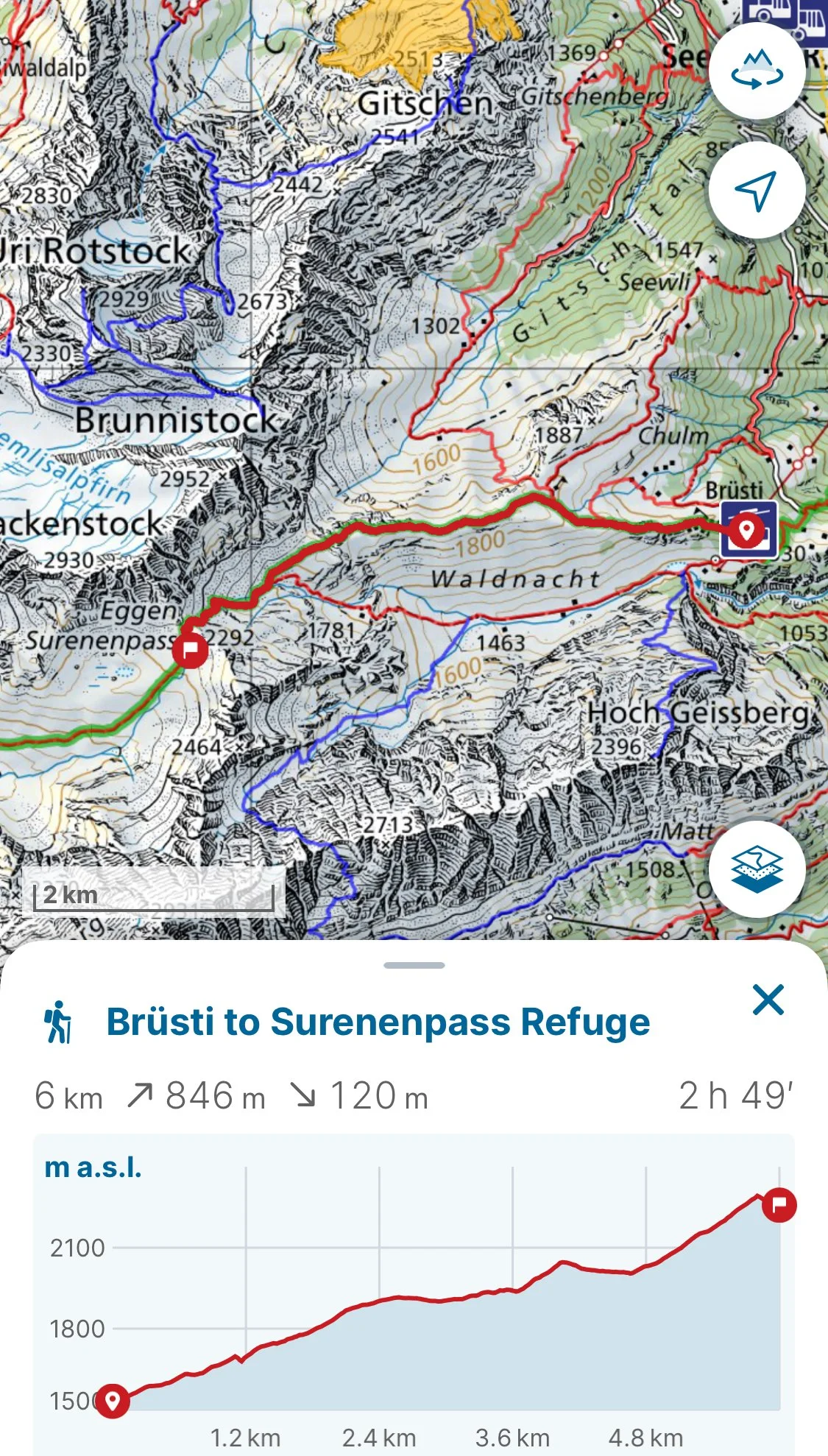
Map from Brüsti gondola to Surenenpass Refuge Hut
Day 6 - Surenenpass to Engelberg
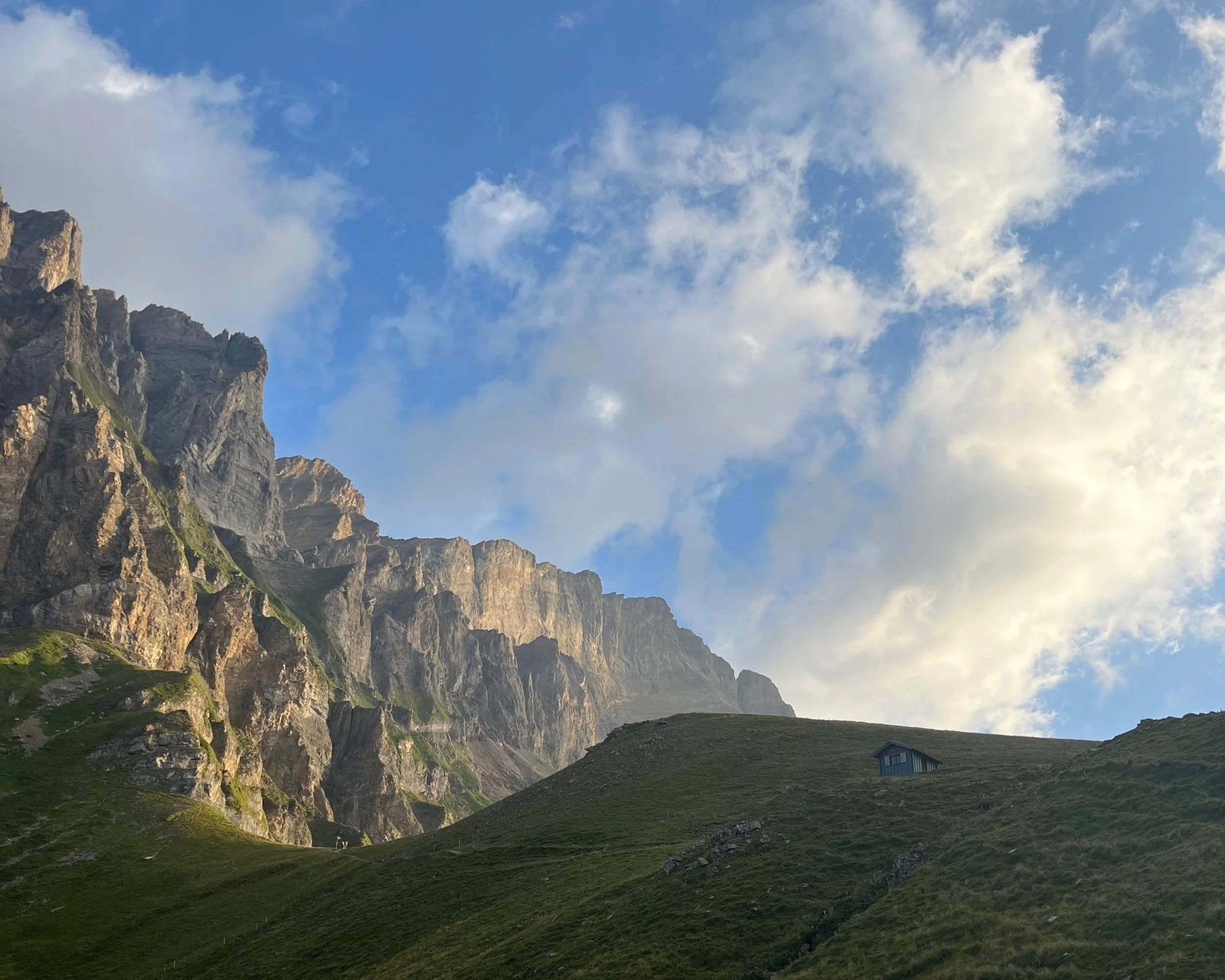
One of the best views was actually looking back on the hut after leaving. The sun glowing on the rocky cliffs in the background was incredibly moving.
On the way down I spotted two little marmots in “meerkat” position in the grass. See if you can spot them in the center of the photo below.
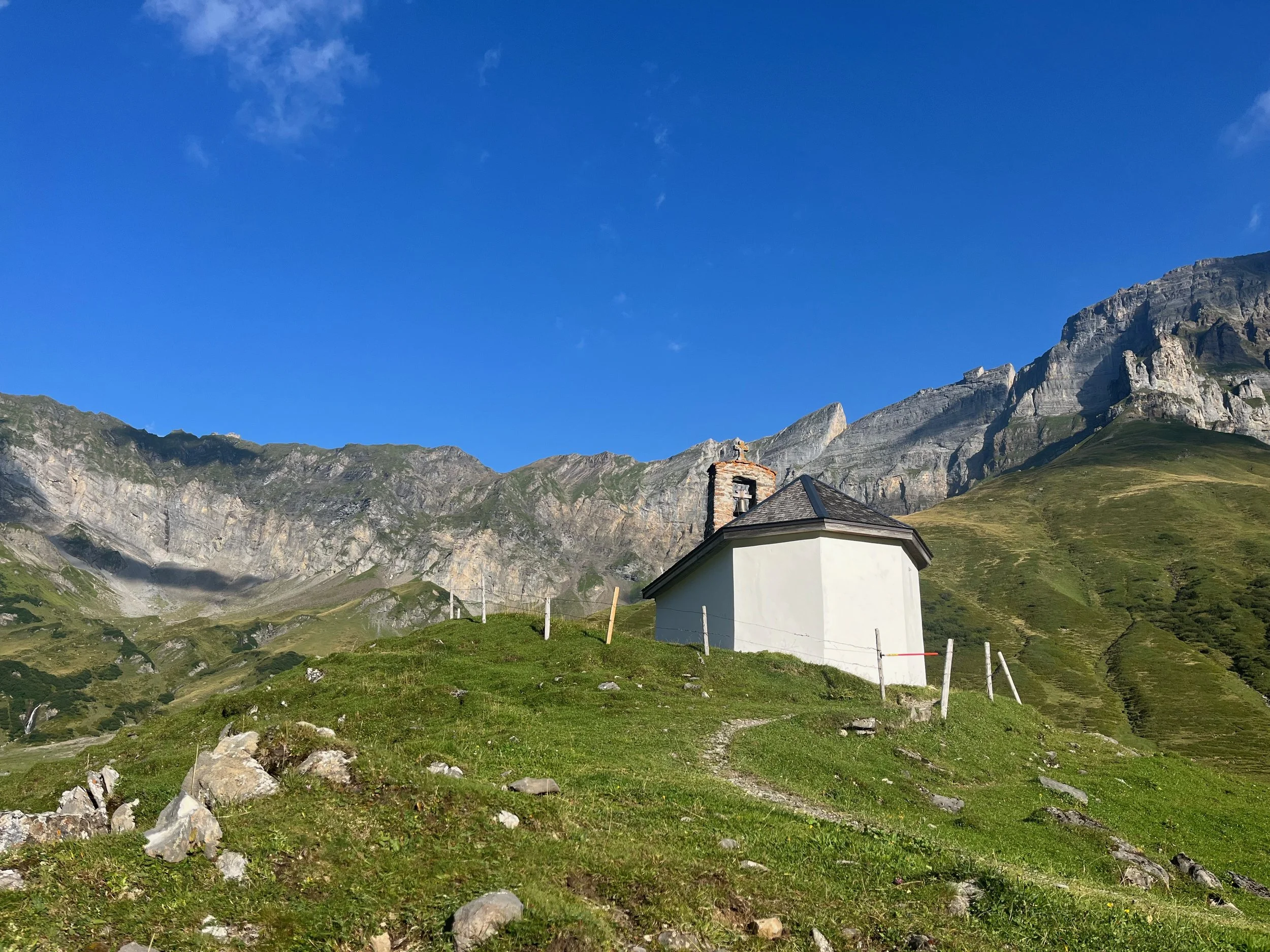
For the majority of the Surenenpass and descent there was no water fountain, so on the way down I had to use my life straw in a stream until I reached a little farm close to a gorgeous little church. The farm also conveniently had bathrooms open even when the little restaurant was closed.
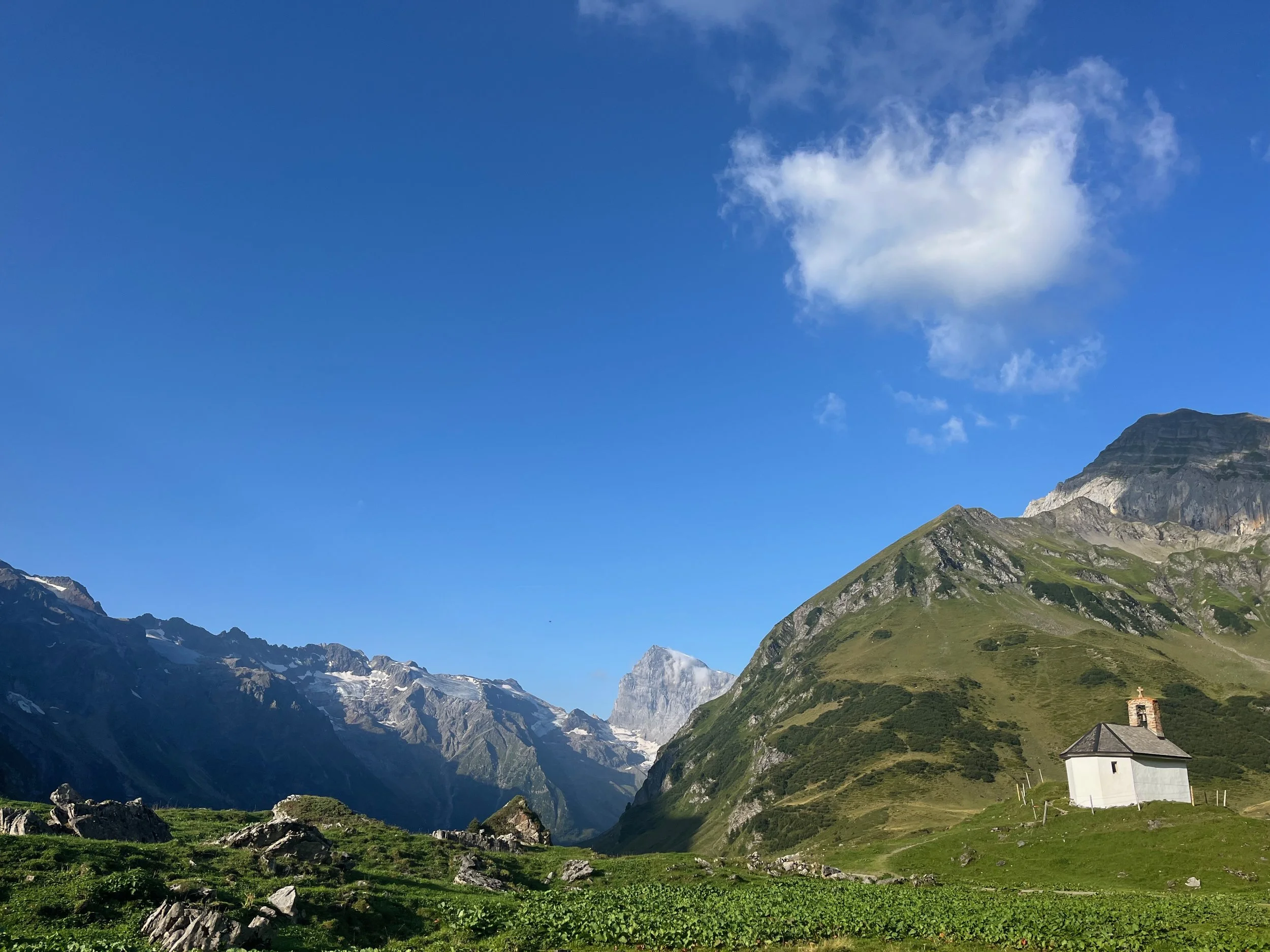
Little church near the farm with fountain
The descent became increasingly road-like; however, the views continued to be amazing as the path followed the river, which at points turned into waterfalls. The surrounding view was also spectacular with extremely tall waterfalls and glaciers in the distance.
In the video above, you can catch a glimpse of another marmot that I spotted during the final descent
The waterfalls can be seen here in the distance surrounding the valley. The descent lasted for a couple hours more until the trail entered a forested area just before arriving the bus stop.
This river crossing is one of the final mountain trail areas before entering the final section of gently forested trail. Based on the rain forest and overall fatigue from the journey thus far, I decided to take a pause in Engelberg and go home before continuing the trail. You can read about the second leg of my journey in the blog on Via Alpina West (Montreux-Adelboden).
Surenenpass to Engelberg GPX Link
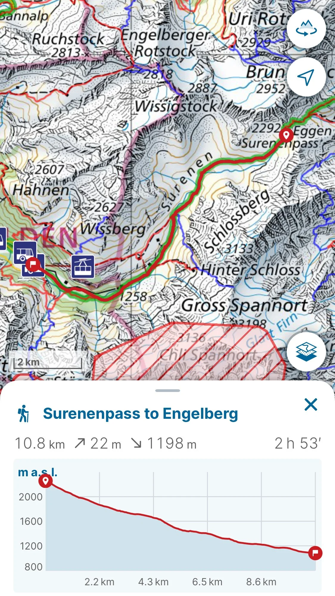
Map from Surenenpass Refuge Hut to Engelberg

Via Alpina (West Section): Montreux to Adelboden
Via Alpina (West Section) from Montreux to Adelboden
Greetings from the French speaking section of the Via Alpina!
Technical Summary:
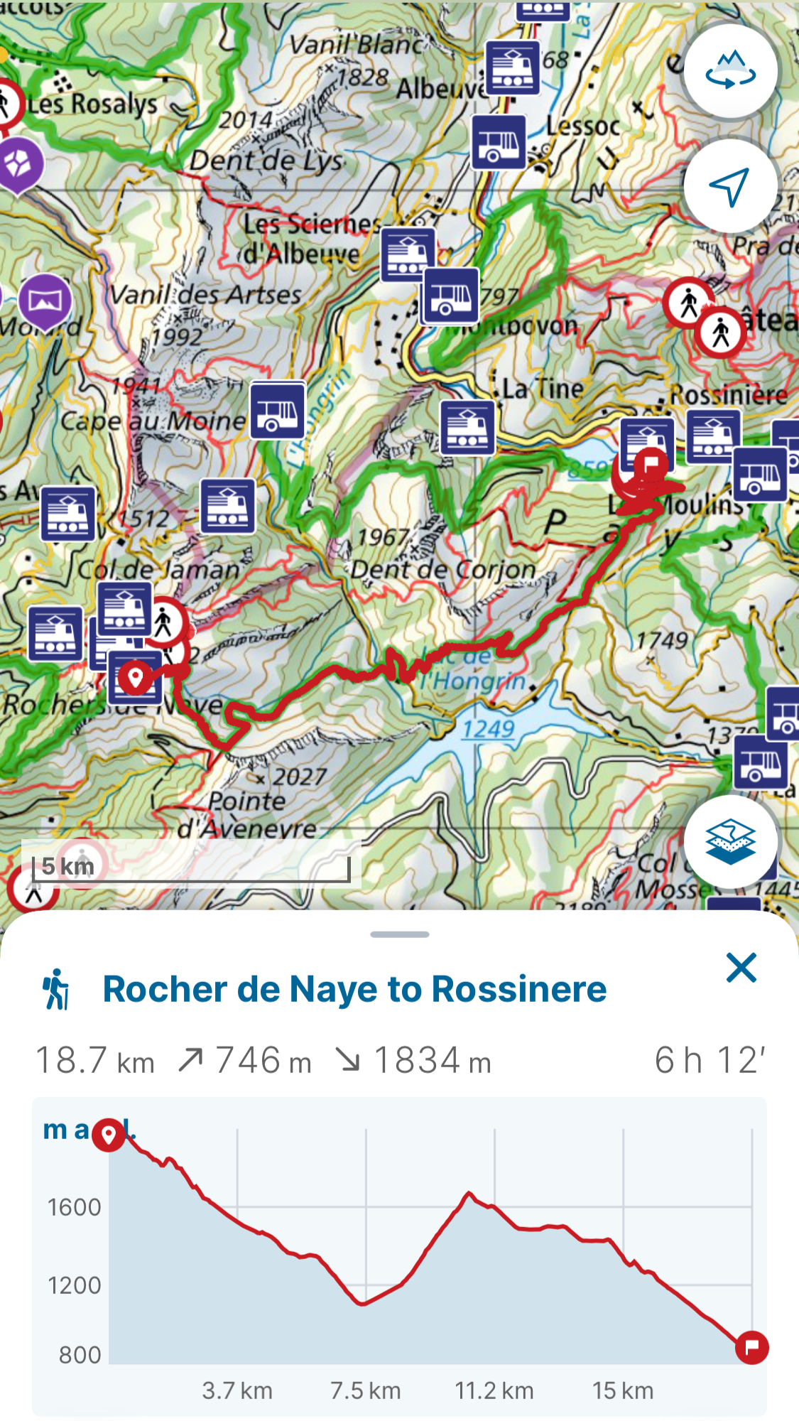
Day 1: Rochers de Naye to Rossinère (then train to Château d’Œx)
Stats: 18.7km (74m ascent/1834m descent)
Trail Conditions: Mostly small dirt trails with a couple of intersecting roads. Beginning is moderately technical but gets easier towards the middle with a more intense section at the end with “Les Traverses”. The physical demands get a bit heavier towards the middle where the ascent starts but the physical toll is really felt going down “Les Traverses”.
Good to Know: There is an option to take the train R37 from Montreux to Rochers de Naye, which I did since I had done the path once before from Montreux to Rochers de Naye and much of the path was on or around streets.
The end of the path contains “Les Traverses”, which is very steep and exposed for such a forested, low alpine section. Do not underestimate the technicality as well as the risk for landslides. In hindsight, I would have preferred climbing up “Les Traverses” rather than going down. I took train PE30 from Rossinère to Château d’Œx since there was camping site I had reserved there - with a pool!)
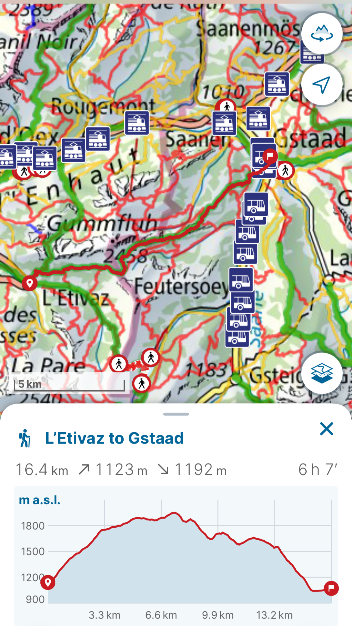
Day 2: L’Etivaz to Gstaad (took bus from Château d’Œx to L’Etivaz)
Stats: 29.4km (1655m ascent/1492m descent) without bus or
16.4km (1123m ascent/1192m descent) with the bus B175
Trail Conditions: The whole trail after the bus was a typical dirt mountain trail with some rocks and grass, but all very technically and physically normal for a typical red and white trail in CH. There was only a brief section of pebble road approaching the final descent into Gstaad around the ski slopes.
Good to Know: There is a bus B175 from Château d’Œx to L’Etivaz. The campsite in Gstaad did not require reservations; however, in the morning, the office to pay was only open from 10am. The campsite was about 20 minutes out of the way but offered clean showers and toilets.
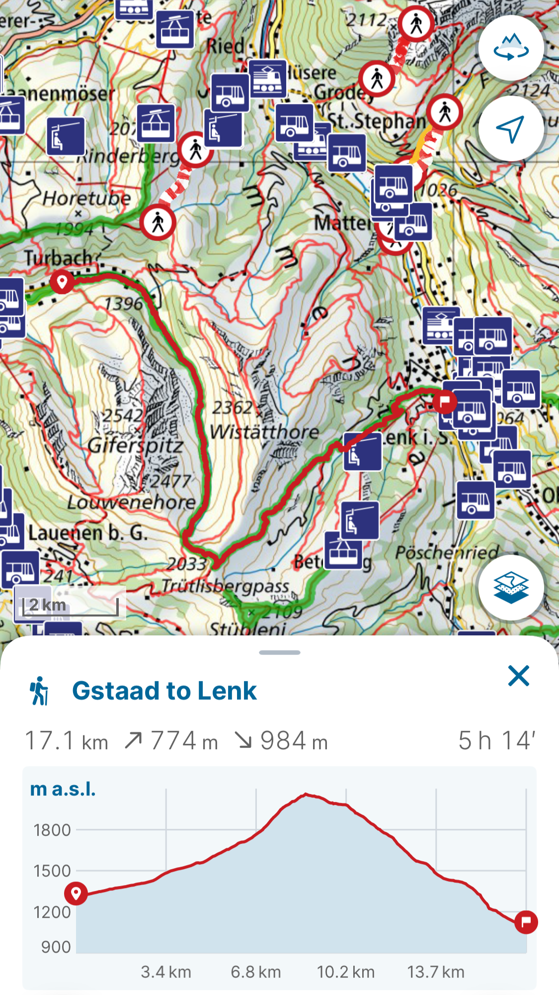
Day 3: Gstaad to Lenk
Stats: 17.1km (774m ascent/984m descent)
Trail Conditions: Starts off on a wide walking trail that turns into a dirt/rocky road, which turns into a normal dirt mountain trail part way up the ascent and continues that way all the way to Lenk.
Good to Know: There is a bus B182 that takes you to Turbach where the path starts to avoid the roads. There are apparently lynx in the area. One of the trail sections is all about lynx, but I didn’t see any but keep any eye out! Also there is a very sweet lady who lets Via Alpina trekkers stay in her garden shed in Lenk and she has a bathroom with a shower inside that trekkers can use. I found out about her via other Via Alpina hikers I met along the way (Bühlbergstrasse 22 with a stone side for Via Alpina).
Day 4: Lenk to Adelboden
Stats: 4.2km (295m ascent/243m descent)
Trail Conditions: Easiest conditions of all; there is a gravel road up and a paved road down
Good to Know: Super easy with bathrooms and public transportation available at the bottom. There was a bus B281 from Lenk to Bühlberg parking lot to avoid a lot of the roads.
Daily Blog:
Day 1 - Rochers de Naye to Château d’Œx
After a week long break due to rainy weather, I resumed my Via Alpina trek, but this time starting from the other side at Montreux as the late summer storms had deposited fresh snow on the highest points of the middle section. The week long break allowed me to recover from the exhausting yet exciting eastern section of the Via Alpina. Eager to set off again, I took the long train from Zurich to the French speaking section of Switzerland, where I started my hike from the top of Rochers de Naye. I had previously hiked from Montreux to Rochers de Naye on a different hiking journey, so this time I elected to take the train up to the top. The train ride up provided lovely views of the lake and the mountains surrounding it. As the train approached the top, the rocky, wild formations of Rochers de Naye were revealed. The clouds added an eerily beautiful and dynamic touch to the landscape.
Approaching Rochers de Naye
Since the journey from Zurich was so long, I first indulged in a little rösti and wine at the restaurant at the top. A sizzling cheesy rösti and delicate glass of wine was the perfect way to start off the journey as the warm meal was one of my last of the trip as I elected for easy to eat cans of tuna, dried fruits, and nuts as my main hiking meals.

Sizzling hot rösti and chilled glass of wine before the start of the trek.
The clouds engulfed the top of the mountain as I started down setting a mysterious scene; I could not see much more than a few feet in front of me so every twist and turn of the trail was a hidden surprise. The beauty of each moment was breathtaking, but I was extra cautious of my footing and surroundings since my visibility was so limited.

Start of descent from Rochers de Names
Especially, once the descent started, the ground was damp and slippery, so careful and steady footing was required.

Lack of visibility yet beautifully mysterious
Finally, around of the final turn of the initial descent, the clouds lifted just enough to catch a glimpse of the surrounding mountains and provide a hint of the journey to come.

Glimpse of surrounding mountains under the cloud cover
After the grassy, muddy, and slippery descent on the hillside, there was a short section of road that provided some relief from the more technically challenging damp grass.

Road pictured to the left
The road allowed me to enjoy a little run down hill.
The next part had a few different cow pastures with a little bit of up and down hill, but was fairly easy-going until the last bigger ascent, which was a bit more physically demanding.
Cow pastures
There were also views towards the Lac de l'Hongrin, which looked beautiful!
Lac de l'Hongrin
The adventure really started after the last major ascent… I met a farmer who spoke native French, but tried speaking to me in German as I was better in answering in German; however, it was very difficult to understand with his dialect. I did understand there was some landslide that had occurred in the storm the previous week and is somehow related to the dead cow next to him as well as the path ahead. I understood there was some deviation due to the landslides and that they were major, but I missed all the details of what happened and how to avoid this. I debated for a long time during the first part of the descent, but decided to try the deviation on the normal route since the only other way was a road with an infrequent bus that I may miss.
Top of Les Traverses
The part that had the deviation was called “Les Traverses” and this section was much more difficult than I had expected, especially considering the wet, loose ground from the recent storm. Below is an image of one of the many landslide crossings I had to pass over on this part. It is hard to fully understand the steepness and exposure from the photo. This was one of the scariest hiking experiences for me and I even debated sliding my backpack down the mountain so that I wouldn't have to carry it but I ended up managing. I had to stay extremely focused on my footing the whole time. I was so thankful when I reached the bottom safely.
Middle of Les Traverses
I had to run catch the train from Rossinère to my camping location after finishing, so there was little time for celebration, but I was so relieved when I arrived in Château d’Œx that I think this town will always hold a special place in my heart.
Map and altitude description
Day 2 - Château d’Œx to Gstaad
Château d’Œx
I enjoyed my camping spot, Camping Le Berceau, in Château d’Œx. They had washers and dryers and a pool. After the craziness of “Les Traverses”, I needed to wash my clothes because they were soaked in mud. I took an easy morning in the pool to relax before I started the day. The town of Château d’Œx was also very sweet and I walked through to go to the Coop there - which shockingly had Sunday hours! I really love this town!
The first ascent started in a protected forest. The incline began get more gradual, but there were technical patches where their were rock fall crossings like the one pictured below.
Some of the little rock slides to climb over
The forest was super majestic and peaceful. Eventually the forest opened up into an alpine meadow with gorgeous views (also the image at the top of the article). You could see all the way to Glacier 3000.
View after the forest
Across the meadow and farm pastures was the crossing from the French to German speaking part. Right at the sign was the sweetest little latter crossing.
Crossing into the German speaking region of Berne!
Leaving French speaking Vaud for German speaking Berne.
There were beautiful rock formations lining the path on both sides.
Rock formations ahead
The path from there gently winded through the hillside and some farm land.
View towards the valley where Gstaad lays
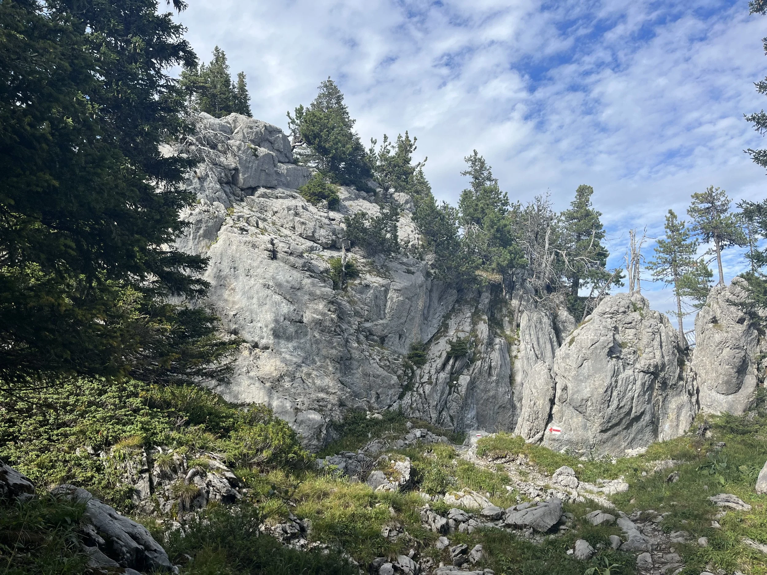
After the gentle farmland, there was a section of chaotic and beautiful rock formations that the hike went through.
Start of the rock formation pass through
All of the land was still protected, so there was no ability to wild camp here.
Cool rock formations!
Then I got to hike in the rocks! This was one of the coolest moments!!
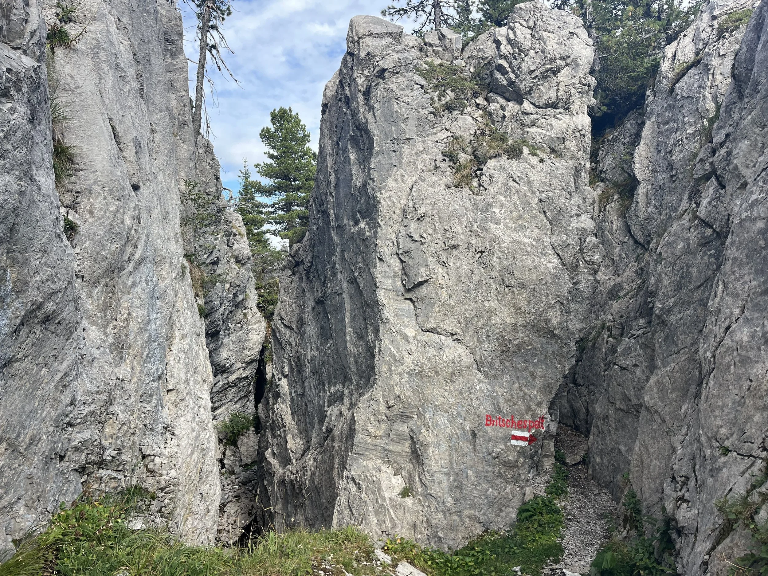
Peep at the tiny point the trail crosses through the rocks
Inside the rocks!!
Even though the rocks look so crazy, the trail was still technically very manageable. I felt safe and secure the whole time. I enjoyed this section so much!
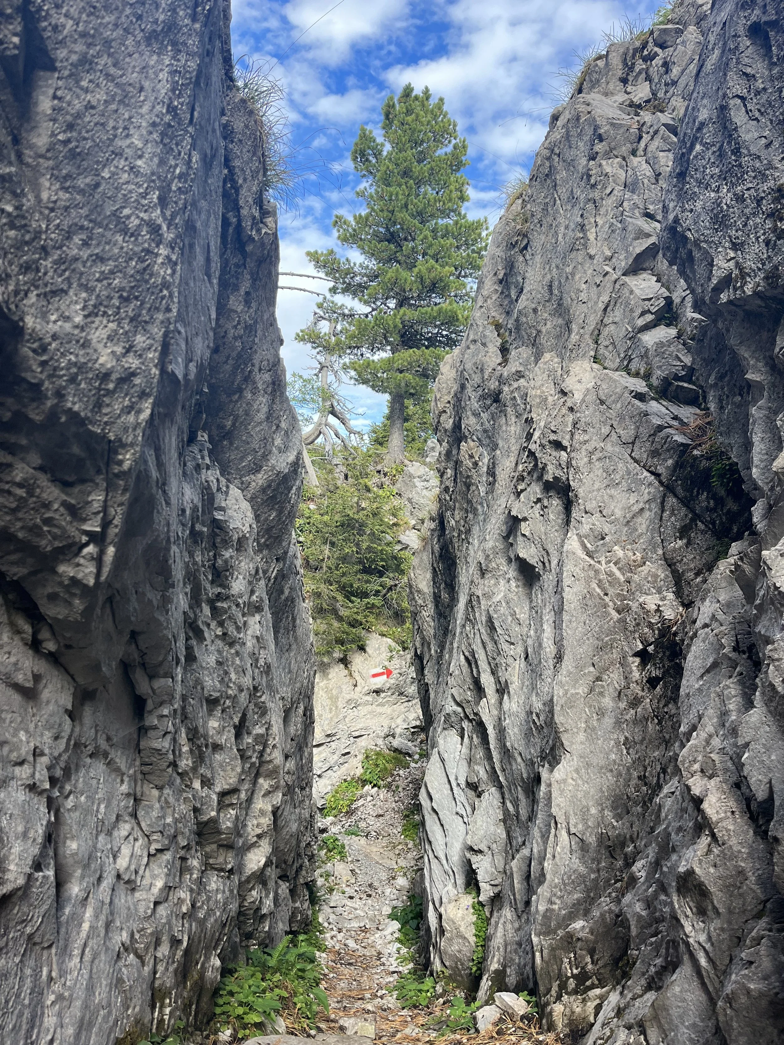
Peep at the next arrow in the rocks!
Last bit of rocks
Once the rock formations ended then there was gentle farmland again followed by a forested hill, which led to more farmland and ski slopes.
View after the rock formations
Along the way towards the ski slopes, I met a little cow buddy who was very curious about me and came to say hi.
My little cow friend
And then of course, I cannot forget that Saanen goats come from this region!
Saanen goats are white and are excellent dairy goats!
The rest of the hike down was very gentle and easy. I ended up camping in Gstaad and meeting quite a few other Via Alpiners. We had lovely chats about where we were from and advice we had for each other. It was here that I learned about the lady in Lenk who offered her garden shed to Via Alpine trekkers. The rain ended up cutting our conversation short but it resumed in the morning. It was a wonderful feeling meeting like-minded individuals all on the same adventure.
Map and altitude description
Day 3 - Gstaad to Lenk
In the morning to avoid taking streets, I took the bus to Turbach where the mountain trail started. Shockingly for Switzerland, our bus was delayed but for a very Swiss reason…. a parade of cows! Since I was hiking on September 1st this is not unusual as there are many cow parade starting in September as the farmers bring their cows down from the mountains for the autumn and winter months.
The trail started along a mountain road next to the river and the flora was quite lush. These little purple flowers pictured below were losing little white tuffs that looked like feathers floating in the wind.
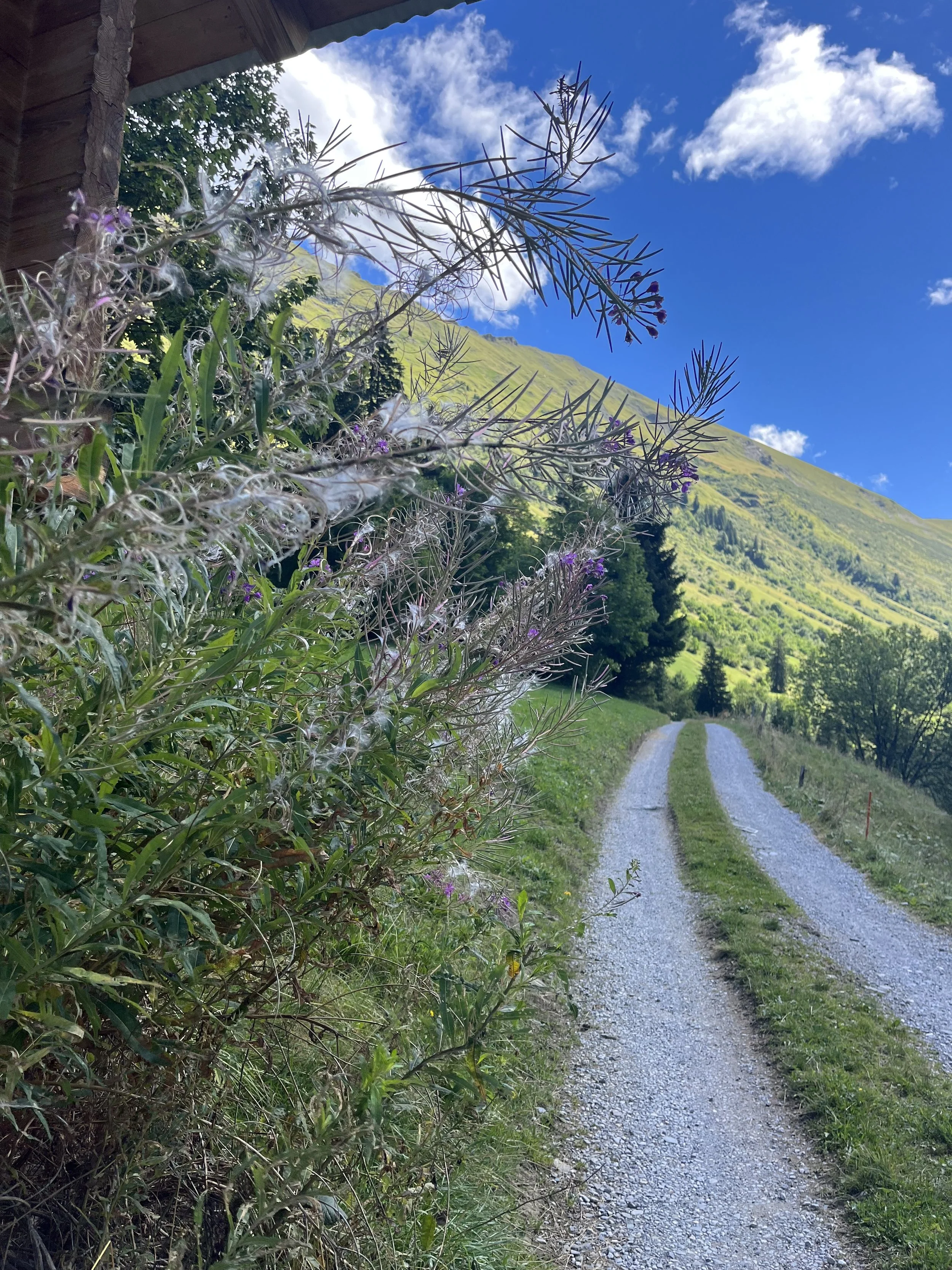
Towards the beginning of the path
I ran into a group of tourists coming down the mountain, but never saw anyone else the rest of the hike. This made the hike very peaceful and serene.
View of the valley towards the ascent
On the way to the top, there were wild blueberry bushes everywhere. I enjoyed quite a few as a snack, but was careful to collect them from higher on the bush (so that foxes can’t pee on them as my husband says).
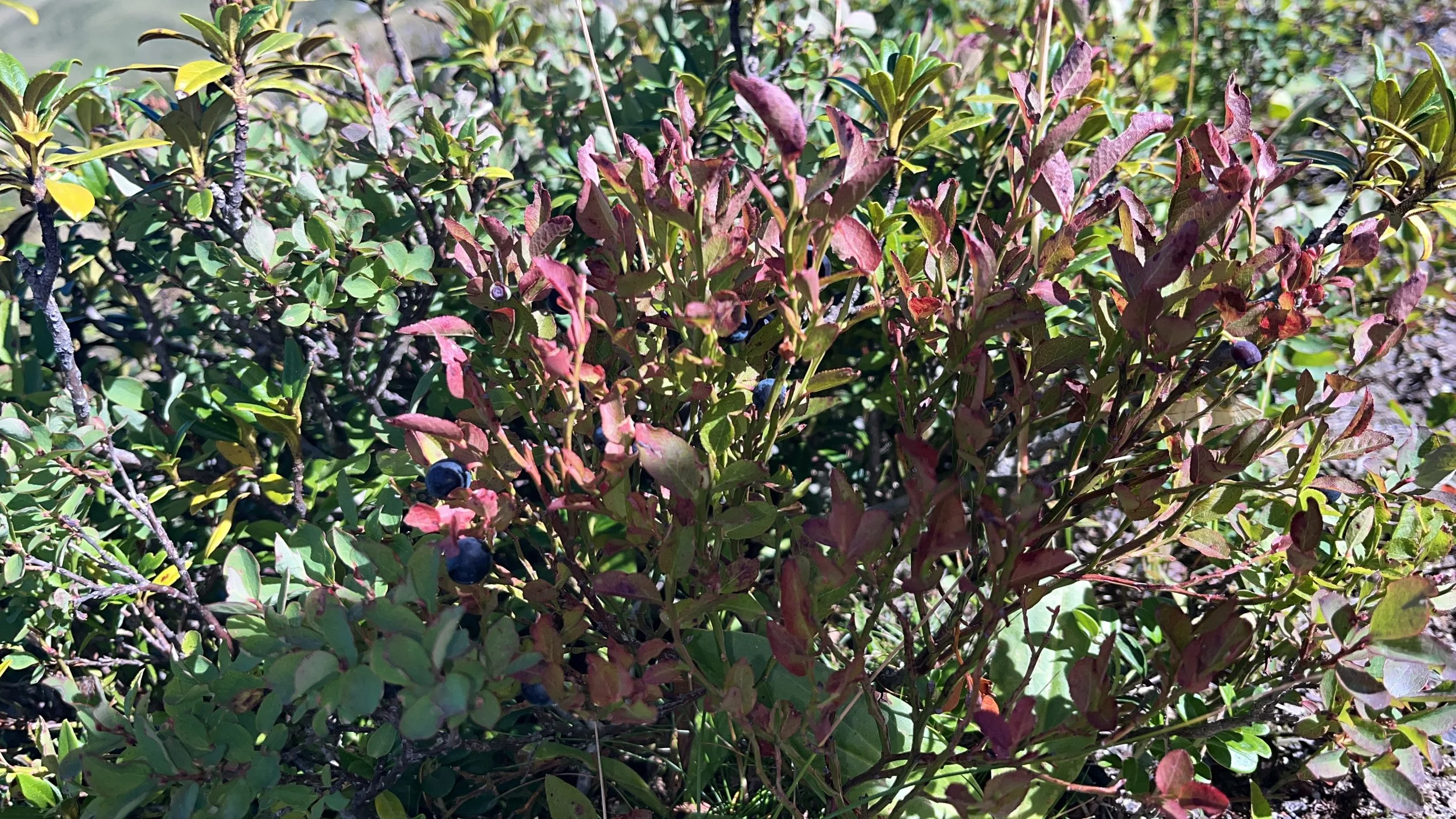
Wild blueberries
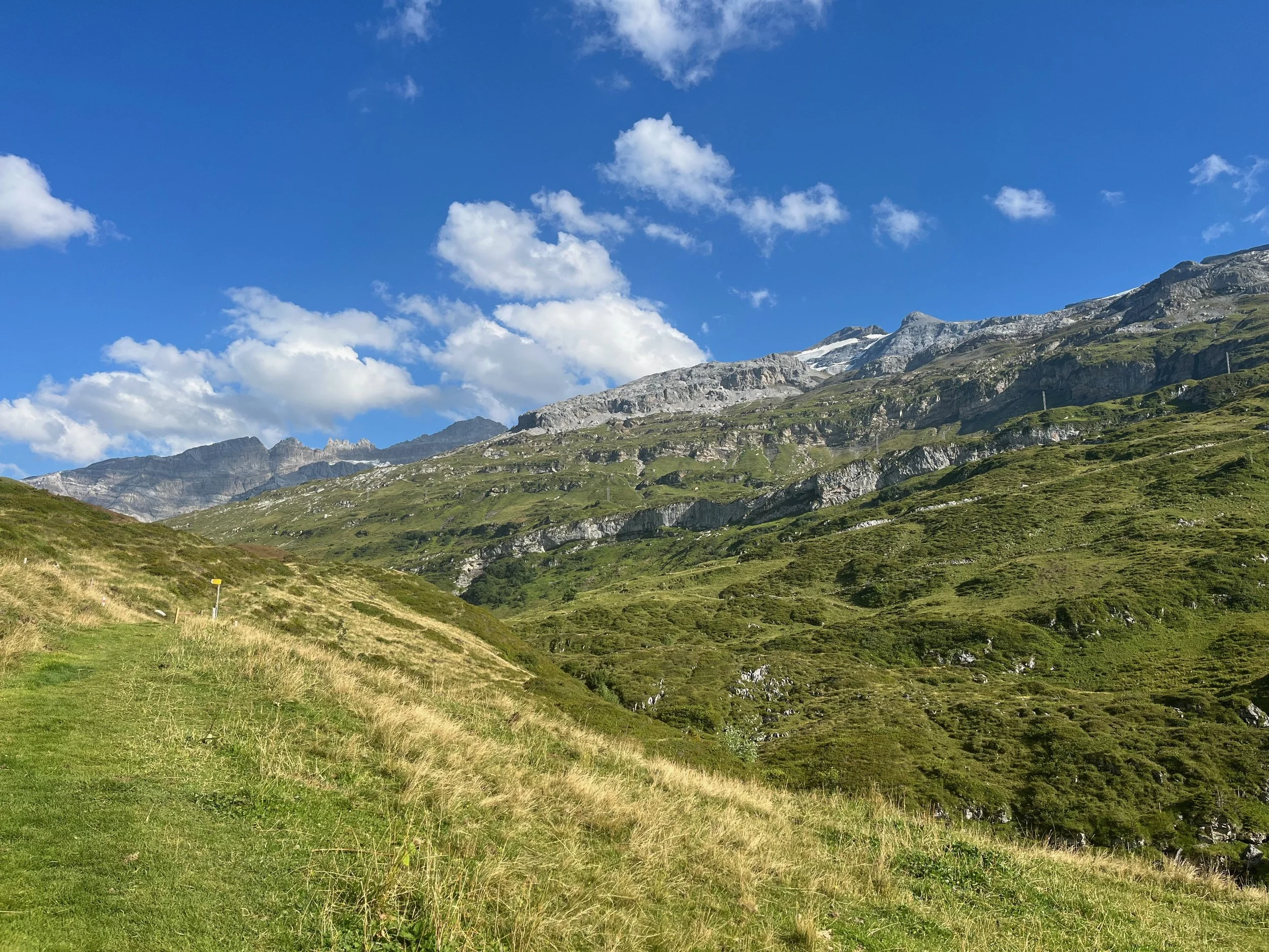
Once at the top, the views were absolutely breathtaking. I was also on the look out for lynx at that point since they were noted to be in the area; however, I didn’t see any.
The start down was so open so the views continued to be impressive, but the wind was strong due to the openness.
View coming down
There were some crazy rock formations in the distance (pictured below) as well as some right along the path that I had noticed on the map (shown on the map image below).
Strange rock formations in the dark green area
The strange rock formations as seen on Swiss Topo
….and then sheep!
Sheep!
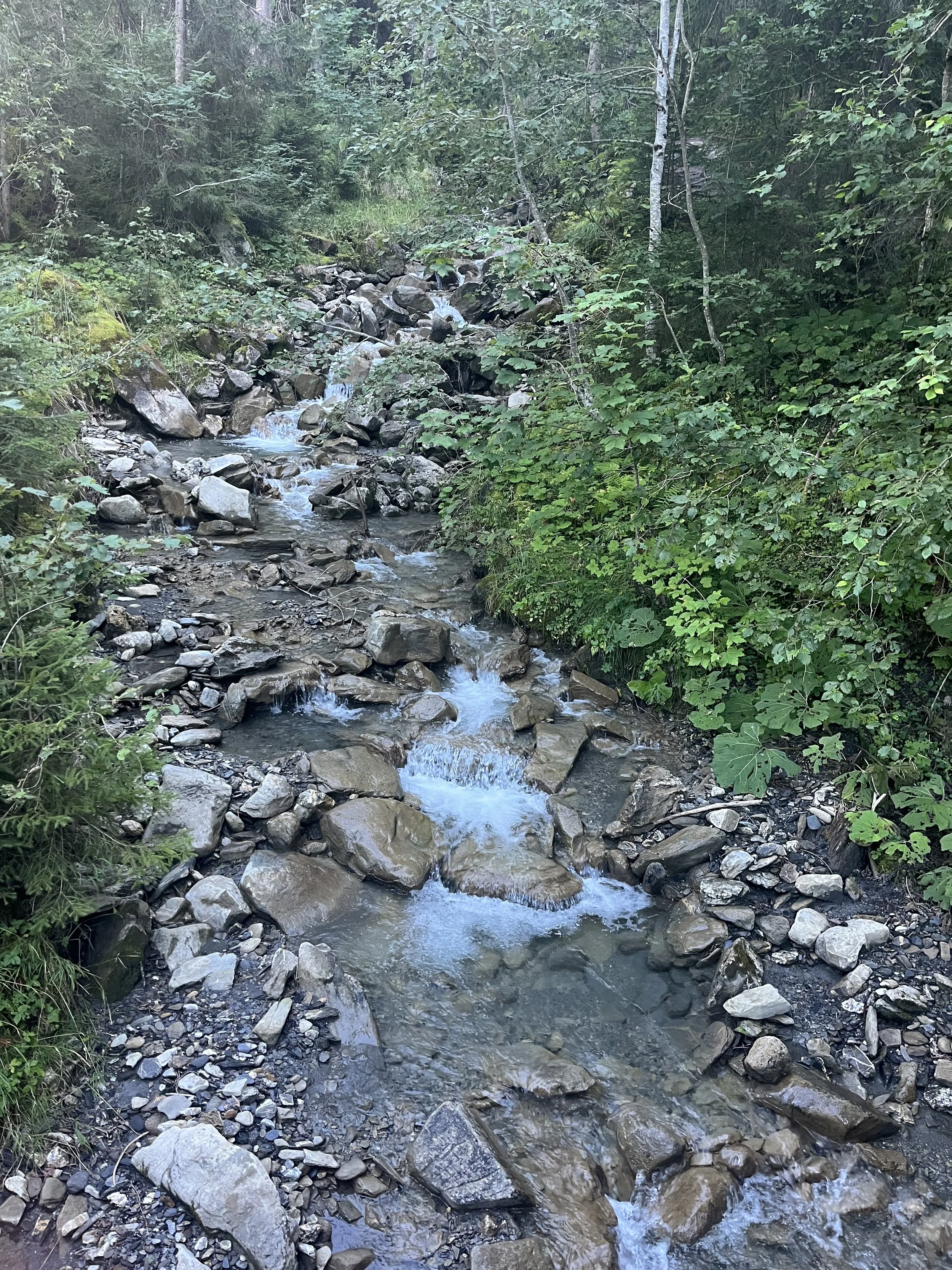
Then I past a rockfall and then met up with a gorgeous river!
Rockfall
River that followed the rest of the path
The rest of the path followed the river down into Lenk. Shortly after, the lynx trail began with cute information about lynx!
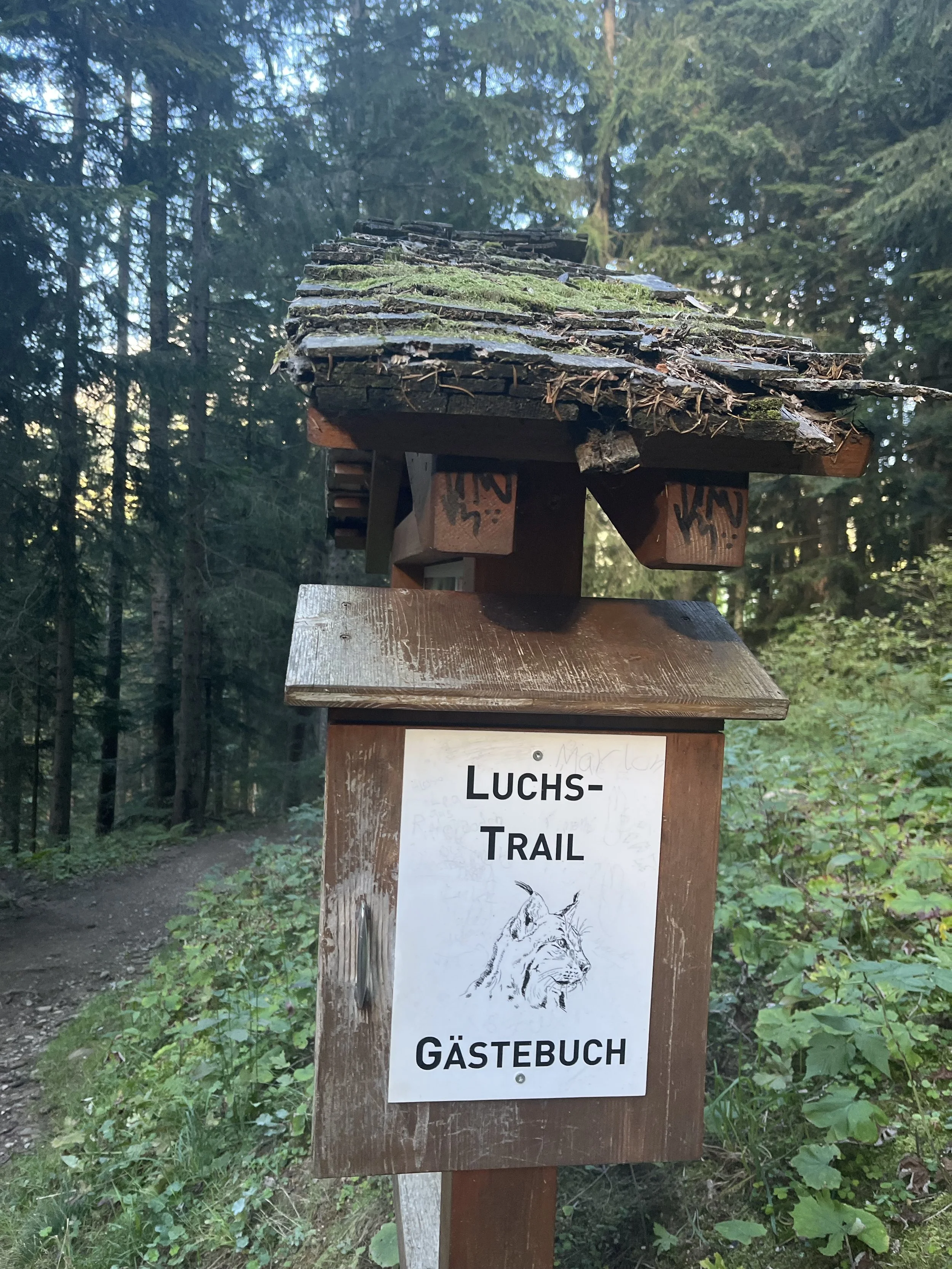
Start of Lynx Trail!
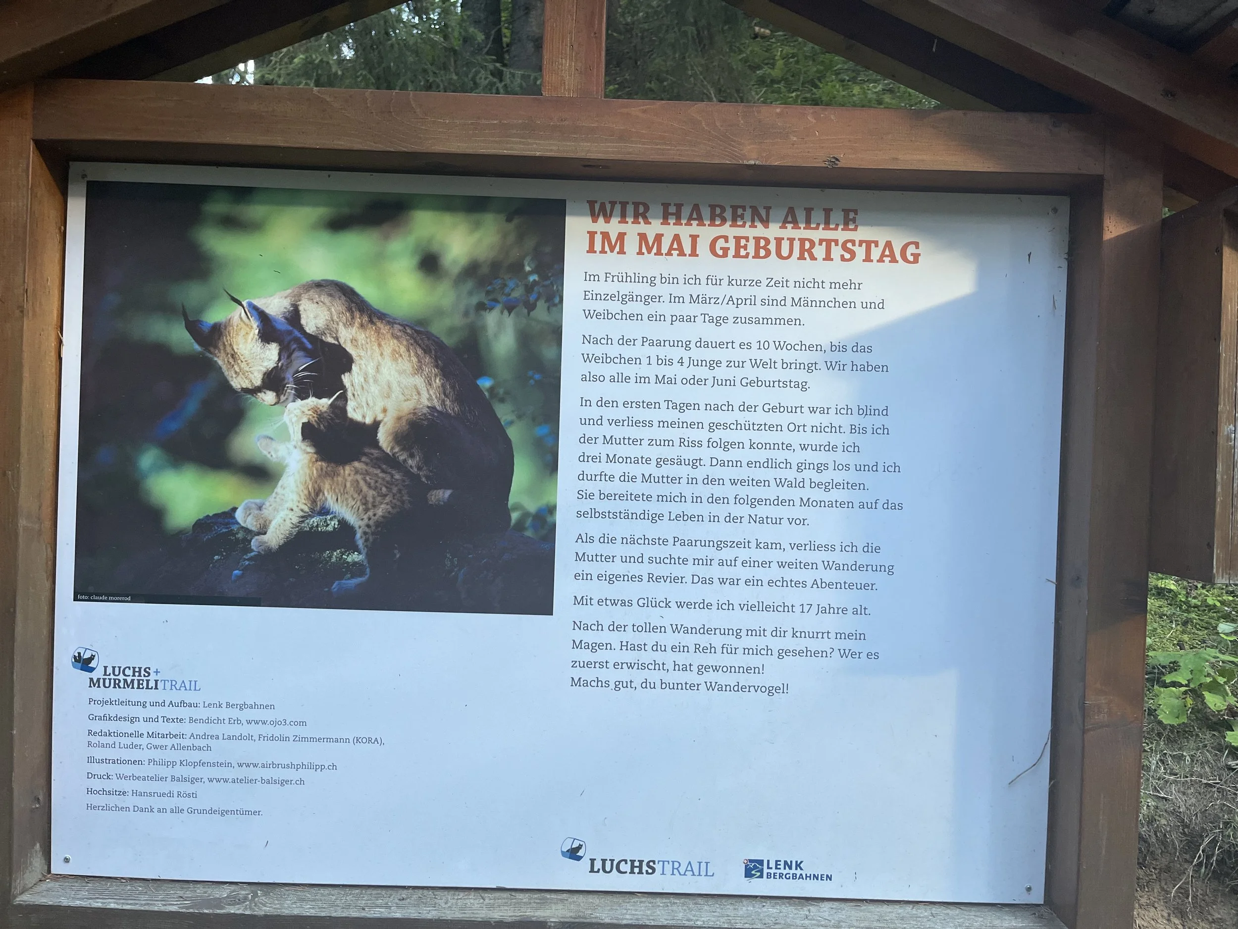
We all have May birthdays!
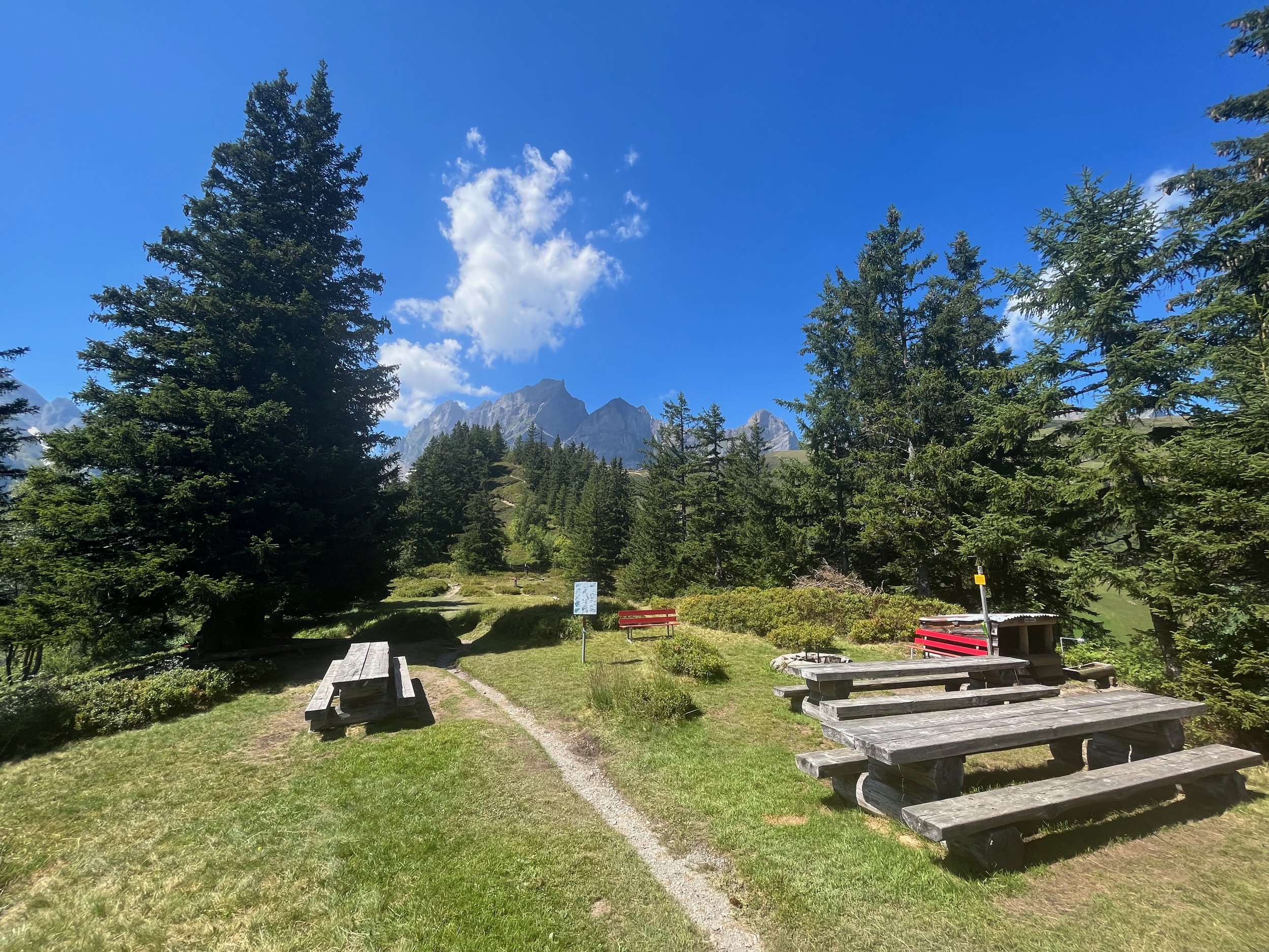
After the lynx trail and before the last descent I stopped at a sweet little restaurant, “Wallegg-Stube”, which had a wonderful view and get place to take a pause.
Wallegg-Stube
The remainder of the descent was very serene and calm next to the river, which had now become more of a gentle, bubbly stream.
Bubbling steam on the way down
At the previous campsite, fellow Via Alpiners coming from the opposite direction told me about a lady who lived in Lenk that would allow Via Alpiners to stay in her garden and use a toilet and shower in her house. Once I arrived in Lenk, I found her house with a little stone “Via Alpina” sign. She was very kind and welcomed me there. I had a lovely conversation with her about her travels such as her cycling tour across the United States and how she was inspired to give back because of the kindness she received on her journeys.
The garden shed had a little bed (could fit two people) and electricity to recharge phones and other small electronics. There was also a hose outside that I used to rinse off my shoes. It was such a touching experience and I’m so thankful for kind people like this that I met on my journey.
Garden shed where I stayed
Map and altitude description
Day 4 - Lenk to Adelboden
This day was the easiest day of the Via Alpina. I had wanted to continue on in Adelboden; however, the trail had been severely damaged by the storm the week before, so I had to stop there and the middle part of the Via Alpina was already covered in at least a couple feet of snow (starting to reach one meter). Despite the easy agenda, I still didn’t want to walk along the streets so I took the bus to the start of the trail head at Bühlberg parking lot.
It was a quick hike up a gravel road with lovely views.
View from the top of the pass
At the top there were a lot of tourist tents and little lookouts, which were very cute.
One of the little tourist lookouts
The way down was easy to hike fast or even jog as the road was paved.
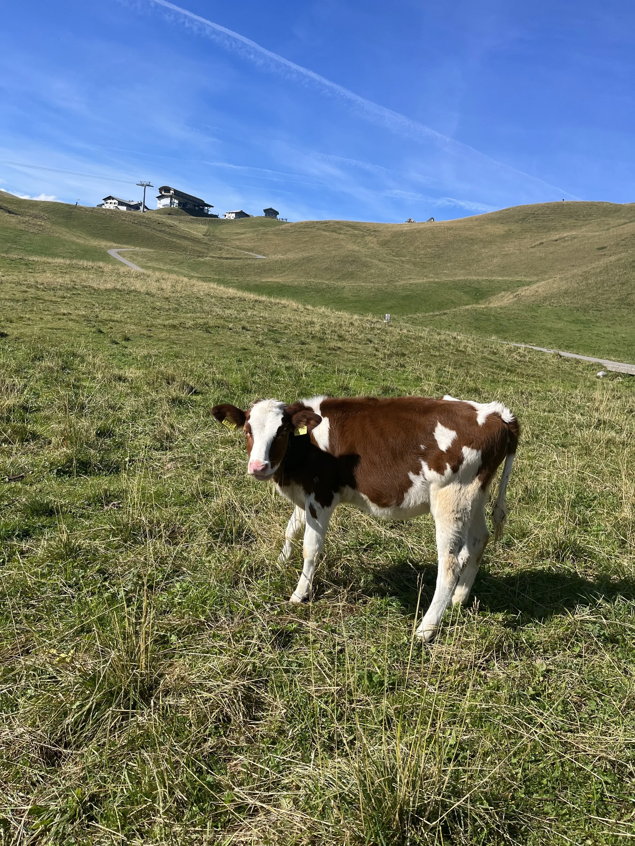
Cute little cow friend along the way
At the end there was the bottom of the lift where there were bathrooms and a bus stop. This is where my journey ended for that year and then I resumed the middle part of the Via Alpina the next year.
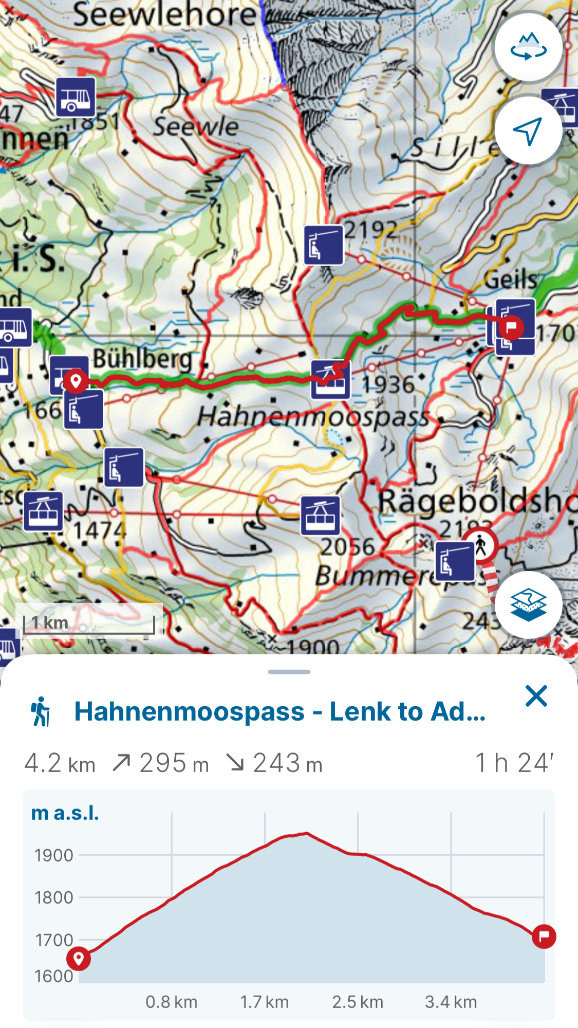
Map and altitude description